Stretching for more than 2,500 kilometres along Ireland’s western coastline, the Wild Atlantic Way is one of the world’s great coastal touring routes. Among its many memorable regions, the Dingle Peninsula stands out for the variety of landscapes, historical sites and cultural experiences found within a relatively compact area.
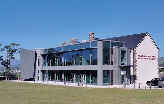
Here, Atlantic cliffs meet sandy beaches, ancient monuments overlook farmland and island communities have left behind an important literary and cultural legacy. The western peninsula also forms part of Corca Dhuibhne, an Irish-speaking Gaeltacht where the language remains part of everyday community life.
Whether you are following the Wild Atlantic Way from north to south or exploring County Kerry as a separate journey, Dingle deserves more than a hurried drive. Its landscape becomes much more meaningful when you have time to understand the archaeology, settlement patterns, language and maritime history behind what you see.
Where Is Dingle on the Wild Atlantic Way?
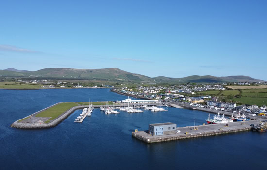
The Dingle Peninsula forms one of the most distinctive sections of the Wild Atlantic Way in County Kerry. It extends westwards into the Atlantic between Tralee Bay to the north and Dingle Bay to the south, with the town of Dingle positioned around a sheltered natural harbour.
Visitors arriving from the north generally approach through Tralee, crossing the peninsula towards Dingle or following the northern coastline. Travellers continuing south towards the Ring of Kerry and Skellig Ring commonly leave through Annascaul, Inch and Castlemaine.
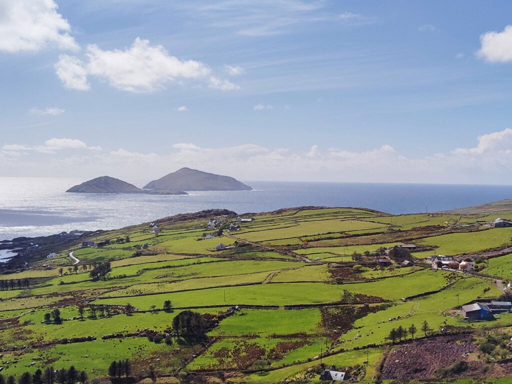
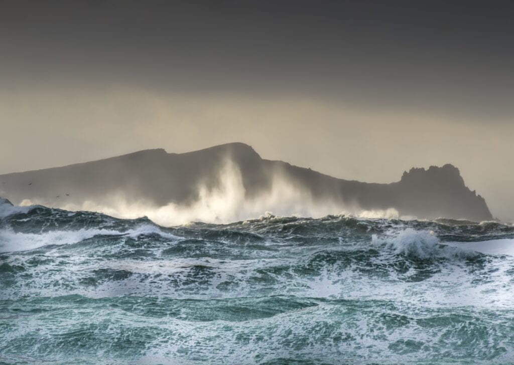
The peninsula reaches its western extremity around Slea Head and Dunmore Head. This is where the mainland appears to break into a succession of headlands and islands, with the Blasket Islands lying offshore beyond the narrow Blasket Sound.
Mountains run through the centre of the peninsula, separating its northern and southern coastlines. This geography creates a remarkable variety of scenery within a short distance: sheltered harbour country around Dingle, open Atlantic coast near Slea Head, mountain roads, broad beaches and quieter agricultural landscapes.
Many visitors choose Dingle Town as a base for two or three nights. This provides time to explore the western peninsula properly while also enjoying the town’s restaurants, pubs, shops and harbour.
Experience the Slea Head Drive
One of the Wild Atlantic Way’s most recognised journeys is the Slea Head Drive, a circular coastal route around the western end of the peninsula. The road leaves Dingle, travels through Ventry and Fahan, follows the Atlantic coast towards Dunquin and then returns through Ballyferriter and the northern side of the peninsula.
The usual touring direction is clockwise. This keeps traffic flowing in the same general direction on the narrowest coastal sections and places vehicles on the coastal side of the road for many of the main views. My detailed guide to driving Slea Head clockwise explains the practical reasons for approaching the route this way.
Important stops and landscapes along the journey include:
- Ventry Beach
- Dún Beag Promontory Fort
- Fahan Beehive Huts
- Coumeenoole Beach
- Dunmore Head
- Dunquin Pier
- The Blasket Islands viewpoints
- Gallarus Oratory
- Kilmalkedar Church
The landscape changes continually. Sheltered fields around Ventry give way to cliffs, stone-walled farmland and exposed Atlantic headlands. Beyond Slea Head, the road opens towards the Blasket Islands before turning north through the Gaeltacht communities around Dunquin and Ballyferriter.
A rushed circuit can be completed in a few hours, but that leaves little time for beaches, archaeological sites, short walks or the Blasket Centre. If this is your first visit, the complete Slea Head Drive route guide will help you choose the stops that best suit your interests.
Discover a Landscape Rich in History
The Dingle Peninsula contains one of Ireland’s most concentrated collections of archaeological remains. People have occupied and shaped this landscape for thousands of years, leaving behind standing stones, ringforts, monastic settlements, early churches and later medieval buildings.
The surviving monuments should not be viewed as isolated attractions. Together, they reveal how communities lived, farmed, travelled, worshipped and responded to the peninsula’s geography. The wider history of the Dingle Peninsula is closely connected to the sea, the Irish language and the limited routes through its mountain landscape.
Early Forts and Settlements
Ringforts were enclosed farmsteads rather than military fortresses in the modern sense. Their circular banks or stone walls protected household areas, livestock and stored goods. Numerous examples survive across the peninsula, although their condition and construction vary considerably.
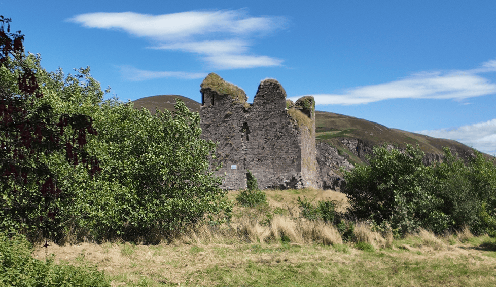
At Fahan, the remains of stone huts and enclosures demonstrate how local communities built with the material available in the surrounding landscape. Nearby Dún Beag occupies a narrow promontory above the Atlantic, using the cliffs as part of its natural defence.
These monuments help visitors understand that the apparently empty coastal landscape was once organised into working farms, family settlements and carefully managed territories.
Early Christian Heritage
The peninsula also contains an important collection of early Christian and medieval sites. Gallarus Oratory is recognised for its carefully constructed dry-stone masonry, while Kilmalkedar preserves a Romanesque church, ogham stone, sundial and other features associated with centuries of religious activity.
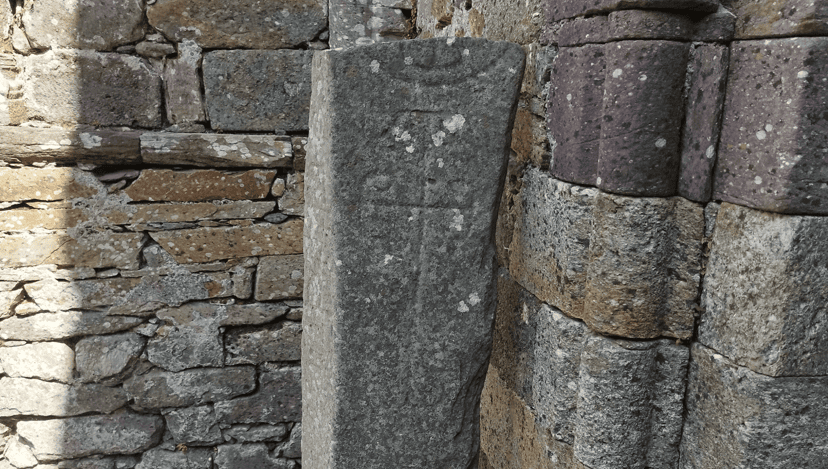
At Riasc Monastic Settlement, low remains mark the site of an early ecclesiastical community. Its carved pillar stone, bearing a cross and spiral designs, is one of the peninsula’s most recognisable pieces of early Christian sculpture.
These sites form part of a much wider historical landscape. Visitors with a particular interest in archaeology can use the guide to historical sites in Kerry to connect the peninsula’s monuments with castles, forts and religious buildings elsewhere in the county.
Experience Ireland’s Living Culture
The western Dingle Peninsula lies within the Corca Dhuibhne Gaeltacht, where Irish continues to be spoken as a community language. Visitors will notice bilingual road signs and Irish placenames throughout the journey, particularly around Dunquin, Ballyferriter and the northern side of the peninsula.
The language is not simply a historical feature preserved for visitors. It remains connected to schools, broadcasting, local organisations, music, storytelling and everyday conversation. English is widely spoken, but recognising the area as a living Gaeltacht helps visitors understand its distinct cultural character.
The Blasket Islands played an especially important part in modern Irish-language literature. Writers from the Great Blasket recorded daily life, hardship, community traditions and the final decades of permanent settlement on the islands. The Blasket Centre in Dunquin provides valuable context for this story while overlooking the islands themselves.
Traditional music also remains part of Dingle’s identity. Sessions vary according to the night, season and venue, so it is worth checking locally rather than assuming every pub will have music at a fixed time. The guide to the best pubs in Dingle for live music provides a useful starting point.
Explore Dingle Town
At the centre of the peninsula sits Dingle Town, known in Irish as An Daingean. Its location around a sheltered harbour helped it develop as a fishing, trading and market town, while today it serves as the principal visitor base for the peninsula.
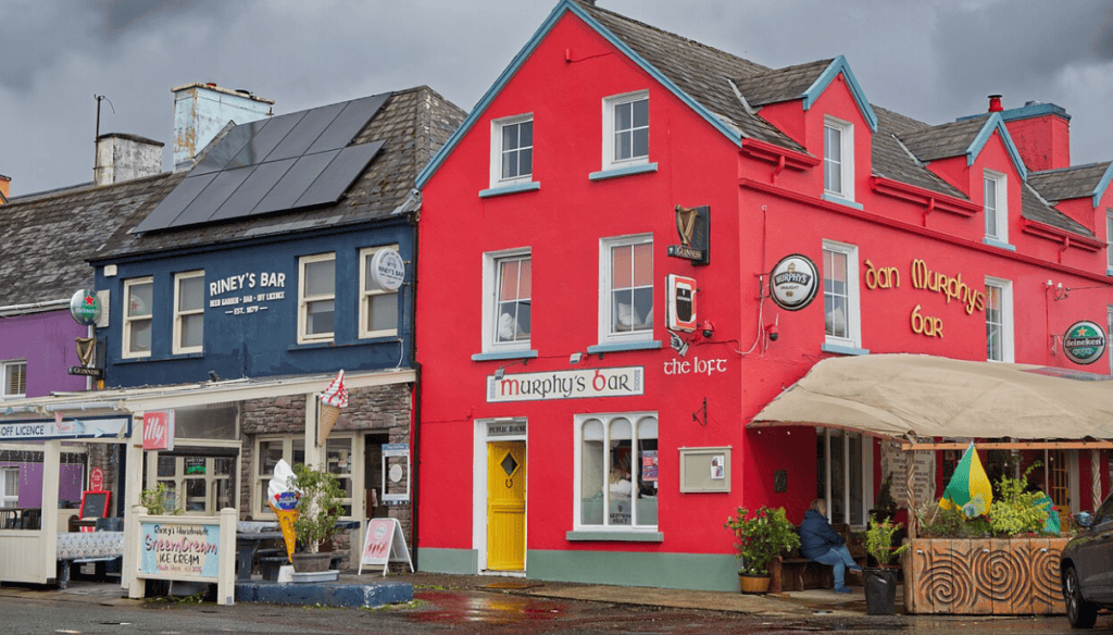
The town’s narrow streets contain independent shops, cafés, seafood restaurants, traditional pubs and galleries. The waterfront and marina are within easy walking distance of the centre, making Dingle enjoyable to explore without a fixed itinerary.
Popular experiences include:
- Walking around Dingle Harbour and the marina
- Eating locally landed seafood
- Browsing independent craft and food shops
- Visiting Dingle Distillery
- Listening to traditional Irish music
- Taking a wildlife or sightseeing boat trip
Dingle is small enough to explore on foot, although parking and traffic can become busier during summer. Visitors staying overnight gain a different experience once day-trippers leave and the town settles into the evening.
For a broader introduction to its attractions, history and practical layout, explore the complete guide to Dingle Town.
Cross the Conor Pass
The Conor Pass crosses the mountains between Dingle and the peninsula’s northern side. It is one of Ireland’s highest paved mountain passes and provides a very different experience from the Atlantic coastline around Slea Head.
From the main viewpoint, visitors can look north across glacial valleys, lakes and the coastline beyond Castlegregory. The southern approach from Dingle is relatively open, while the road north of the summit becomes much narrower and includes sections where vehicles must give way carefully.
Restrictions apply to certain larger vehicles on the northern section. Weather also plays an important role: low cloud can remove the view entirely, while strong winds and heavy rain can make stopping less comfortable.
When conditions are clear, the pass is an excellent addition to a peninsula itinerary. It should be treated as a mountain road rather than a guaranteed viewpoint, and drivers unfamiliar with narrow Irish roads should take their time.
Discover the Atlantic Coastline
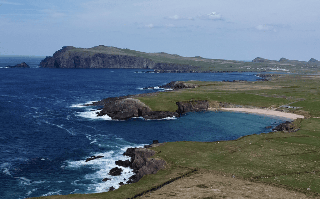
The Wild Atlantic Way is defined by its relationship with the ocean, and the Dingle Peninsula presents that relationship in several different forms. There are exposed cliffs, broad sandy beaches, rocky coves, sheltered harbours and headlands shaped by constant Atlantic weather.
Inch Beach extends along a sand spit at the entrance to Dingle Bay and offers views towards both the Iveragh Peninsula and the mountains of central Dingle. On the western peninsula, Coumeenoole is smaller, more enclosed and much more exposed to Atlantic swell.
On the northern coast, Clogher Strand sits within a rocky bay facing the open ocean. Nearby Clogher Head provides wider views towards the Three Sisters and the Blasket Islands.
These beaches are visually impressive, but conditions differ greatly from place to place. Strong waves, currents and rapidly changing weather mean visitors should observe warning signs and never assume that a sandy beach is automatically suitable for swimming.
The guide to beaches around the Dingle Peninsula provides a useful comparison of the area’s principal coastal locations.
Wildlife and Marine Life
The waters surrounding the peninsula support seals, dolphins, whales and a wide variety of seabirds. Sightings depend on the season, sea conditions, food availability and simple chance, so no particular species should be treated as guaranteed.
Boat trips from Dingle Harbour provide an opportunity to see the coastline from the water. Depending on the operator and conditions, routes may focus on marine wildlife, the harbour, the cliffs near Slea Head or the Blasket Islands.
Seabirds seen around the peninsula can include gannets, fulmars, shearwaters and other species adapted to the Atlantic environment. Puffins are seasonal visitors and are most closely associated with offshore islands and breeding areas rather than the town itself.
Always choose an established operator and allow flexibility for weather. Atlantic boat trips may be altered or cancelled when sea conditions make sailing unsuitable.
Food and Local Produce
The Atlantic has shaped Dingle’s food culture as strongly as it has shaped the coastline. Fresh fish and shellfish feature prominently, while farms throughout the peninsula produce beef, lamb and dairy products.
The town also supports artisan food producers, bakeries, cafés and restaurants ranging from informal seafood counters to longer evening dining experiences. During busy periods, booking ahead for dinner is sensible, particularly if you have a specific restaurant in mind.
Local food experiences include seafood, traditional Irish cooking, artisan cheese, small-batch spirits and locally produced ice cream. The Dingle food guide explains what to try and how the peninsula’s landscape influences what appears on local menus.
How Long Should You Spend on the Dingle Peninsula?
It is possible to see several major attractions in one full day, but a single day requires careful choices. Driving every road and stopping at every signed attraction generally produces a rushed experience.
Two days provide a much better balance. One day can be devoted to Dingle Town and the Slea Head Drive, while the second can include Conor Pass, the northern coastline, additional historical sites or a longer walk.
Three days allow time for changing weather, a boat trip, quieter beaches and unplanned discoveries. Visitors deciding how the peninsula fits into a wider itinerary can use the detailed guide to how long to spend in Dingle.
A Suggested Wild Atlantic Way Dingle Itinerary
One Day on the Dingle Peninsula
- Begin in Dingle Town
- Follow the Slea Head Drive clockwise
- Stop at Ventry and the archaeological sites around Fahan
- Continue to Coumeenoole Beach and Dunmore Head
- Visit Dunquin Pier or the Blasket Centre
- Return through Ballyferriter, Gallarus and Kilmalkedar
This is a full day once photography, walking and visitor attractions are included. The guide to spending one day on the Dingle Peninsula provides a more detailed sequence.
Two Days on the Dingle Peninsula
Use the first day for Dingle Town and the principal Slea Head locations. On the second day, travel across Conor Pass if conditions permit, explore the northern coastline and allow additional time for Riasc, Kilmalkedar or a local walk.
A second day also gives you flexibility if visibility is poor during your first attempt at the coastal route. Kerry weather rarely follows a perfect schedule, and retaining some freedom can make a significant difference to the experience.
Three Days on the Dingle Peninsula
With three days, you can include a boat trip, explore beaches without rushing, spend more time in the Gaeltacht and enjoy Dingle Town in the evening. My three-day Dingle Peninsula itinerary helps organise these experiences without repeatedly covering the same roads.
Driving and Practical Touring Advice
Roads around Dingle range from normal regional routes to narrow rural and coastal sections. Distances can appear short on a map, but journey times increase when traffic, livestock, cyclists, viewpoints and single-lane sections are taken into account.
Drive patiently and use designated parking areas wherever possible. Avoid stopping on blind bends, blocking farm entrances or pulling onto soft roadside verges. When meeting oncoming traffic on a narrow road, the nearest vehicle to a safe passing place should generally use it rather than forcing both vehicles into an awkward position.
Fuel is available in Dingle, but visitors continuing into quieter areas should avoid beginning the day with an almost empty tank. Mobile coverage can also vary, so downloading maps in advance is useful.
Visitors who do not wish to drive can still explore the area, although reaching smaller sites requires more planning. The guide to visiting Dingle without a car explains the main options and their limitations.
Weather and the Best Time to Visit
The Dingle Peninsula can be visited throughout the year, but the experience changes with the seasons. Summer brings long evenings and the widest selection of visitor services, but it is also the busiest period on the main roads and at recognised viewpoints.
Spring and early autumn can provide a good balance between daylight, visitor numbers and available services. Winter is quieter, although days are shorter and some attractions, tours and seasonal businesses may operate reduced hours.
Atlantic weather can change quickly in every season. Bring a waterproof layer and avoid planning the entire day around one distant view. Cloud on Conor Pass does not necessarily mean poor visibility at Slea Head, and rain in Dingle Town may pass before you reach the western coast.
The guide to the best time to visit Dingle compares the seasons in greater detail.
My Local Tip
Many visitors treat the Dingle Peninsula as a short detour from the Wild Atlantic Way. In reality, it deserves at least one complete day and ideally two or three.
Do not measure the experience only by how many marked viewpoints you reach. Some of the most memorable moments come from walking a beach, spending time at an archaeological site, hearing Irish spoken locally or stopping when the light changes across the Blasket Islands.
If your schedule allows only one day, decide in advance whether your priority is archaeology, coastal scenery, walking, photography or family attractions. A focused day is usually more rewarding than trying to complete every possible stop.
Visitors who want local historical context without concentrating on navigation or narrow-road driving can explore the peninsula on a private full-day Dingle Peninsula tour.
Continue Exploring the Dingle Peninsula
The Dingle Peninsula is one of the defining experiences of the Wild Atlantic Way, but it also forms part of a wider Kerry journey. South of Dingle Bay, the Iveragh Peninsula continues through Killorglin, Glenbeigh, Cahersiveen, Waterville, Sneem, Kenmare and Killarney.
Travellers deciding how to divide their time between Kerry’s two best-known peninsulas may find the comparison of the Ring of Kerry and Dingle Peninsula particularly useful.
Within Dingle itself, continue exploring Gallarus Oratory, Dún Beag Promontory Fort, Coumeenoole Beach, Dunquin Pier, Conor Pass and the Blasket story. Together, these places reveal how geography, language, farming, religion and the Atlantic shaped life in Corca Dhuibhne.
Frequently Asked Questions About Wild Atlantic Way Dingle
Is the Dingle Peninsula part of the Wild Atlantic Way?
Yes. The Dingle Peninsula forms one of the principal County Kerry sections of the Wild Atlantic Way. Its best-known coastal journey is the Slea Head Drive around the western end of the peninsula.
How long should I spend in Dingle?
One full day allows you to see several major attractions, but two or three days provide a more relaxed experience and greater flexibility for weather, walks, historical sites and time in Dingle Town.
Can I drive the Dingle Peninsula in one day?
Yes, provided you choose your stops carefully. A one-day visit normally focuses on Dingle Town and the Slea Head Drive rather than attempting to cover every road and attraction on the peninsula.
What are the main highlights of the Dingle Peninsula?
Popular highlights include Slea Head Drive, Dingle Town, Coumeenoole Beach, Dunquin Pier, the Blasket Islands viewpoints, Gallarus Oratory, Kilmalkedar Church, Dún Beag Promontory Fort and Conor Pass.
Which direction should I drive around Slea Head?
Clockwise is generally the most practical direction. It follows the usual flow of visitor traffic and places vehicles on the coastal side for much of the narrow western section.
Is the Dingle Peninsula suitable for families?
Yes. Families can combine beaches, short walks, animal experiences, boat trips and historical attractions. The best itinerary will depend on the children’s ages, the weather and how much time the family is comfortable spending in the car.
Do I need a car to explore Dingle?
A car provides the greatest flexibility, but it is possible to visit without one by combining organised tours, taxis, seasonal transport and activities within Dingle Town. Reaching smaller archaeological sites and remote coastal locations requires more advance planning.