
SCENIC COASTAL DRIVE · DINGLE PENINSULA
Slea Head Drive is a circular coastal route around the western end of the Dingle Peninsula, passing Atlantic cliffs, beaches, historic sites and the Irish-speaking communities of West Kerry. Beginning and ending in Dingle, the route forms part of the Wild Atlantic Way and offers extensive views towards the Blasket Islands.
Scenic Coastal Drive
Dingle Peninsula, County Kerry
Circular Route from Dingle
Clockwise via Ventry
Slea Head Drive traces the western edge of the Dingle Peninsula, where the mountains meet a deeply indented Atlantic coastline of cliffs, headlands, coves and sandy beaches. The circular route begins and ends in Dingle and follows the R559 west through Ventry before continuing around Slea Head, Dún Chaoin and the Gaeltacht communities of West Kerry.
What makes the drive particularly rewarding is the concentration of landscape, archaeology and living culture along a relatively compact stretch of coast. Views open towards the Blasket Islands, while the roadside landscape is marked by dry-stone walls, old farmsteads and historic sites that reflect centuries of settlement on the peninsula. Rather than treating it simply as a scenic road, Slea Head Drive is best experienced slowly, allowing time for viewpoints, beaches, villages and stops along the route.
Every turn along Slea Head Drive reveals something new, from sheltered beaches and colourful West Kerry villages to dramatic Atlantic headlands and views across to the Blasket Islands. Take your time, enjoy the photographs and discover some of the remarkable landscapes waiting along this unforgettable coastal drive.
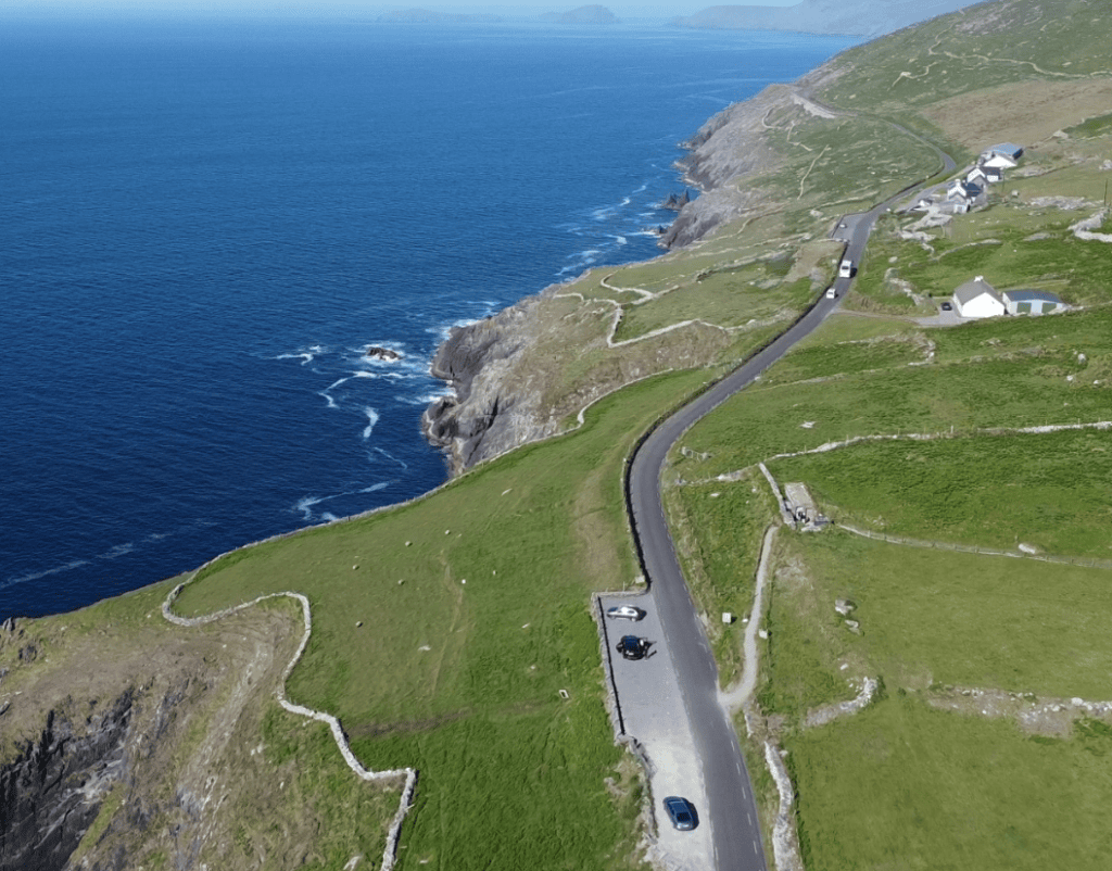
The R559 follows the exposed western coastline of the Dingle Peninsula, with successive viewpoints opening across the Atlantic.
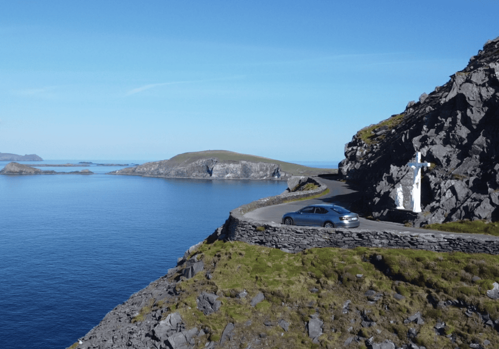
Rocky coves, Atlantic headlands and the offshore Blasket Islands create the distinctive coastal landscape encountered along the western section of Slea Head Drive.
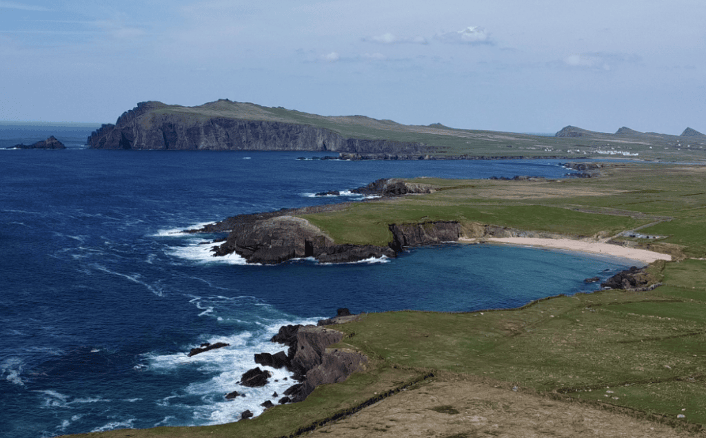
The Blasket Islands lie offshore from the western end of the Dingle Peninsula and form a defining part of the seascape along Slea Head Drive.
Slea Head Drive is a public-road scenic circuit around the western Dingle Peninsula. The route is straightforward to follow, but its narrow coastal sections, regular visitor stops and changing Atlantic weather make it a drive to take slowly rather than rush.
PLACE TYPE
Scenic Coastal Drive
NEAREST TOWN OR VILLAGE
Dingle
ROUTE LENGTH
Approx. 47 km / 30 miles
ROAD
R559
AREA
Western Dingle Peninsula
PUBLIC ACCESS
Public road, year-round
TYPICAL VISIT
3–4 hours with stops
ROUTE TYPE
Circular
ADMISSION
Free to drive
RECOMMENDED DIRECTION
Clockwise from Dingle via Ventry
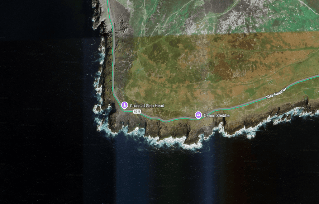
Latitude
52.098258
Longitude
-10.454764
Address
Slea Head, Dingle Peninsula, County Kerry, Ireland
NEAREST TOWN OR VILLAGE
Dunquin
Road access
Follow the R559 west from Dingle through Ventry and continue clockwise around Slea Head towards Dún Chaoin and Ballyferriter before returning towards Dingle.
Slea Head Drive is best understood as a journey through the landscape rather than simply a road between viewpoints. Travelling clockwise from Dingle, the route gradually leaves the town behind and moves through Ventry towards the increasingly exposed Atlantic coast, where narrow roads run between stone-walled fields, steep hillsides and the sea.
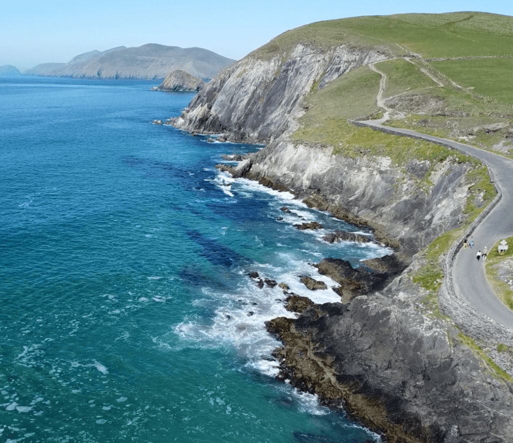
Slea Head Drive Cliffs
The value of the drive lies in how quickly the landscape changes. Sheltered Ventry Harbour gives way to the exposed coast around Fahan and Slea Head, followed by views across the Blasket Sound and the dramatic headlands around Coumeenoole and Dún Chaoin.
Historic and cultural sites are woven into this landscape rather than separated from it. Around Fahan, clocháns or beehive huts and the remains of Dún Beag reflect a long history of settlement along this coast. Further west, the road reaches Slea Head itself before continuing towards Coumeenoole and Dún Chaoin, with increasingly prominent views of the Blasket Islands offshore.
The route then passes through the Gaeltacht of West Kerry, where Irish remains part of everyday community life. This combination of Atlantic geography, archaeology and living culture is what gives Slea Head Drive its character: the scenery is not simply a backdrop, but part of a landscape that has been lived in and worked for generations.
Travel clockwise from Dingle through Ventry and follow the local Slea Head Drive and Wild Atlantic Way signs. Local guidance specifically advises visitors to prioritise these road signs over sat-nav or Google Maps routing. Roads can be narrow and busy, particularly in summer, so allow plenty of time and use designated stopping places rather than stopping on the roadway.
Slea Head Drive rewards an unhurried approach. Although the circuit itself is relatively compact, narrow roads, frequent viewpoints and worthwhile stops mean you should allow several hours to experience the western Dingle Peninsula properly.
Begin in Dingle and follow the R559 towards Ventry, continuing clockwise around the peninsula. Follow the signed Slea Head Drive and Wild Atlantic Way route rather than allowing sat-nav to divert you onto unsuitable minor roads.
There is no single car park for Slea Head Drive. Parking and designated stopping areas are available at various attractions and viewpoints along the route, but capacity varies considerably. Avoid stopping on narrow sections of roadway or obstructing entrances and passing places.
Allow approximately 3–4 hours for a relaxed circuit with several stops. More time is worthwhile if you plan to visit heritage sites, beaches, the Blasket Centre or spend longer exploring Dún Chaoin and the surrounding coast.
Slea Head Drive can be enjoyed throughout the year, but late spring through early autumn generally offers longer daylight hours and more time for stops along the route. Summer is the busiest period, so an earlier start can make the drive more relaxed. Outside the main season, expect quieter roads but shorter days and more changeable Atlantic weather.
Much of the route uses narrow regional roads with bends, limited sightlines and sections where larger vehicles require additional space. Drive conservatively, expect cyclists, walkers and oncoming traffic, and be prepared to wait where necessary.
Conditions on the exposed western peninsula can change quickly. Atlantic wind, rain, mist and low cloud can significantly reduce visibility, even when conditions in Dingle are relatively settled. Check the forecast before setting out, but be prepared for conditions to change during the drive.
Slea Head Drive brings together several of the western Dingle Peninsula’s most recognisable landscapes. Rather than one single viewpoint, the route unfolds through a succession of beaches, Atlantic headlands, island views and historic landscapes.
Leaving Dingle, the route reaches Ventry and the broad sweep of Ventry Harbour before climbing towards the more exposed western coastline. Mount Eagle rises above this section of the peninsula, marking the transition from the sheltered harbour landscape to the Atlantic-facing coast.
Around Fahan, stone-walled fields contain archaeological remains including clocháns, commonly known as beehive huts, while Dún Beag occupies a dramatic coastal position nearby. These sites are important reminders that the landscape along Slea Head has a long history of human settlement.
As the road rounds Slea Head, views open across the Atlantic towards the Blasket Islands. Great Blasket is the largest of the group, while the islands and smaller offshore rocks create one of the defining seascapes of the western Dingle Peninsula.
The coastline around Coumeenoole and Dún Chaoin is among the route’s most distinctive sections, with steep cliffs, exposed headlands and views across Blasket Sound. Nearby Dunquin Pier descends dramatically towards the water, while the wider Dún Chaoin area provides important cultural context for the Blasket Islands and West Kerry’s Gaeltacht heritage.
Slea Head Drive is suitable for ordinary cars, but it should not be approached like a conventional main road. Parts of the western coastal section are narrow, with restricted sightlines and limited space for vehicles to pass, while cyclists, walkers, farm traffic and local residents also use the road.
Visitors should travel clockwise from Dingle through Ventry, following signs for Slea Head Drive and the Wild Atlantic Way. The Dingle Peninsula Tourism Alliance specifically asks visitor traffic to follow this clockwise system and to prioritise local road signage rather than sat-nav or Google Maps directions. This helps keep visitor traffic moving in the same direction through the narrowest sections.
Driving conditions vary considerably around the circuit. Some sections are comfortably two-way, while others narrow significantly around the exposed western coastline. Allow extra time, reduce speed before blind bends and use appropriate lay-bys or pull-in areas when necessary. Local traffic, livestock, cyclists and walkers can all be encountered along the route, particularly during the busier summer months.
Leave Dingle towards Ventry / Ceann Trá and continue clockwise around Slea Head. Following the established visitor traffic direction reduces the likelihood of meeting larger visitor vehicles at the narrowest points.
Use the Slea Head Drive and Wild Atlantic Way signs as your primary navigation. Do not follow sat-nav instructions that attempt to shorten the journey by diverting onto minor local roads unsuitable for through visitor traffic.
Expect cyclists, walkers, local vehicles, agricultural traffic and occasionally livestock on the road. Drive patiently, leave adequate passing space and use designated pull-ins where appropriate rather than stopping on the carriageway for photographs.
Continue exploring Kerry’s landscapes, coast, mountains and remarkable places, with more locations worth discovering across the county.
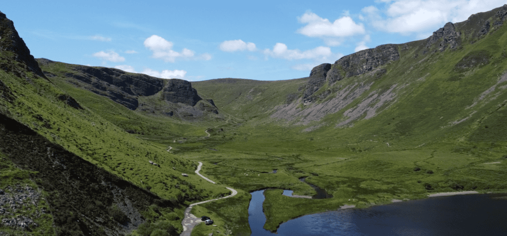
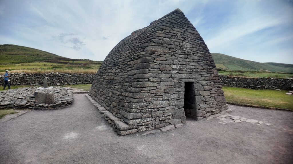
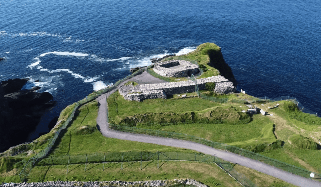
Slea Head Drive can be explored independently, but many of the places along the route become more meaningful with the history, landscape and local stories behind them. Ancient settlement sites, the Blasket Islands, West Kerry’s Gaeltacht communities and the changing coastal landscape all form part of a much wider story of the Dingle Peninsula.
Steve’s Peninsula Tours explores this coastline on the Slea Head Drive Private Tour, with time for carefully chosen stops rather than simply driving the circuit. Travelling with a local guide also removes the need to concentrate on navigation and narrow-road driving, leaving you free to enjoy the scenery and understand the places you are passing.
If you would rather leave the driving behind, I offer private tours across the Dingle Peninsula and County Kerry. Each experience is designed for small private groups, with a relaxed pace, local knowledge and the flexibility to spend more time at the places that interest you most.
A relaxed three-hour private tour around Slea Head and the spectacular western coastline of the Dingle Peninsula.
Explore Slea Head, ancient heritage sites, coastal viewpoints and the landscapes of West Kerry on a private half-day experience.
Discover more of the Dingle Peninsula with a full day to explore its scenery, history, villages and lesser-known places.
Journey around the Iveragh Peninsula, combining the Ring of Kerry with the dramatic landscapes and Atlantic coastline of the Skellig Ring.
Explore Killarney National Park, its lakes, mountain viewpoints, waterfalls and some of the most beautiful landscapes in County Kerry.
Travel north from Kerry for a private day tour through the Burren to the spectacular Cliffs of Moher on Ireland’s Atlantic coast.
Create a private Kerry itinerary around the places, landscapes and experiences that matter most to you.
Loading availability…