
HISTORY COLLECTION
The Fahan Clocháns, often known as the Beehive Huts, form part of an extensive archaeological landscape on the southern slopes of Mount Eagle.
Multi-period
Fahan & Glanfahan
Dingle Peninsula, County Kerry
Clocháns, cashels
& associated structures
Mixed access
State care & private sites
The surviving monuments at Fahan and Glanfahan form part of a wider archaeological landscape rather than a single settlement. Clocháns occur alongside stone-walled cashels, rectangular buildings, souterrains, field boundaries and routeways. Their different forms and structural relationships reflect repeated phases of construction, alteration and reuse across the slopes of Mount Eagle.
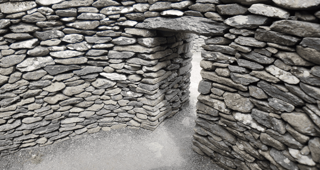
Corbelled clocháns were built from unmortared stone, with successive courses projecting inward to form the roof.
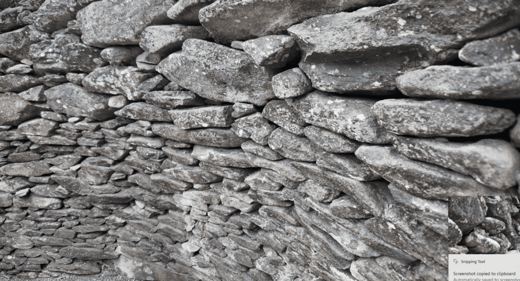
Some clocháns stand within stone-walled cashels associated with early medieval rural farmsteads.
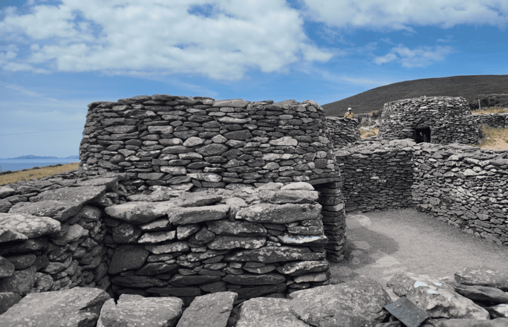
Field boundaries, routeways and stone structures preserve evidence of a working agricultural landscape used across different periods.
Every historic site has a unique story shaped by its landscape, history and surviving remains. This section provides the key facts you need to understand the monument, including its location, historical importance and defining features, offering a solid foundation before exploring the site in greater depth.
Irish name
Fán / Gleann Fán
County
Kerry
Monument Type
Clocháns, cashels and associated structures
National Monument Number
156 — Cathair Conor
Historical Period
Multi-period
Ownership
Mixed State and private ownership
Date
Early medieval to modern
Condition
Variable; restored, surviving and collapsed structures
Townland
Fahan and Glanfahan
Archaeological Investigation
Excavations in 1989, 2011 and 2012
Civil Parish
Ballinvoher
Public Access
Mixed
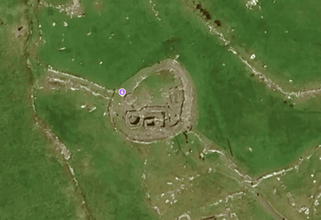
Latitude
52.101709
Longitude
-10.421822
Address
Fahan, Co. Kerry
Nearest Town
Ventry
Road access
R559
The Fahan and Glanfahan clocháns are best understood as part of a multi-period rural landscape, rather than the remains of one settlement built at a single moment. Across the southern slopes of Mount Eagle, corbelled huts survive alongside stone-walled cashels, rectangular buildings, souterrains, field boundaries and routeways. Together, these features indicate repeated periods of occupation, construction and changing land use.
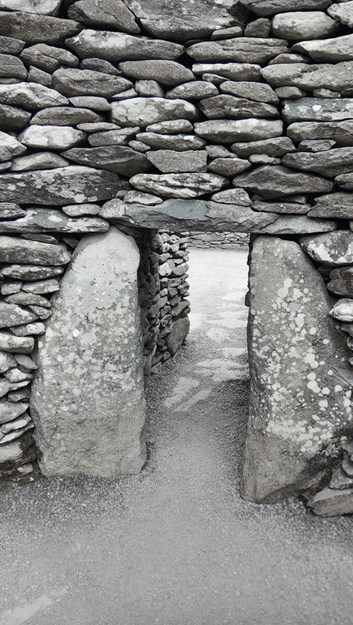
Fahan Cashel Stone Entrance
Cashels — ringforts enclosed by stone walls — are generally associated with the early medieval period in Ireland. They are usually interpreted as farmsteads containing houses, storage areas and other features associated with a household. At Fahan, the presence of buildings that were joined together, altered or constructed over earlier structures indicates that some settlements developed through several phases rather than following a single building plan.
This pattern continued beyond the early medieval period. The available evidence allows for medieval occupation, rebuilding and new construction at some sites, while dry-stone building traditions remained in use much later. Excavation at Clochán na mBó demonstrated that at least one apparently ancient-looking clochán was probably a modern booley shelter, associated with the seasonal movement of livestock to upland pasture.
The surviving monuments therefore cannot be assigned one universal date or purpose. The evidence instead points towards generations of people adapting the landscape for settlement, agriculture and pastoral activity, while continuing to use locally established dry-stone building techniques.
The corbelled form of a clochán does not establish its age. Excavation has shown that the Fahan-Glanfahan landscape contains structures belonging to different periods and serving different purposes. The popular idea that all the huts were constructed by monks, or by displaced communities following the Anglo-Norman invasion, is not supported by the available archaeological evidence.
The clocháns of Fahan and Glanfahan were predominantly constructed from unmortared local stone. Dry-stone construction did not mean simply stacking stones together. Builders carefully selected and positioned individual pieces according to their structural role, using larger stones for foundations and lintels and elongated stones where sufficient bearing was required within a corbelled roof.
Corbelling was achieved by laying successive courses of stone so that each projected slightly further inward than the course beneath it. As the opening gradually narrowed, the remaining space could be closed with one or more capstones. Despite their appearance, these roofs are not true arches. Their stability depends upon the weight and geometry of the masonry, friction between the stones and sufficient support within the surrounding walls.
The buildings themselves were not confined to the familiar rounded “beehive” form. Clocháns could have circular, oval, D-shaped, rectangular or composite plans, while some contained adjoining chambers. Changes in masonry, blocked entrances, differences in floor level and the junctions between walls can provide important evidence for alterations and separate phases of construction.
Excavation at Cathair Conor also revealed how sophisticated — and vulnerable — this construction could be. Carefully selected corbels formed the internal face of Clochán 3, while its core contained looser rubble and earth. Movement within this core contributed to structural instability, eventually requiring conservation work.
Corbelling Is a Technique, Not a Date
The distinctive roof does not reveal when a clochán was built. Corbelled construction remained in use over a long period and could serve different purposes. Archaeologists must therefore examine structural relationships, occupation deposits and other evidence rather than dating a building from its shape alone.
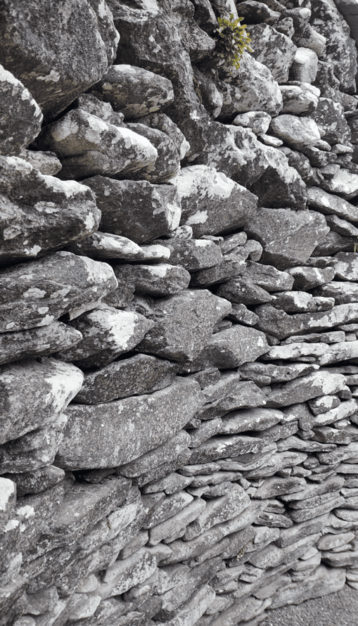
Fahan Cashel Dry Stone Wall
Archaeological excavation provides some of the strongest evidence for understanding the Fahan-Glanfahan clocháns. Two sites are particularly important: Clochán na mBó, excavated in 1989, and Clochán 3 at Cathair Conor, investigated during conservation work in 2011 and 2012. Together, they demonstrate why similar-looking stone huts cannot automatically be assigned the same date or function.
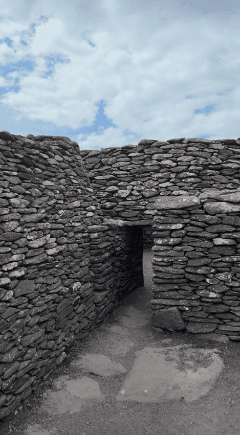
Fahan Dry Stone Passage
At Cathair Conor, excavation exposed paving, surviving basal stones and a cultural layer within the entrance passage. Further investigation in 2012 revealed the foundations of an earlier rectangular structure beneath part of Clochán 3. This established an important structural sequence: the surviving clochán was constructed after an earlier building had already occupied part of the site.
Finds included a carefully fashioned hone, a possible hammerstone, quartz and flint pieces, together with sheep or goat bone, a wrasse tooth, bivalve shell and possible hazelnut shell. Some animal bone showed evidence of processing and burning. These remains provide evidence for human activity and the use of terrestrial and coastal resources, although their archaeological contexts do not provide a precise construction date for the clochán.
The 1989 excavation of Clochán na mBó produced a very different picture. Relatively recent material was recovered, no secure ancient occupation horizon was identified and no external hearth was found. The excavator concluded that the building was probably a booley hut, used as temporary shelter by a herdsman. This provides direct evidence that the local tradition of corbelled construction continued into much later periods.
No radiocarbon dates are reported in the published excavation summaries. As a result, the precise construction dates of most individual clocháns remain uncertain.
An Earlier Building Beneath the Clochán
Excavation at Cathair Conor in 2012 uncovered the basal courses of a rectangular structure beneath part of Clochán 3. This proves that the visible building belongs to a later phase of activity and provides direct archaeological evidence for repeated construction and alteration at the site.
The archaeological evidence from Fahan and Glanfahan provides limited but valuable clues to how people used this landscape. Early medieval cashels are generally interpreted as family farmsteads, where enclosed areas organised domestic activity, livestock and movement. At Fahan, however, the evidence does not support assuming that every clochán was a permanent dwelling or that all were occupied at the same time.
Material recovered at Cathair Conor offers a closer view of everyday activity. Sheep or goat bones were found, including examples with evidence of carcass processing and burning. A rotary quern fragment is associated with grain processing, although it was recovered as a surface find and therefore cannot securely establish when such activity occurred at the site.
Marine resources also formed part of the archaeological evidence. A wrasse tooth and bivalve shell were recovered during the 2012 investigation, while possible hazelnut shell may represent gathered plant food. The assemblage is too small to reconstruct the inhabitants’ diet in detail, but it demonstrates connections between the settlement and the resources of its surrounding coastal landscape.
Later use of the slopes included booleying, the seasonal movement of livestock to summer pasture. Excavation of Clochán na mBó led to its interpretation as a temporary shelter used by a herdsman rather than a permanent home or animal house. It provides particularly clear evidence that the clochán building tradition also belonged to the working pastoral landscape of later centuries.
One Building Tradition, Different Uses
Excavation shows that clocháns did not necessarily serve the same purpose. While structures associated with early medieval cashels can form part of domestic farmsteads, Clochán na mBó was interpreted as a later temporary shelter connected with seasonal livestock management.
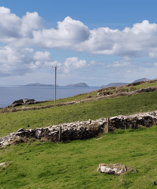
Fahan Coastal Landscape
The Fahan and Glanfahan monuments occupy steep, south-facing ground between Mount Eagle and Dingle Bay. Their position provided extensive views, exposure to sunlight and access to upland grazing, while also leaving buildings exposed to Atlantic wind and rain. The steep terrain influenced construction, requiring builders to create levelled areas, use terraces or incorporate structures into the hillside.
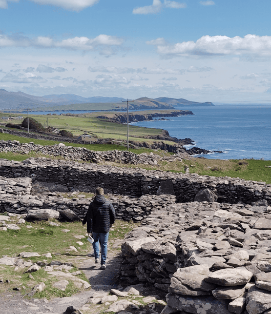
Fahan Clocháns Coastal Setting
This landscape was not simply a setting for the clocháns. Field walls helped control livestock and divide land, while routeways connected areas of settlement with grazing ground. Cashels defined household spaces within this wider agricultural landscape. At Clochán na mBó, part of the roof survived where the structure was embedded into the slope, demonstrating how the natural topography could also provide shelter and structural support.
The nearby coast contributed another dimension to life here. Archaeological finds from Cathair Conor include a wrasse tooth and bivalve shell, providing small but direct indications that marine resources formed part of the activities associated with the site.
The wider western Dingle Peninsula contains monuments from several different contexts and periods. Nearby sites include Dún Beag promontory fort, Riasc monastic settlement, Gallarus Oratory and the Kilmalkedar ecclesiastical complex. Together with the Fahan-Glanfahan remains, they demonstrate the long history of settlement and land use across this part of the peninsula.
A Working Landscape
The relationship between buildings, fields, routes and grazing ground is fundamental to understanding Fahan. The archaeological evidence indicates that the clocháns formed part of a broader working landscape shaped by farming, seasonal pastoral activity and access to coastal resources, rather than an isolated collection of stone huts.
Follow the Fahan and Glanfahan landscape from early medieval enclosed farmsteads through later building, seasonal pastoral use and modern archaeological investigation. The surviving clocháns belong to different phases and cannot be assigned a single construction date, reflecting centuries of settlement, adaptation and changing use across the slopes of Mount Eagle.
Human activity is well established across the wider Dingle Peninsula. Worked quartz and flint occur at Cathair Conor, but these finds do not date the surviving clochán walls.
Cathair Conor and other cashel sites provide evidence for enclosed rural settlement within the Fahan-Glanfahan landscape during the early medieval period.
Cathair Conor is classified as an early medieval cashel, a stone-walled enclosure associated with the wider tradition of enclosed rural farmsteads.
Continued occupation, rebuilding or new construction is considered plausible at some sites, although the individual phases have not been securely dated.
Dry-stone construction and seasonal pastoralism continued in the landscape. Excavation identified Clochán na mBó as a probable modern booley shelter.
Clochán na mBó was already marked as an antiquity on the first-edition Ordnance Survey six-inch map.
A three-week excavation found relatively recent material and led to the interpretation of the structure as a probable herdsman’s booley shelter.
Conservation excavations at Clochán 3 documented its construction, recovered evidence of human activity and revealed an earlier rectangular structure beneath part of the building.
The monuments remain under mixed State and private management, with continuing conservation and interpretation requirements.
The Fahan and Glanfahan monuments extend across a wider archaeological landscape rather than forming a single visitor site. Access arrangements vary between individual monuments, with some places under State care and others privately managed. Visitors should therefore respect local access arrangements and individual site conditions.
Fahan and Glanfahan, along the R559 Slea Head Drive
Public Parking is available
Mixed; access arrangements vary between individual sites
Some privately managed sites charge admission
Early morning and late afternoon generally offer quieter conditions, softer light and excellent views across the Atlantic coast.
Dún Beag, Riasc, Gallarus Oratory and Kilmalkedar
Explore more historic places, monuments and archaeological sites across County Kerry.
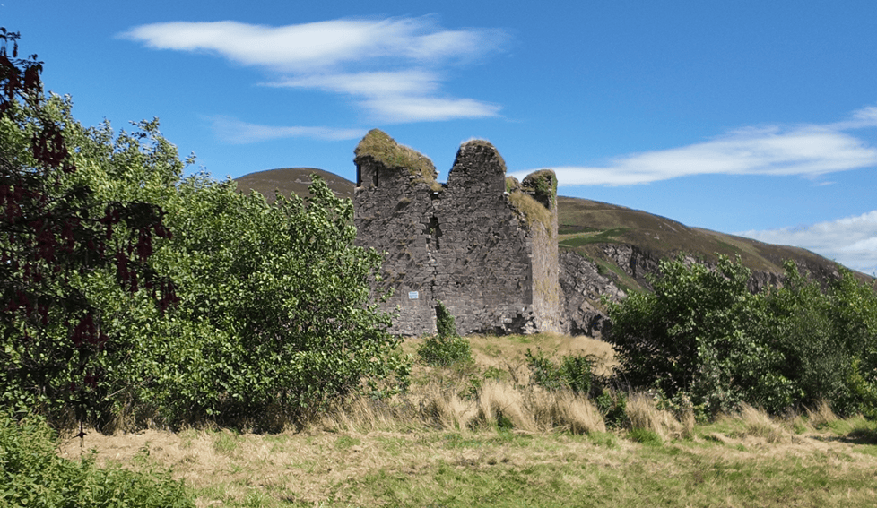
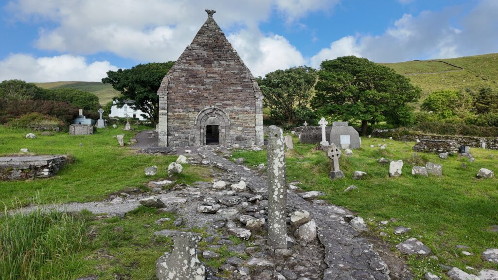
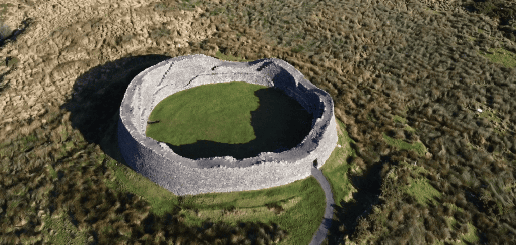
You can experience the Fahan Clocháns with Steve as part of a private tour of the Dingle Peninsula. Exploring the surviving stone structures within their wider landscape helps reveal how clocháns, cashels, field systems and pastoral activity formed part of a landscape used and adapted across many centuries.
If you would rather leave the driving behind, I offer private tours across the Dingle Peninsula and County Kerry. Each experience is designed for small private groups, with a relaxed pace, local knowledge and the flexibility to spend more time at the places that interest you most.
A relaxed three-hour private tour around Slea Head and the spectacular western coastline of the Dingle Peninsula.
Explore Slea Head, ancient heritage sites, coastal viewpoints and the landscapes of West Kerry on a private half-day experience.
Discover more of the Dingle Peninsula with a full day to explore its scenery, history, villages and lesser-known places.
Journey around the Iveragh Peninsula, combining the Ring of Kerry with the dramatic landscapes and Atlantic coastline of the Skellig Ring.
Explore Killarney National Park, its lakes, mountain viewpoints, waterfalls and some of the most beautiful landscapes in County Kerry.
Travel north from Kerry for a private day tour through the Burren to the spectacular Cliffs of Moher on Ireland’s Atlantic coast.
Create a private Kerry itinerary around the places, landscapes and experiences that matter most to you.
Archaeological excavation, field survey and national monument records provide important evidence for understanding the Fahan and Glanfahan clocháns. The principal sources below document individual structures, excavation findings and the wider archaeological landscape of the western Dingle Peninsula.
Bennett, I. (1989)
“Clochán na mBó, Gleann Fán or Glanfahan, Kerry.” Excavations 1989, No. 053. Excavations.ie.
Cuppage, J., Bennett, I., Cotter, C., O Rahilly, C. & O hEailidhe, P. (1986)
Archaeological Survey of the Dingle Peninsula: A Description of the Field Antiquities of the Barony of Corca Dhuibhne from the Mesolithic Period to the Seventeenth Century. Ballyferriter: Oidhreacht Chorca Dhuibhne.
Dunne, L. (2011)
“Glanfahan, Kerry.” Excavations 2011, No. 317. Licence E004374, SMR KE052-183. Excavations.ie.
Dunne, L. (2012)
“Glanfahan/Gleann Fán, Kerry.” Excavations 2012, No. 311. Licence E4374 ext., SMR KE052-183. Excavations.ie.
Government of Ireland (2004)
An tOrdú Logainmneacha (Ceantair Ghaeltachta) 2004 / Placenames (Ceantair Ghaeltachta) Order 2004.
Placenames Database of Ireland — Logainm.ie
Official placename record for Gleann Fán/Glanfahan.
National Monuments Service
Sites and Monuments Record / Historic Environment Viewer records for the Fahan-Glanfahan district.
Office of Public Works
Conservation records relating to National Monument No. 156, Cathair Conor.
Loading availability…