
DINGLE PENINSULA · MOUNTAIN PASS
Conor Pass is a high mountain road crossing the Dingle Peninsula, linking Dingle with the peninsula’s northern side through a dramatic glaciated landscape. Rising to around 410 metres, the pass is known for its mountain scenery, corrie lakes and far-reaching views across the surrounding valleys and coastline.
Mountain Pass & Scenic Drive
Dingle Peninsula, County Kerry
Approx. 410 metres
Mountain road with narrow sections
Conor Pass crosses the mountains of the Dingle Peninsula between Dingle on the southern side and the Brandon Bay area to the north. The road climbs rapidly away from Dingle into a high, open landscape shaped by glacial activity, where steep mountain slopes, corries and small lakes reveal the physical character of the peninsula’s interior.
At the summit area, the landscape opens dramatically in both directions. Looking south, the road descends towards Dingle and the Atlantic coastline beyond, while the northern side drops towards Brandon Bay and the lowlands around Castlegregory. The combination of elevation, exposed mountain terrain and changing coastal views makes Conor Pass more than simply a route across the peninsula — the crossing itself is an important part of experiencing this part of Kerry.
From the high mountain setting around the summit to the narrow northern approach and the wider views towards the coast, Conor Pass reveals several distinct sides of the Dingle Peninsula’s interior landscape.
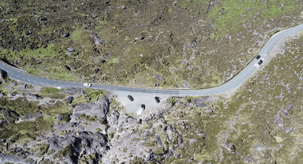
The summit area of Conor Pass sits at approximately 410 metres, surrounded by the steep mountain landscape of the central Dingle Peninsula.
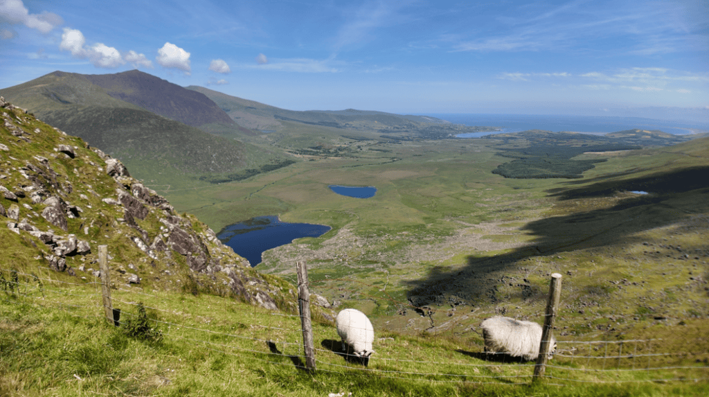
North of the summit, the road becomes particularly narrow as it crosses the mountainside above the glaciated valley.
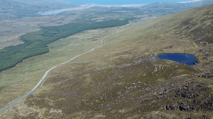
Small corrie lakes below Conor Pass are part of a landscape shaped by glacial erosion during the Ice Age.
Conor Pass is part of the R560 and provides a direct mountain crossing between Dingle and the northern side of the Dingle Peninsula. The summit viewpoint has space to stop, but visitors should be prepared for narrow road sections, changing mountain weather and limited facilities once they leave Dingle. Discover Ireland specifically confirms parking at the summit and describes the route as passing through a glaciated landscape of mountains and corrie lakes.
PLACE TYPE
Mountain Pass & Scenic Drive
NEAREST TOWN OR VILLAGE
Dingle
Irish name
An Chonair
PARKING
Summit viewpoint parking
AREA
Dingle Peninsula, County Kerry
PUBLIC ACCESS
Public road
ELEVATION
Approx. 410 metres
FACILITIES
No visitor facilities at the summit
ROAD
R560
LANDSCAPE
Glaciated mountain valley, corrie lakes & coastal views
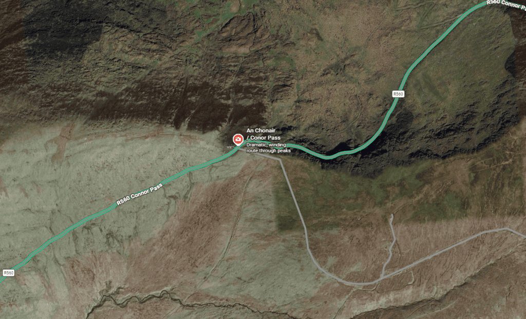
Latitude
52.182225
Longitude
-10.206208
Address
Conor Pass, Dingle Peninsula, County Kerry, Ireland
NEAREST TOWN OR VILLAGE
Dingle
Road access
R560 from Dingle towards Cloghane and Castlegregory
Driving Conor Pass takes you from the streets of Dingle into a markedly different landscape within a relatively short distance. As the R560 climbs into the mountains, the town and farmland fall away and the road enters exposed upland terrain shaped by rock, water and glacial erosion.
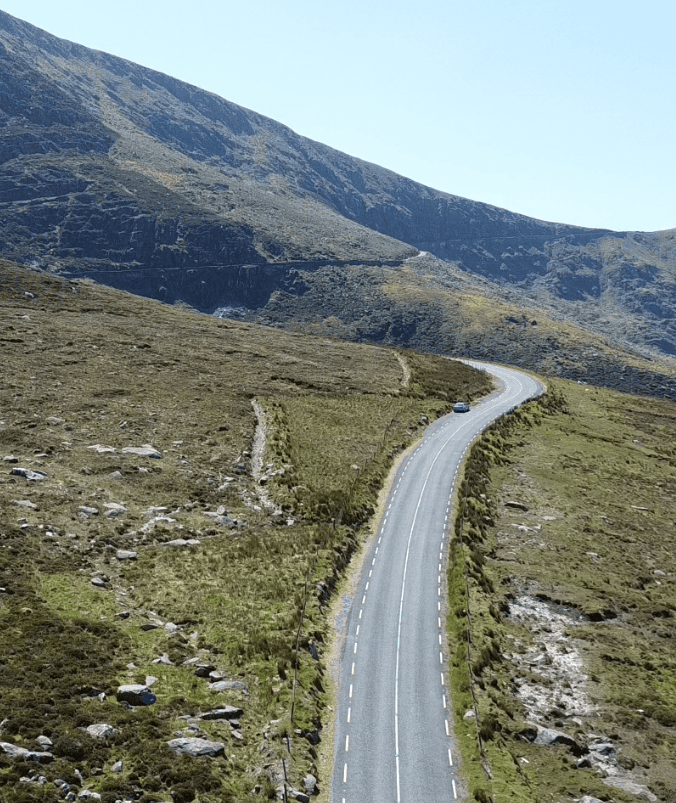
Driving the Conor Pass
The attraction of Conor Pass is not simply reaching its highest point. The changing landscape throughout the climb, summit and descent is what makes the journey particularly rewarding.
From Dingle, the road climbs northwards towards the central mountains of the peninsula. As elevation increases, there are increasingly expansive views back towards Dingle and the surrounding countryside before the road reaches the main summit viewpoint.
The northern side has a distinctly different character. Here the road passes beneath steep rock faces and above a glacial valley containing corrie lakes. The road is narrow in places, so this is a section to drive patiently rather than rush. On clear days, the descent gradually reveals the lower country towards Cloghane, Brandon and Brandon Bay.
Weather is an important part of the experience. Low cloud can obscure the higher landscape very quickly, while clear conditions reveal considerably more of the peninsula and coastline. Even when conditions change during the crossing, the contrast between the sheltered lowlands and exposed mountain pass gives visitors an excellent sense of Kerry’s Atlantic mountain geography.
Allow other vehicles plenty of space and use established stopping areas rather than stopping on narrow sections for photographs. Visibility and road conditions can change quickly at this elevation, so if cloud, heavy rain or poor visibility moves in, concentrate on the road rather than trying to complete the pass as a sightseeing stop.
Conor Pass is easy to reach from Dingle, but it is a mountain road rather than an ordinary sightseeing stop. Allow time for changing weather, slower traffic and safe stops at designated areas, particularly if you plan to continue down the narrower northern side of the pass.
From Dingle, follow the R560 north towards Conor Pass. The road climbs quickly from the town to the summit before continuing towards Cloghane and the northern side of the peninsula.
There is a recognised parking/viewing area at the summit. Space is limited, particularly during busy periods, so avoid stopping on the carriageway or unsuitable roadside areas when the viewpoint is busy.
Allow approximately 30–60 minutes if visiting from Dingle primarily for the drive, summit stop and photographs. Allow longer if crossing the pass as part of a wider journey around the northern Dingle Peninsula.
Clear weather provides the widest views, but conditions can change rapidly in the mountains. Earlier or quieter periods can also make stopping at the summit and negotiating the road more comfortable.
Expect steep gradients, bends and narrow sections, particularly north of the summit. Drive cautiously, anticipate oncoming traffic and be prepared to stop or give way where necessary.
Cloud, mist, rain and strong winds can significantly alter conditions at the pass even when the weather in Dingle appears relatively good. In poor visibility or severe weather, treat the crossing primarily as a mountain road rather than a sightseeing opportunity.
Conor Pass reveals several distinct sides of the Dingle Peninsula within one relatively short mountain crossing. These are four features worth looking out for as you travel through the pass.
At approximately 410 metres, the summit provides the principal stopping point on the route. In clear conditions, the elevated position gives a strong sense of the peninsula’s geography, with mountains immediately around you and lower countryside extending towards the coast.
On the northern side of the pass, look below the road towards the small mountain lakes set beneath the steep slopes. These corrie lakes occupy hollows formed through glacial erosion and are among the clearest visible clues to how ice shaped this mountain landscape.
The northern descent is one of the defining features of Conor Pass. The R560 follows the mountainside beneath exposed rock faces, creating a very different driving experience from the wider roads through the lower parts of the peninsula.
As you descend northwards and the landscape begins to open, the mountains give way to views towards the northern Dingle Peninsula and Brandon Bay. The transition helps reveal how closely Kerry’s mountains and Atlantic coastline are connected, with high upland terrain dropping towards broad coastal lowlands.
Conor Pass is a working regional road through mountain terrain, not a purpose-built scenic route. Although the approach from Dingle is relatively straightforward, conditions become more demanding around and beyond the summit, particularly on the northern side.
From Dingle, the R560 climbs steadily towards the summit through increasingly open mountain terrain. The road provides good forward visibility in places, but drivers should expect bends, gradients and changing weather as elevation increases.
Beyond the summit towards Cloghane, the character of the road changes significantly. Sections are narrow, with rock immediately beside the carriageway and limited room for opposing vehicles to pass. Drivers should travel slowly, look well ahead and use available passing space responsibly.
The mountain environment also means conditions can differ considerably from those in Dingle or at sea level. Mist and low cloud can reduce visibility, while heavy rain and strong winds can make the crossing more demanding. In winter or severe weather, road conditions should be checked before travelling.
Conor Pass is best approached as a slow scenic mountain crossing, not simply as the quickest route between Dingle and the northern peninsula.
The northern side contains particularly narrow sections where two vehicles may not be able to pass comfortably. Reduce speed and be prepared to give way or reverse to a suitable passing point when necessary.
Drivers of campervans, motorhomes, minibuses and other large vehicles should check the roadside restrictions before proceeding beyond the summit/northern approach. Do not rely on a generic vehicle-size rule online; posted restrictions and current road signage should always take precedence.
Conditions at approximately 410 metres can be very different from those in Dingle. Low cloud, rain, wind and poor visibility can develop quickly, so reconsider the crossing when conditions make safe driving difficult.
Continue exploring Kerry’s landscapes, coast, mountains and remarkable places, with more locations worth discovering across the county.
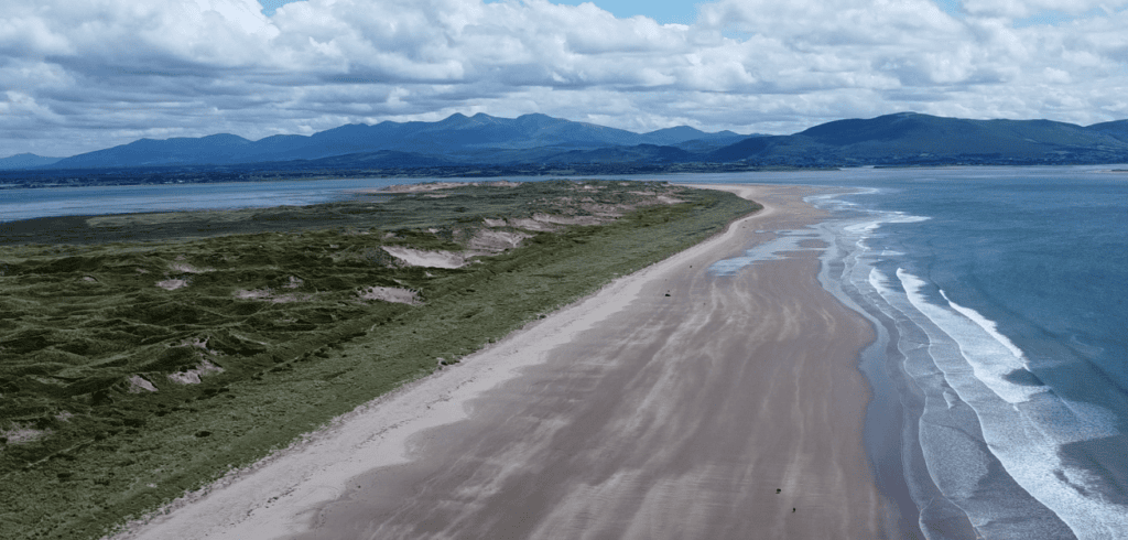
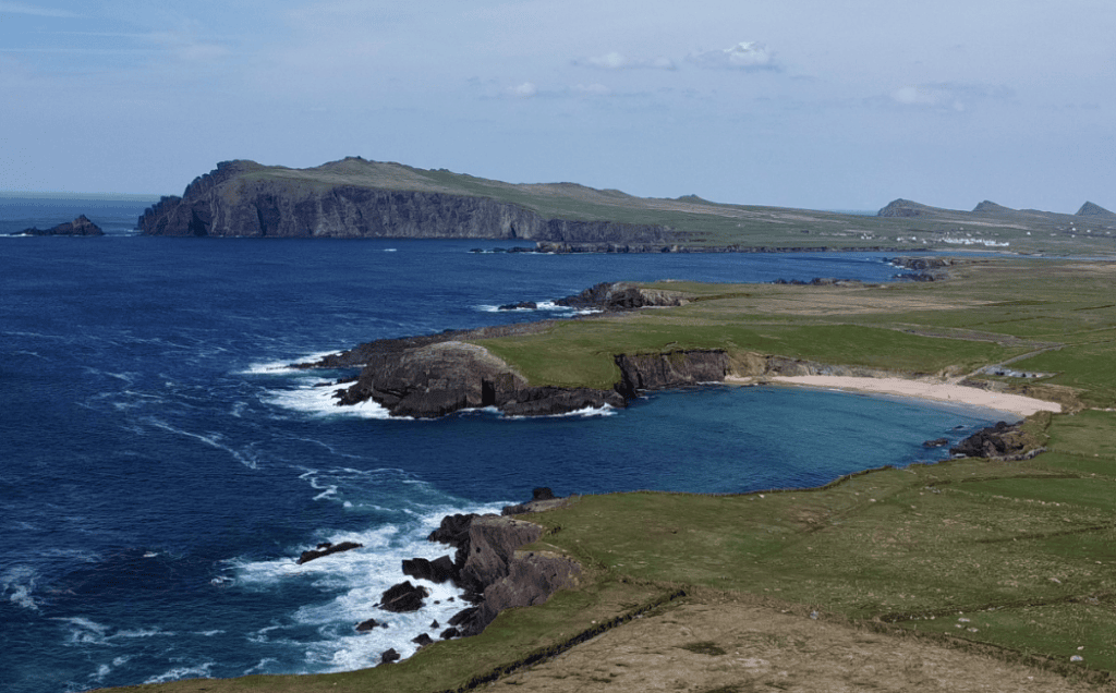
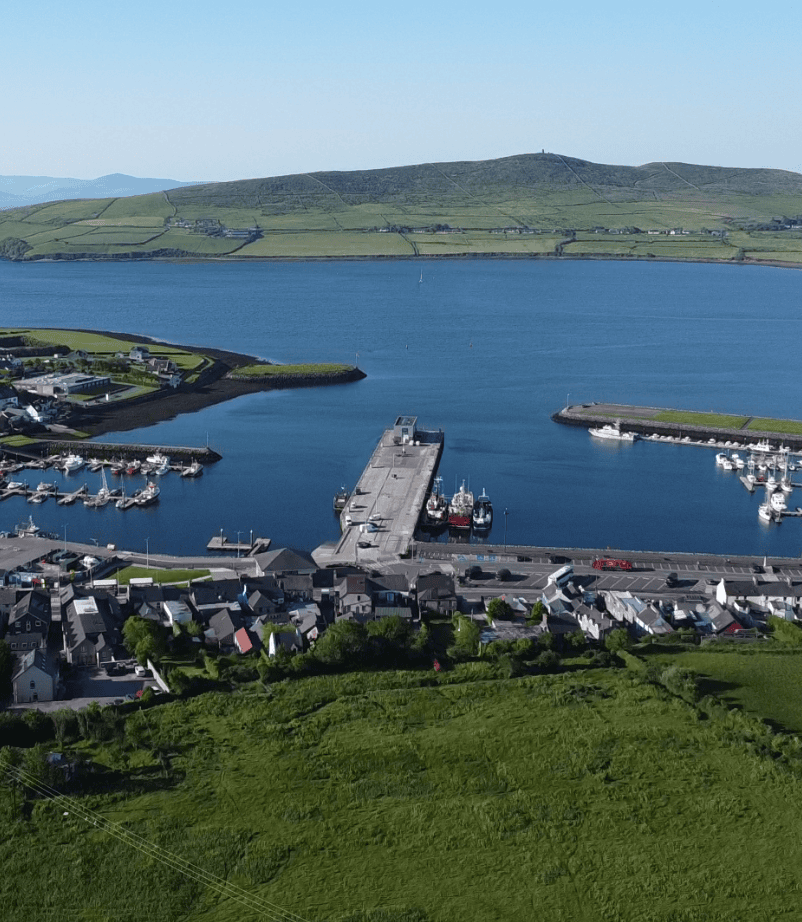
Conor Pass is one of the landscapes that helps explain the Dingle Peninsula beyond its better-known Atlantic coastline. Travelling through the mountains reveals how the peninsula’s glacial valleys, uplands and coastal settlements fit together, while a local guide can add context to the landscape and adapt the route to the weather and visibility on the day.
Conor Pass can be incorporated naturally into a private Dingle Peninsula tour, particularly when conditions are suitable and the route complements the day’s itinerary. Rather than treating it simply as a viewpoint, the journey can form part of a wider exploration of Dingle’s mountain and coastal landscape.
If you would rather leave the driving behind, I offer private tours across the Dingle Peninsula and County Kerry. Each experience is designed for small private groups, with a relaxed pace, local knowledge and the flexibility to spend more time at the places that interest you most.
A relaxed three-hour private tour around Slea Head and the spectacular western coastline of the Dingle Peninsula.
Explore Slea Head, ancient heritage sites, coastal viewpoints and the landscapes of West Kerry on a private half-day experience.
Discover more of the Dingle Peninsula with a full day to explore its scenery, history, villages and lesser-known places.
Journey around the Iveragh Peninsula, combining the Ring of Kerry with the dramatic landscapes and Atlantic coastline of the Skellig Ring.
Explore Killarney National Park, its lakes, mountain viewpoints, waterfalls and some of the most beautiful landscapes in County Kerry.
Travel north from Kerry for a private day tour through the Burren to the spectacular Cliffs of Moher on Ireland’s Atlantic coast.
Create a private Kerry itinerary around the places, landscapes and experiences that matter most to you.
Loading availability…