Ring of Kerry from Dingle: A Complete Day-Trip Guide
The Ring of Kerry from Dingle is a substantial but highly rewarding full-day journey through the Iveragh Peninsula. Starting on the Dingle Peninsula, the route crosses to Killorglin before following the Atlantic coast through Glenbeigh, Cahersiveen, Waterville, Sneem and Kenmare. It then returns through the mountains and lakes of Killarney before the final drive back to Dingle.
This is not simply a circular scenic road. The landscape changes repeatedly during the day, from the farmland around Castlemaine to the mountains of Glenbeigh, the exposed Skellig Coast, the sheltered coves of Derrynane and the wooded lake country of Killarney. Along the way are prehistoric monuments, island stories, fishing villages and places connected with figures including Daniel O’Connell.
However, visitors need to approach the day realistically. Travelling from Dingle adds considerable distance to the traditional Ring of Kerry circuit. You cannot explore every beach, village, viewpoint and historical site properly in one day. The best experience comes from selecting a manageable number of stops and allowing the route itself to remain part of the journey.
Can You Drive the Ring of Kerry from Dingle in One Day?
Yes, it is entirely possible to experience the Ring of Kerry from Dingle in one day. I would normally recommend leaving at approximately 8.00 or 8.30 in the morning and allowing between ten and twelve hours for the full outing.
The final duration depends on traffic, weather, the number of stops and whether you include the Skellig Ring. A straightforward circuit with carefully selected stops may be completed in about ten hours. Adding Valentia Island, Portmagee, the Kerry Cliffs or longer walks can easily extend the day.
This journey suits visitors spending at least three or four nights in Dingle who want to explore another major part of County Kerry without changing accommodation. If you have only one free day, you may prefer to remain closer to Dingle and experience the peninsula more thoroughly. The comparison between the Ring of Kerry and the Dingle Peninsula can help you decide which route best matches your interests.
Understanding the Ring of Kerry
The Ring of Kerry is the recognised touring circuit around the Iveragh Peninsula, the largest of Kerry’s Atlantic peninsulas. The traditional route begins and ends in Killarney, following the N72 and N70 around the coast before returning through Kenmare and Killarney National Park on the N71.
Visitors starting in Dingle normally join the route near Killorglin. From there, the most logical sequence is Glenbeigh, Cahersiveen, the Skellig Coast, Waterville, Sneem, Kenmare, Moll’s Gap, Ladies View and Killarney.
The complete journey from Dingle covers considerably more ground than the standard circuit from Killarney. The exact distance depends on detours, but a day including the Skellig Ring and selected attractions can involve approximately 250 kilometres or more of driving.
Road distance does not tell the whole story. Many sections are rural, winding or narrow, and progress is naturally slower than it would be on a motorway. Sheep, cyclists, tour coaches, roadworks and summer traffic can all affect journey times.
Which Direction Should You Drive?
From Dingle, travelling towards Killorglin and continuing around the peninsula through Glenbeigh and Cahersiveen creates the most natural circuit. This takes you along the northern and western coast first, then through Waterville, Sneem and Kenmare before finishing with the mountain and lake scenery around Killarney.
This is also the direction traditionally followed by many tour coaches. Some self-driving advice recommends travelling the opposite way to avoid meeting coaches on narrower roads, but the situation is not as simple as choosing one universally correct direction. Starting from Dingle, the coastal route through Killorglin works geographically and avoids adding unnecessary backtracking.
Whatever direction you choose, drive at a speed appropriate to the road and do not stop suddenly at viewpoints. Use established parking areas and pull in safely when allowing faster local traffic to pass.
A Realistic Ring of Kerry Itinerary from Dingle
A good day from Dingle should combine major landscapes with a limited selection of towns, historical places and short walks. The following route is realistic, but it should be adjusted according to weather, traffic and your particular interests.
Dingle to Killorglin
Leave Dingle on the N86, travelling through Lispole and Annascaul before turning towards Castlemaine. The road initially crosses the interior of the Dingle Peninsula, with the Slieve Mish Mountains to the north and the mountains surrounding Dingle Bay to the south.
Near Annascaul, a short detour can bring you to Inch Beach. Its long strand and views across Dingle Bay make it an excellent early stop, but keep the visit brief if you intend to include the Skellig Ring later in the day.
From Castlemaine, continue to Killorglin, traditionally regarded as one of the principal gateways to the Ring of Kerry. The town stands beside the River Laune, which flows from the Lakes of Killarney towards Castlemaine Harbour.
Killorglin is best known for the Puck Fair, a long-established August festival centred on the crowning of a wild mountain goat as King Puck. On a touring day, it is normally a passing point rather than a major stop, although it is a practical place for fuel or refreshments.
Killorglin to Glenbeigh
Beyond Killorglin, the N70 travels west through the valley of the River Caragh towards Glenbeigh. Mountains rise on either side, and glimpses of the Atlantic begin to appear as you approach the coast.
Glenbeigh is associated with the story of Red Fox, a nineteenth-century landlord’s agent whose killing became part of local history and folklore. The village is also the access point for Rossbeigh Strand, a long sandy spit extending into Dingle Bay.
Rossbeigh is worth visiting when beach scenery is a priority, but the return drive from the main road requires additional time. On a full circuit from Dingle, I would usually choose between Rossbeigh and several later coastal detours rather than attempting them all.
Glenbeigh to Cahersiveen
The road between Glenbeigh and Cahersiveen contains some of the most memorable scenery on the northern side of the peninsula. The route passes above stretches of coastline with views towards the Dingle Peninsula across the bay.
Near Kells, the road rises and curves along the mountainside. Safe stopping opportunities are limited, so use designated pull-ins rather than stopping on bends or narrow verges.
Cahersiveen is the principal town of western Iveragh. It stands near the mouth of the River Fertha and is closely associated with Daniel O’Connell, who was born nearby in 1775.
The town and surrounding area contain several places of historical interest, including the Old Barracks, Ballycarbery Castle and the stone forts of Cahergall and Leacanabuaile. Exploring all of them would require a separate visit, but one carefully chosen historical stop can add valuable context to the day.
Should You Include Valentia Island and the Skellig Ring?
The Skellig Ring is an extension of the main Ring of Kerry that travels through the western edge of the Iveragh Peninsula. It includes Valentia Island, Portmagee, the Kerry Cliffs, Ballinskelligs and coastal viewpoints looking towards the Skellig Islands.
If scenery, island history or early Christianity interests you, this is often the most rewarding part of the journey. However, it adds significant time. I would allow at least an additional 90 minutes for a basic drive and considerably longer if you intend to explore Valentia Island or visit attractions.
Valentia Island
Valentia Island can be reached by bridge from Portmagee throughout the year. A seasonal vehicle ferry may also operate between Reenard Point and Knightstown, but visitors should check current arrangements before relying on it.
The island played an important role in nineteenth-century communications. In 1866, the first permanently successful transatlantic telegraph cable was completed between Valentia and Newfoundland, transforming communication between Europe and North America.
Valentia also offers coastal viewpoints, walking routes and evidence of a much older natural history. Fossilised trackways discovered on the island preserve traces of early vertebrates that moved from water onto land hundreds of millions of years ago.
The Skellig Experience Visitor Centre is located on Valentia Island near the Portmagee bridge. It interprets the history, archaeology, birdlife and lighthouse story of the offshore Skellig Islands. Opening arrangements and admission can change, so check directly before planning a visit.
Portmagee
Portmagee is a colourful fishing village facing Valentia Harbour. It is one of the principal departure points for boat trips towards Skellig Michael, although sailings are seasonal and entirely dependent on sea conditions.
Skellig Michael lies approximately 12 kilometres off the Kerry coast. The island contains the remains of an early medieval monastery built high above the Atlantic and is recognised as a UNESCO World Heritage Site. Landing trips must be booked in advance and cannot realistically be treated as a casual addition to a one-day Ring of Kerry circuit from Dingle.
Portmagee works well as a coffee or lunch stop. It also provides the entrance to the narrow coastal road leading towards the Kerry Cliffs and Ballinskelligs.
Kerry Cliffs
The Kerry Cliffs stand west of Portmagee and offer broad views across the Atlantic towards the Skellig Islands. The cliffs are located on private land, and an admission charge normally applies.
A visit involves a walk from the parking area to the viewpoints. Allow approximately 45 minutes to an hour if you want to enjoy the setting without rushing. The ground is exposed, so wind and rain can considerably affect the experience.
The Kerry Cliffs are among the strongest additions to a Ring of Kerry day, but including them means something else may need to be omitted. The article about the Kerry Cliffs on the Ring of Kerry explains what to expect in greater detail.
Ballinskelligs and the Skellig Coast
Beyond the cliffs, the Skellig Ring continues through exposed coastal country towards Ballinskelligs and Waterville. Views open towards the Skellig Islands when conditions are clear, while small beaches, former monastic settlements and the remains of Ballinskelligs Castle reveal the area’s long relationship with the sea.
The road is narrower than much of the main Ring of Kerry. Large coaches generally cannot use the complete Skellig Ring, which gives it a different character from the principal touring circuit. Drivers should allow extra time and be prepared to use passing places correctly.
Waterville
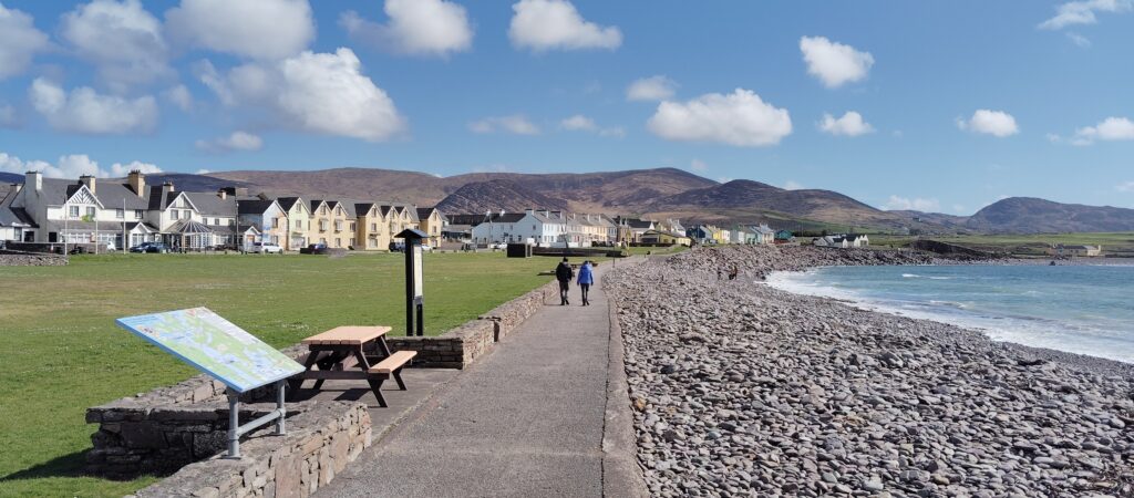
Waterville sits on a narrow strip of land between Lough Currane and Ballinskelligs Bay. Its Irish name, An Coireán, refers to the surrounding landscape, while its position between lake and ocean gives the village a distinctive setting.
Waterville became known as a holiday destination during the nineteenth century and later developed a strong association with Charlie Chaplin, who visited with his family over a number of years. A statue on the seafront commemorates that connection.
The promenade provides a useful place to stretch your legs, and the village is well positioned for lunch if you have not already stopped in Portmagee. It is also a natural point at which to reassess the day. If time is running short, continue directly towards Sneem rather than adding further lengthy detours.
Waterville to Sneem
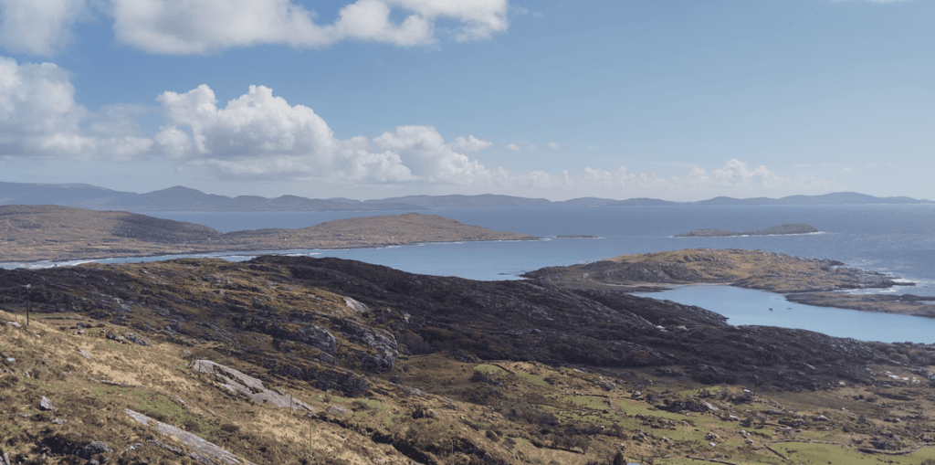
South of Waterville, the road climbs through open mountain country before descending towards Caherdaniel and Derrynane. Views extend across islands, bays and the deeply indented coastline of southern Iveragh.
Derrynane is closely associated with Daniel O’Connell, known as the Liberator for his role in the campaign for Catholic Emancipation. Derrynane House was his ancestral home and is now preserved as a museum within Derrynane National Historic Park.
Nearby Derrynane Beach is one of the most attractive stretches of sand on the peninsula. Abbey Island, reached across the sand when conditions allow, contains the ruins of a medieval church and graveyard. Tide, weather and terrain must be considered, and the island should not be treated as a quick roadside stop.
For a single day from Dingle, you will normally need to choose between a meaningful stop at Derrynane and a longer visit to the Skellig Coast. Trying to do both fully will place the rest of the itinerary under pressure.
Sneem
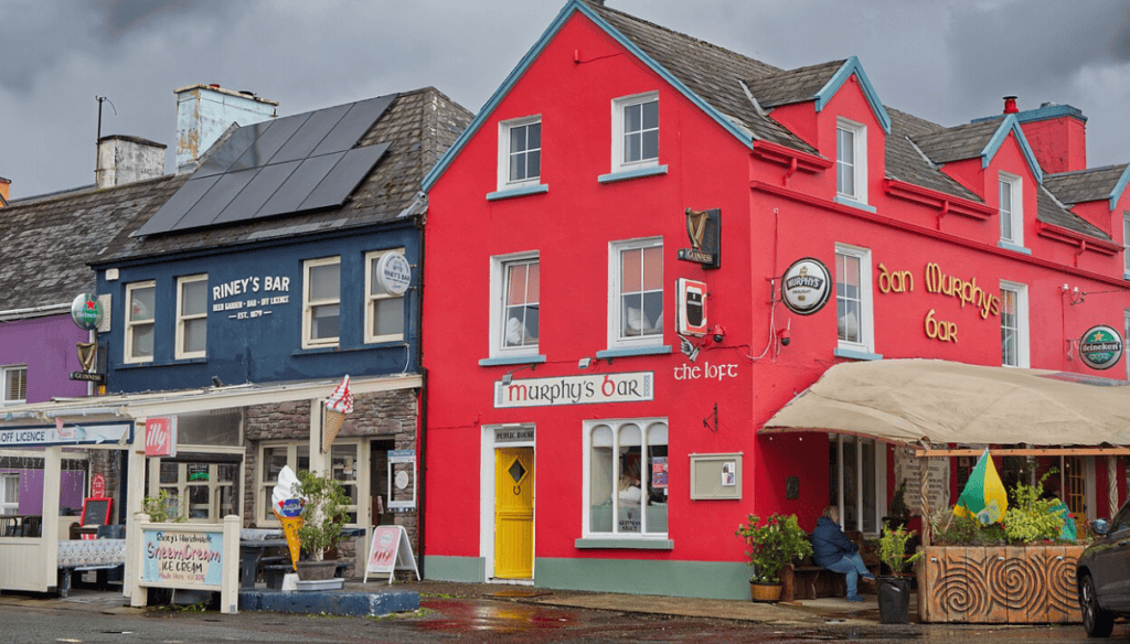
Sneem stands where the River Sneem reaches a sheltered inlet on the southern side of the peninsula. The village is divided by the river, with bridges connecting its two principal squares.
Its colourful buildings, stone bridges and riverside setting make Sneem a pleasant short stop. It is suitable for coffee, a short walk or an early evening break before continuing to Kenmare.
The surrounding landscape differs noticeably from the exposed Skellig Coast. Woodland and sheltered inlets become more prominent, reflecting the milder influence of Kenmare Bay.
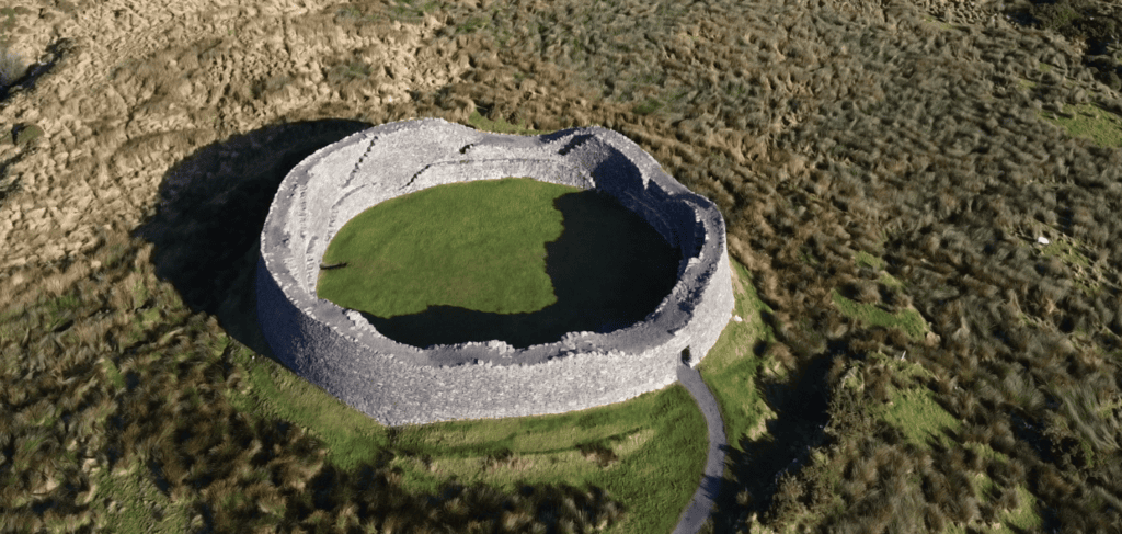
Staigue Fort
Staigue Fort is one of Ireland’s most impressive stone ringforts. It stands in a valley north of Castlecove, reached by a narrow local road from the N70.
The fort was constructed without mortar, using carefully fitted stone to create massive circular walls. Its exact date and purpose remain debated, but it is generally interpreted as a defended residence associated with a high-status local family during the early medieval period.
Staigue Fort is a worthwhile archaeological stop, especially for visitors interested in the settlement history of Kerry. However, the approach road is narrow and the detour takes longer than it may appear on a map. Allow approximately 45 minutes to an hour from leaving the main road to returning, including time at the monument.
If you have already visited the beehive huts of the Dingle Peninsula, Staigue offers an interesting comparison. Both demonstrate sophisticated dry-stone building traditions, but they served different communities and purposes.
Kenmare
Kenmare lies at the head of Kenmare Bay, between the Iveragh and Beara peninsulas. It was established as a planned town in the seventeenth century and retains a compact triangular street pattern.
The town is known for restaurants, independent shops and traditional pubs. It can be an excellent late lunch stop, although visitors travelling from Dingle should keep an eye on the remaining daylight and the drive through Killarney National Park.
A short walk from the centre leads to Kenmare Stone Circle, a prehistoric monument consisting of an oval arrangement of stones surrounding a central boulder burial. If archaeology is a priority, it provides a manageable stop without a long detour.
The broader Kenmare visitor guide is useful if you are considering a separate day in the town or continuing towards the Beara Peninsula.
Kenmare to Killarney Through the Mountains
The N71 between Kenmare and Killarney is one of the defining sections of the Ring of Kerry. The road climbs through mountain country towards Moll’s Gap before descending into Killarney National Park.
Moll’s Gap
Moll’s Gap is a mountain pass on the road between Kenmare and Killarney. The surrounding views include the MacGillycuddy’s Reeks, valleys, lakes and open mountain terrain.
The name is traditionally associated with Moll Kissane, who is said to have operated a shebeen in the area during the construction of the road in the nineteenth century. As with many local placename stories, the details belong partly to tradition rather than firmly documented history.
Parking is limited and the road can be busy. Use established spaces and avoid stopping where you obstruct traffic or reduce visibility.
Ladies View
Ladies View overlooks the Upper Lake and the mountain landscape of Killarney National Park. The name is associated with Queen Victoria’s visit to Killarney in 1861, when her ladies-in-waiting reportedly admired the view.
The main viewpoint is close to the road, making it suitable for visitors who do not want a long walk. Visibility can change quickly, with low cloud sometimes hiding the mountains before clearing again within a short period.
Torc Waterfall and Muckross
As the road descends towards Killarney, it enters an increasingly wooded landscape. Torc Waterfall is reached by a short walk from its parking area, but spaces can be difficult to find during busy periods.
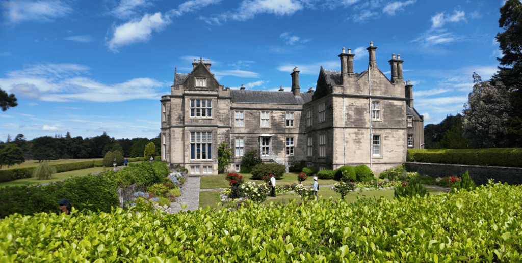
Nearby Muckross House and Muckross Abbey are among the principal historical attractions within the national park. Both deserve more time than is normally available near the end of a Ring of Kerry day from Dingle.
If Muckross, Torc Waterfall and the lakes are priorities, consider visiting them on a dedicated Killarney day rather than squeezing them into the final hour of this circuit. The Killarney National Park guide explains how the area fits together.
Returning from Killarney to Dingle
From Killarney, the most direct return route normally travels towards Farranfore and Castlemaine before rejoining the N86 to Dingle. Allow approximately one hour to one hour and fifteen minutes for this final section, depending on traffic and conditions.
It is easy to underestimate this last drive. By the time you reach Killarney, you may already have spent eight or nine hours touring. Keeping earlier stops under control ensures that the return journey does not become unnecessarily late or tiring.
If you are driving yourself, take a proper break before leaving Killarney when required. Fatigue matters more than completing one final viewpoint or attraction.
How Many Stops Can You Realistically Include?
From Dingle, I would normally select approximately five or six principal stops rather than attempting every attraction. A balanced itinerary might include:
- A brief coastal stop near Glenbeigh
- Cahersiveen or Valentia Island
- Portmagee and the Kerry Cliffs
- Waterville for lunch or a seafront walk
- Sneem or Kenmare
- Ladies View within Killarney National Park
If archaeology is particularly important, Staigue Fort could replace one of the longer coastal stops. If beaches are your priority, Rossbeigh or Derrynane may be more rewarding than spending additional time in a town.
The guide to the best stops on the Ring of Kerry can help you choose places according to your interests.
How Long Does the Ring of Kerry Take from Dingle?
A realistic Ring of Kerry day from Dingle normally lasts between ten and twelve hours. Poor weather, seasonal traffic and extra detours can extend this further.
The main considerations are:
- Approximately one hour from Dingle to the traditional circuit
- A full coastal route around the Iveragh Peninsula
- Additional time for the Skellig Ring
- Parking and walking at attractions
- Meal and comfort stops
- The final return journey from Killarney to Dingle
The separate guide explaining how long the Ring of Kerry takes provides more detail on distance, driving time and the difference between simply completing the road and experiencing it properly.
Weather and Seasonal Conditions
The Ring of Kerry crosses several different coastal and mountain environments, so weather can vary considerably during the same day. Dingle may be dry while the Skellig Coast experiences showers, or Kenmare may be overcast while visibility improves around Killarney.
Low cloud can obscure mountain viewpoints such as Moll’s Gap and Ladies View. Strong Atlantic winds affect exposed places including the Kerry Cliffs, while heavy rain may make longer walks less appealing.
Bring waterproof clothing and comfortable footwear regardless of the morning forecast. During winter, shorter daylight hours make the complete route more demanding, and some visitor attractions operate reduced seasonal schedules or close temporarily.
Boat trips to the Skellig Islands are seasonal and weather-dependent. They should be planned as a separate experience and booked in advance rather than treated as an optional stop during a Ring of Kerry road trip.
Driving the Ring of Kerry Yourself
Independent driving gives you freedom to choose your stops, but the route requires concentration. Some sections are narrow, particularly around the Skellig Ring and local detours such as Staigue Fort.
Visitors unfamiliar with Irish roads should remember that journey times may be longer than navigation apps suggest. Drive on the left, use passing places correctly and avoid following a large coach too closely. Never stop on the roadway simply because a view appears unexpectedly.
Parking can be limited at beaches, waterfalls and roadside viewpoints. During the busiest summer periods, arriving early and remaining flexible will make the day much easier.
Taking a Private Ring of Kerry Tour from Dingle
A private tour removes the pressure of navigating, parking and monitoring the day’s schedule. It also allows the route to be adjusted around weather, traffic and the interests of the group.
On a private Ring of Kerry and Skellig Ring tour from Dingle, the most useful advantage is flexibility. If visibility is poor at one viewpoint, time can be used elsewhere. If guests are particularly interested in archaeology, history, photography or the Skellig Coast, stops can be selected accordingly.
This is especially valuable on a long touring day. Instead of concentrating on the road for ten hours, visitors can watch the landscape change and understand how the towns, monuments and coastlines connect.
Is the Ring of Kerry from Dingle Worth It?
The Ring of Kerry is worth the journey from Dingle when you have enough time to treat it as a complete day rather than a rapid checklist. It provides a broader understanding of County Kerry and shows how different the Iveragh Peninsula is from Dingle.
The Dingle Peninsula feels more compact, with archaeological sites and Atlantic viewpoints appearing close together along its western roads. The Ring of Kerry covers a larger area, with longer transitions between mountain valleys, beaches, towns and historical landscapes.
Visitors planning a wider Kerry holiday may also find the seven-day Kerry itinerary useful for deciding which regions deserve separate days.
Continue Exploring the Ring of Kerry
The Ring of Kerry cannot be fully understood in a single day. The main circuit introduces the Iveragh Peninsula, but places such as Valentia Island, Derrynane, Killarney National Park and the Skellig Coast can each justify much longer visits.
If you are planning further exploration, the Places to See in Kerry guide brings together beaches, viewpoints, scenic roads and natural attractions. Visitors with an interest in archaeology can also explore the collection of historical sites around Kerry.
For a second full day, consider exploring Killarney’s lakes, woodland and monuments at a slower pace. Ross Castle, Muckross Abbey and the walking routes around the national park are difficult to appreciate properly when added to the end of a long coastal circuit.
Frequently Asked Questions About the Ring of Kerry from Dingle
Can you do the Ring of Kerry from Dingle in one day?
Yes. Leave early and allow approximately ten to twelve hours. The day becomes longer if you include the Skellig Ring, Valentia Island, the Kerry Cliffs or several extended walks.
What time should I leave Dingle?
A departure between 8.00 and 8.30 in the morning is sensible for most full-day itineraries. An earlier departure may be useful during busy summer periods or when you want to include more of the Skellig Coast.
Should I drive clockwise or anticlockwise?
From Dingle, joining the circuit near Killorglin and continuing towards Glenbeigh and Cahersiveen creates a logical route. Road safety, available daylight and sensible stop selection matter more than following a rigid directional rule.
Can I include the Skellig Ring?
Yes, but allow at least an additional 90 minutes and longer if visiting Valentia Island or the Kerry Cliffs. The Skellig Ring is one of the most rewarding parts of the day, so it is often better to omit a less important stop elsewhere.
Can I visit Skellig Michael during the day trip?
No, not realistically as part of the same road itinerary. Landing trips and sea cruises are separate, weather-dependent experiences requiring advance booking and several hours. Plan a dedicated day for the islands.
How many stops should I choose?
Approximately five or six meaningful stops normally create a comfortable day. Trying to visit every beach, fort, village and viewpoint will result in more time parking and less time enjoying the places themselves.
Is the route suitable for nervous drivers?
Most of the main circuit uses established national roads, but sections can be winding and busy. The Skellig Ring and some attraction approaches are narrower. Visitors uncomfortable with left-side driving or rural roads may prefer a private guided tour.