
HISTORY COLLECTION
Staigue Fort is a monumental dry-stone cashel, or stone ringfort, standing in Staigue townland on the southern Iveragh Peninsula.
Date unresolved
Possibly Iron Age
Staigue, Iveragh Peninsula
County Kerry
Cashel
Stone Ringfort
Unguided
Daylight Hours
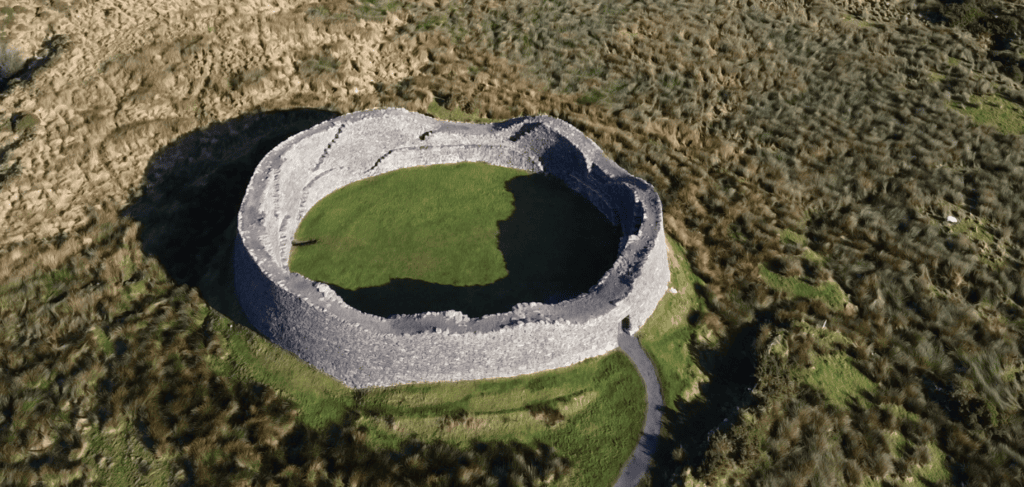
Staigue Fort’s surviving architecture reveals the scale and complexity of this remarkable stone enclosure. Its massive dry-stone walls incorporate a controlled southern entrance, internal chambers and numerous flights of steps leading towards the upper wall levels. The fort’s position within a south-draining valley also provides important context for understanding its relationship with the surrounding Iveragh landscape.
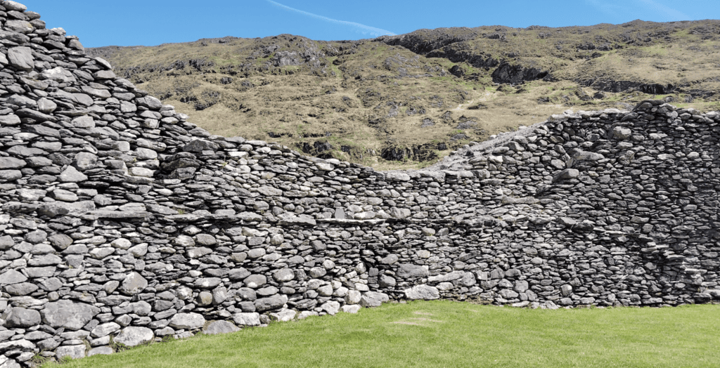
Massive dry-stone walls form the near-circular enclosure of Staigue Fort.
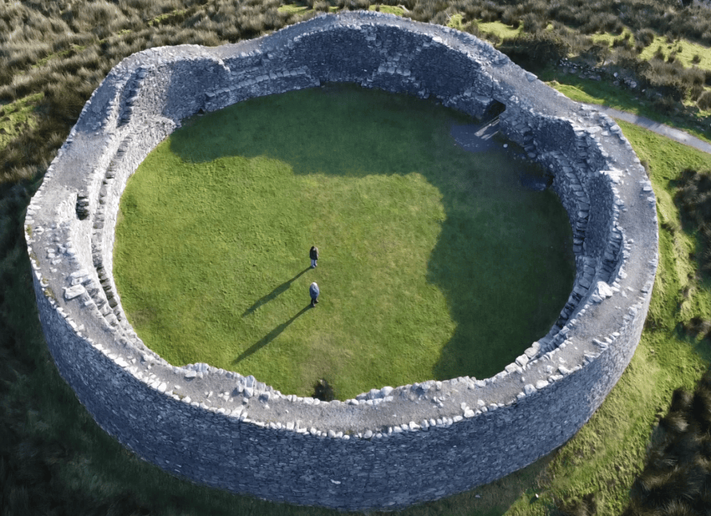
Internal stone stairways provided access towards the fort’s upper wall levels.
A narrow lintelled passage forms the fort’s single south-facing entrance.
Every historic site has a unique story shaped by its landscape, history and surviving remains. This section provides the key facts you need to understand the monument, including its location, historical importance and defining features, offering a solid foundation before exploring the site in greater depth.
Irish name
Cathair na Stéige
County
Kerry
Monument Type
Cashel / Stone Ringfort
National Monument Number
143
Historical Period
Uncertain; possibly Iron Age
Ownership
State guardianship
Date
Uncertain; possibly Iron Age
Condition
Exceptionally well preserved
Townland
Staigue
Archaeological Investigation
No comprehensive modern excavation recorded
Civil Parish
Liss Upper
Public Access
Unguided; daylight access
Latitude
51.805145
Longitude
-10.015007
Address
Liss Upper, County Kerry
Nearest Town
Sneem
Road access
N70
Staigue Fort belongs to the Irish tradition of enclosed settlements known as ringforts. Where the enclosing boundary was constructed primarily from stone rather than earth, archaeologists generally use the term cashel. Staigue is an exceptional example, distinguished by the scale of its surviving walls and the complexity of its internal architectural features.
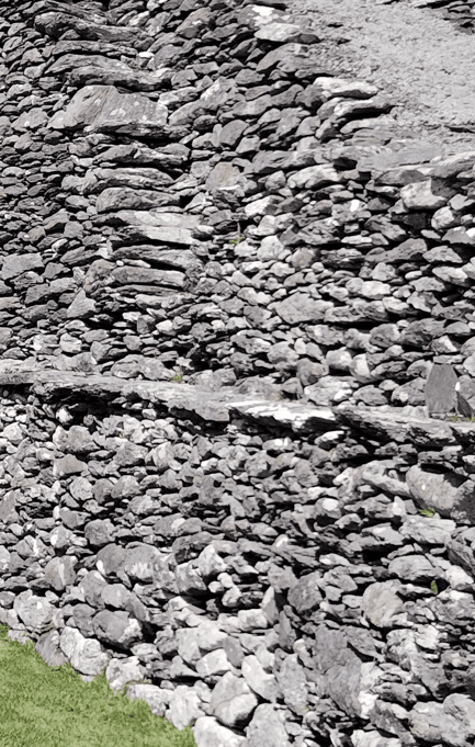
Staigue Fort Dry Stone Masonry
The precise date of its construction remains unresolved. Heritage Ireland attributes the fort to the Iron Age, around 300–400 BC. Comparisons with excavated Irish ringforts suggest that monuments of this general class were especially prominent during the Early Medieval period, but this wider pattern cannot by itself provide a secure date for Staigue.
Its substantial enclosure, carefully controlled entrance and elaborate wall-access system indicate considerable investment in its construction. These characteristics have led to interpretations of Staigue as a high-status residence, defended settlement or local centre of authority. Such interpretations are plausible from its architecture, but without excavation the identities of its builders and inhabitants, and the precise activities undertaken within the enclosure, remain unknown.
The fort eventually ceased to function in its original role, although when or why this occurred remains unknown. Its remarkable level of preservation subsequently made Staigue an important surviving example of Irish dry-stone fortification. Today it is protected as National Monument No. 143 in State guardianship.
Staigue’s famous Iron Age date should be understood as an attribution rather than a scientifically established construction date. Without comprehensive excavation or absolute dating, the fort’s precise chronology remains one of the most important unanswered questions surrounding the monument.
Staigue Fort is a near-circular enclosure defined by exceptionally substantial dry-stone walls. The fort measures approximately 27.4 metres internally, while its enclosing wall is about 5.5 metres high and approximately 4 metres thick. No mortar was used to bind the masonry; instead, carefully selected stones were laid and balanced so that the weight of the structure stabilised the wall.
A single narrow entrance on the southern side controls access to the interior. The passage is roofed with stone lintels and narrows as it passes through the massive enclosing wall. This restricted entrance contrasts strongly with the broad open space within the fort and would have allowed movement into the enclosure to be closely controlled.
One of Staigue’s most remarkable architectural features is the system of stone stairways incorporated into the inner face of the wall. These flights provided access towards the upper wall levels and demonstrate that the enclosing wall was designed as more than a simple boundary. Internal chambers are also built within the thickness of the masonry, adding further complexity to the structure.
The sheer quantity of stone required, combined with the thickness of the walls and integrated passages, chambers and stairways, demonstrates a considerable investment of labour and building skill. Without archaeological excavation, it is not possible to establish how long construction took, how the workforce was organised or whether all surviving architectural elements belong to a single building phase.
Staigue’s enclosing wall was designed as an accessible structure rather than simply a barrier. Stairways built into its inner face allowed movement towards the upper levels, while chambers were incorporated within the thickness of the masonry.
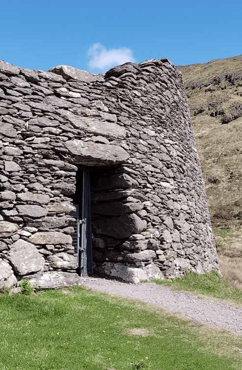
Staigue Fort Lintelled Entrance
Staigue Fort has not been subjected to a modern comprehensive archaeological excavation. Consequently, archaeologists do not have the stratified deposits, artefact assemblages or scientific samples that would normally help establish when a monument was constructed, how long it remained occupied or how its use changed through time. This absence of excavation is fundamental to understanding why important questions about Staigue remain unresolved.
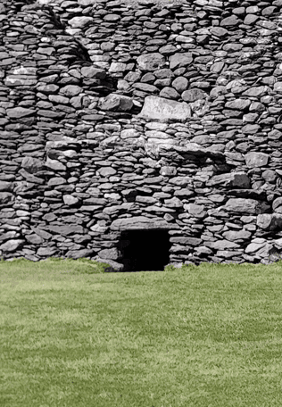
Staigue Fort Internal Opening
The fort is instead understood principally through its surviving architecture, historical records and comparison with other Irish ringforts and cashels. Its monumental dry-stone enclosure, restricted entrance, internal chambers and integrated stairways provide evidence of sophisticated construction and considerable investment of labour. These features can help archaeologists interpret the character of the site, but architecture alone cannot provide a secure construction date.
This is particularly important when considering Staigue’s traditional chronology. Heritage Ireland currently attributes the monument to around 300–400 BC and describes it as an Iron Age fort. No published site-specific radiocarbon dates, securely dated artefacts or other absolute dating evidence currently confirm this attribution. Comparison with the broader Irish ringfort tradition points towards the Early Medieval period as another chronological possibility, but this too remains an interpretation rather than a proven date for Staigue itself.
Until modern archaeological investigation provides firmer evidence, questions surrounding Staigue’s builders, occupation and chronology must therefore remain open. Its archaeology demonstrates an important principle: the exceptional survival of a monument does not necessarily mean that its history is equally well understood.
No scientifically established construction date currently exists for Staigue Fort. Its often-quoted Iron Age date is an official attribution, while the absence of comprehensive excavation means its precise chronology remains unresolved.
No houses or other domestic buildings are securely visible above ground within Staigue Fort today. This does not mean that the enclosure was uninhabited. Structures built from timber, turf or relatively light stonework may have disappeared, while archaeological remains of buildings, hearths, pits and working areas could survive beneath the present ground surface. Without excavation, their presence at Staigue cannot be confirmed.
Comparisons with excavated Kerry cashels such as Cahergal, Leacanabuaile and Loher provide an indication of how substantial stone enclosures could function. These sites have produced evidence for houses, underground chambers known as souterrains, farming and other domestic activities. They make a residential interpretation of Staigue plausible, but their archaeological evidence cannot simply be transferred to this unexcavated site.
One interpretation is that Staigue may have functioned as a high-status enclosed settlement or local centre of authority. Its walls could provide protection while also controlling movement, livestock and access to the interior. Their extraordinary scale would additionally have demonstrated the ability of a household or ruling group to organise labour and command resources.
Farming was probably important within the wider social context represented by Irish ringforts. Comparative Early Medieval evidence indicates mixed farming in which cattle were significant alongside cereals, sheep, pigs and other resources. However, no food remains or environmental evidence have been recovered from Staigue itself, so claims that the fort was built specifically to protect cattle go beyond the available evidence.
Staigue may have been as much a home and centre of authority as a defensive stronghold. Its monumental walls are compatible with a high-status enclosed settlement, but excavation is required before the everyday lives of its inhabitants can be reconstructed with confidence.
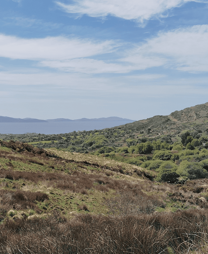
Landscape Around Staigue Fort
Staigue Fort occupies a low but visually commanding position near the head of a valley on the southern Iveragh Peninsula. Rather than being placed on the highest available summit, the enclosure stands within a landscape that provided access to water, pasture and cultivable ground while maintaining a broad relationship with the route southwards towards Kenmare Bay.
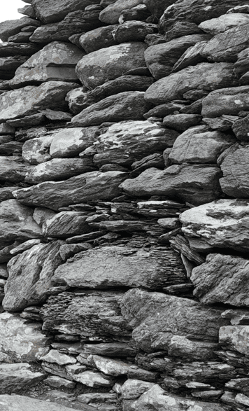
Staigue Fort Stone Construction
This location suggests that practical considerations were important in choosing the site. Shelter, agricultural resources and movement through the valley could all have mattered alongside defence. The fort’s position allowed its inhabitants to observe and potentially control movement through the surrounding landscape without isolating themselves from the land and resources on which a settlement depended.
The monument itself would also have transformed how this landscape was experienced. Anyone approaching through the valley would have encountered a substantial stone enclosure with a single controlled entrance. Archaeologically, this monumentality can be interpreted as a visible expression of authority, permanence and the ability to organise considerable labour, although the precise social identity of Staigue’s occupants remains unknown.
Staigue also belongs to a wider archaeological landscape containing other cashels, ringforts, prehistoric rock art, historic routeways and later settlements. Comparable stone forts at Loher, Cahergal and Leacanabuaile demonstrate a broader regional tradition of monumental stone enclosures across the Iveragh Peninsula, although proximity and architectural similarity do not prove that these sites were constructed at the same time.
Staigue was not built on the highest ground available. Its position combined visibility and control of a valley route with practical access to water, pasture and cultivable land, supporting the interpretation of the monument as more than a purely military fortress.
Follow Staigue Fort from its traditionally attributed Iron Age origins through antiquarian documentation and comparative archaeological study to its protection as a National Monument. Its precise construction date remains unresolved, making the monument’s chronology one of the central questions in understanding its history.
Heritage Ireland attributes Staigue Fort to approximately 300–400 BC. No site-specific scientific dating currently confirms this proposed date.
Most Irish ringfort occupation belongs broadly to the Early Medieval period. This provides an important comparison for Staigue but does not establish when the fort itself was constructed.
Staigue attracted the attention of antiquarians because of its exceptional surviving stonework and became an important monument in early studies of Irish fort architecture.
Francis C. Bland produced an influential description of Staigue, recording its dimensions and distinctive construction features for later researchers.
Augustus Pitt-Rivers referred to Staigue while examining the construction of Kerry’s stone forts, including its wall facings and possible construction joints.
Staigue Fort is protected as National Monument No. 143 and remains in State guardianship, with unguided public access during daylight hours.
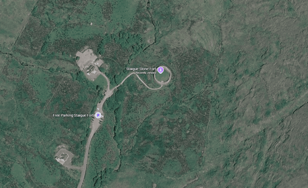
Staigue Fort can be visited independently during daylight hours. The monument lies inland from Castlecove on the southern Iveragh Peninsula, with visitor parking and a walking trail providing access to the site.
Staigue townland, inland from Castlecove on the southern Iveragh Peninsula, County Kerry.
A gated visitor car park is provided and is in the care of Kerry County Council.
Unguided daylight access via a walking trail. Visitors should expect uneven surfaces and walkways.
Honesty box on site.
Daylight hours.
Loher Cashel, Cahergal, Leacanabuaile and the wider Derrynane historic landscape.
Explore more historic places, monuments and archaeological sites across County Kerry.
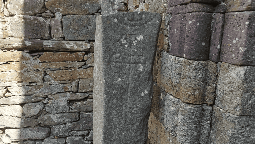
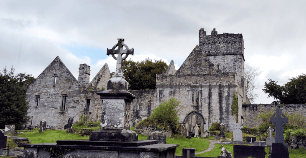
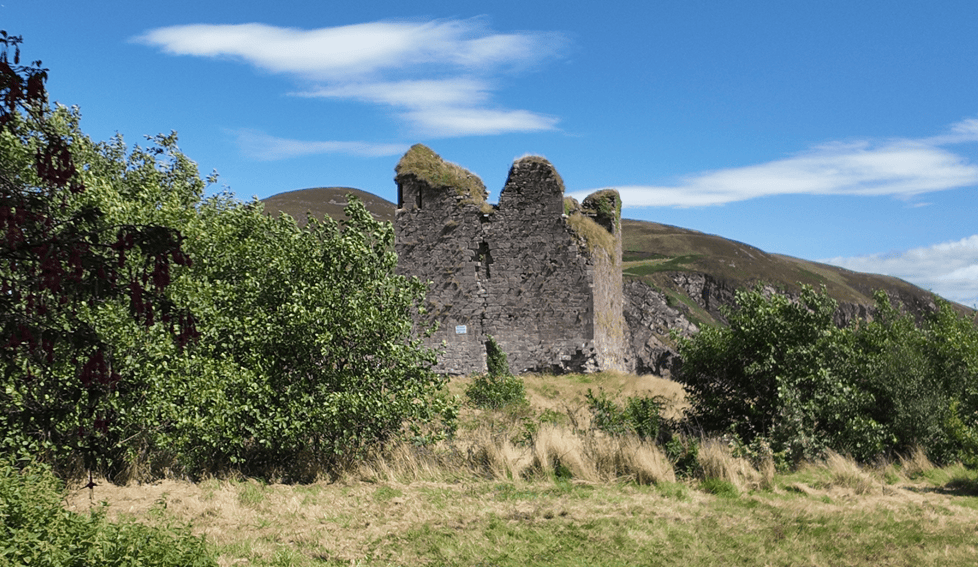
You can experience Staigue Fort with Steve as part of a private Ring of Kerry and Skellig Ring tour. Visiting the monument in its landscape provides an opportunity to examine its remarkable dry-stone construction, monumental walls and controlled entrance while exploring the wider historic landscape of the Iveragh Peninsula.
If you would rather leave the driving behind, I offer private tours across the Dingle Peninsula and County Kerry. Each experience is designed for small private groups, with a relaxed pace, local knowledge and the flexibility to spend more time at the places that interest you most.
A relaxed three-hour private tour around Slea Head and the spectacular western coastline of the Dingle Peninsula.
Explore Slea Head, ancient heritage sites, coastal viewpoints and the landscapes of West Kerry on a private half-day experience.
Discover more of the Dingle Peninsula with a full day to explore its scenery, history, villages and lesser-known places.
Journey around the Iveragh Peninsula, combining the Ring of Kerry with the dramatic landscapes and Atlantic coastline of the Skellig Ring.
Explore Killarney National Park, its lakes, mountain viewpoints, waterfalls and some of the most beautiful landscapes in County Kerry.
Travel north from Kerry for a private day tour through the Burren to the spectacular Cliffs of Moher on Ireland’s Atlantic coast.
Create a private Kerry itinerary around the places, landscapes and experiences that matter most to you.
Staigue Fort has been documented through national heritage records, archaeological surveys, antiquarian accounts and specialist studies of Irish ringforts and stone forts. The principal sources below provide the evidence used to understand its architecture, landscape setting, protected status and unresolved chronology.
National Monuments Service — National Monuments in State Care: County Kerry
Heritage Ireland / Office of Public Works — Staigue Stone Fort
Kerry County Council — Kerry County Development Plan 2022–2028, archaeological and National Monument records
National Monuments Service — Historic Environment Viewer / Sites and Monuments Record
O’Sullivan, M. & Sheehan, J. — The Iveragh Peninsula: An Archaeological Survey of South Kerry
Stout, M. — The Irish Ringfort
O’Sullivan, A., McCormick, F., Kerr, T. R. & Harney, L. — Early Medieval Ireland AD 400–1100: The Evidence from Archaeological Excavations
Sheehan, J. & O’Sullivan, M. — research on the excavations at Cahergal, County Kerry
Francis C. Bland — nineteenth-century antiquarian description of Staigue Fort
Royal Irish Academy — nineteenth-century records and illustrations of Staigue Fort
Twohig, E. — Pitt-Rivers in Munster 1862–65/6
Loading availability…