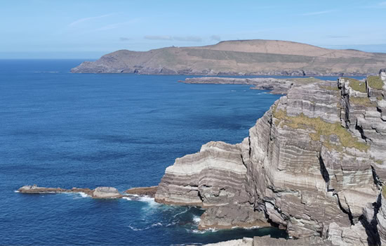
Kerry Cliffs stand on the Atlantic edge of the Iveragh Peninsula, a short distance from Portmagee on the Skellig Ring. From the cliff-top viewpoints, the coastline falls sharply towards the ocean while the Skellig Islands rise from the Atlantic in the distance. It is the combination of the cliffs themselves and that remarkable offshore view that makes this such a worthwhile stop when exploring this part of County Kerry.
Why Kerry Cliffs Are Worth Visiting
There are many coastal viewpoints around Kerry, but Kerry Cliffs offers a different perspective. Rather than looking along a beach or across a sheltered bay, you are standing above an exposed stretch of Atlantic coastline with open ocean ahead.
On a clear day, the view extends towards Skellig Michael and Little Skellig. Puffin Island lies much closer to the mainland, while the surrounding headlands help reveal just how rugged this section of the Iveragh Peninsula really is.
For visitors travelling the Ring of Kerry, the cliffs are also a good reason to follow the Skellig Ring rather than remaining entirely on the main N70 route.
What You’ll See from Kerry Cliffs
The experience begins with a walk from the entrance towards the cliff-top viewing areas. As you approach the coast, the landscape opens and the Atlantic increasingly dominates the view.
The cliffs themselves are impressive, but it is worth taking time to look beyond them. The offshore islands are an important part of understanding this coastline.
On days with good visibility, Skellig Michael can be seen rising sharply from the Atlantic. Beside it is Little Skellig, another dramatic rocky island that supports an internationally important seabird colony.
Closer to shore is Puffin Island, separated from the mainland by a narrow stretch of water.
Visibility can change quickly on the west coast of Ireland, so no two visits are quite the same. Clear conditions reveal the scale of the wider seascape, while Atlantic weather can make the coastline feel considerably more exposed.
Looking Across to the Skellig Islands
For many visitors, one of the highlights of Kerry Cliffs is seeing the Skellig Islands from the mainland.
Skellig Michael is the larger and better-known of the two principal Skellig islands. Early Christian monks established a monastery on its steep slopes, and the surviving monastic remains are now part of a UNESCO World Heritage Site.
Seeing the island from Kerry Cliffs also helps put its isolation into perspective. From the mainland, it becomes much easier to appreciate the journey that generations of monks, fishermen and later visitors made across open Atlantic water.
Little Skellig lies nearby but has a very different character. Rather than a monastic settlement, the island is particularly important for its seabird population.
The cliffs therefore offer more than a coastal panorama. They provide a useful geographical introduction to the Skellig coast before exploring Portmagee, Valentia Island or learning more about Skellig Michael itself.
The Landscape Around Kerry Cliffs
Kerry Cliffs form part of the rugged Atlantic coastline of the Iveragh Peninsula. Rock, ocean and weather have shaped this landscape over immense periods of geological time.
Standing at the viewpoints makes the relationship between land and sea particularly clear. The exposed rock faces descend towards the Atlantic while offshore stacks and islands continue the landscape beyond the mainland.
It is worth looking at the coastline rather than concentrating only on the distant Skelligs. The layers, fractures and changing shapes of the rock help explain why this section of Kerry feels so different from the long beaches and sheltered bays found elsewhere around the county. Visitors interested in comparing Kerry’s varied landscapes can find further ideas among the wider selection of places to see in Kerry.
Wildlife Around the Cliffs
The Atlantic coast around Kerry Cliffs supports a variety of seabirds, although what you see will depend on the season, weather and a little luck.
Rather than expecting a particular species, take a few minutes to watch the cliffs and the water below. Birds use the coastline for feeding, nesting and shelter, while the offshore islands form part of a much wider marine environment.
Binoculars are useful here, particularly when looking towards the offshore islands.
Wildlife sightings should always be treated as part of the experience rather than guaranteed. Conditions around the Atlantic coast change constantly, and different seasons can produce very different visits.
Walking to the Kerry Cliffs Viewpoints
Kerry Cliffs is a managed visitor attraction rather than an informal roadside viewpoint.
From the entrance, visitors follow a walking route towards the designated viewing areas overlooking the cliffs and Atlantic. Allow enough time not simply to reach the viewpoint, but to stop and properly explore the different perspectives along the coast.
The site is exposed to Atlantic weather, so suitable footwear and a waterproof layer are sensible even when conditions appear settled.
Wind is particularly important. Conditions at an exposed cliff-top can feel considerably stronger than they do around Portmagee or from the car park.
Visitors should remain within the designated visitor areas and follow the safety guidance provided on site.
Planning Your Visit
Kerry Cliffs is situated near Portmagee on the Skellig Ring in southwest County Kerry.
Parking is provided for visitors at the attraction, with the viewpoints reached on foot from the entrance. Admission charges apply.
Opening arrangements, admission prices and facilities can change, so it is worth checking the official Kerry Cliffs visitor information before travelling if these details are important to your plans.
For most visitors, Kerry Cliffs works best as one stop within a longer journey rather than as a destination requiring several hours. Allow enough time for the walk, the viewpoints and a few minutes simply watching the coastline rather than treating it as a quick photograph stop.
Anyone with limited mobility should check current accessibility information with the attraction before visiting, as reaching and exploring cliff-top viewpoints involves outdoor terrain and exposure to changing weather.
Weather and the Best Time to Visit
There isn’t one particular month that guarantees the best experience at Kerry Cliffs.
Visibility is more important than season.
On a clear day, the offshore views towards the Skellig Islands can be exceptional. Low cloud, mist or Atlantic rain can partially or completely obscure those distant views.
That doesn’t necessarily make the cliffs uninteresting, but it changes the experience considerably.
If you have some flexibility while travelling around the Ring of Kerry, pay attention to the conditions rather than automatically planning the cliffs for a particular time of day.
The site is also exposed, so check the weather and be prepared for conditions to change.
Photography at Kerry Cliffs
Kerry Cliffs offers several different photographic subjects rather than one obvious photograph.
The wider view can incorporate the cliffs, Atlantic and offshore islands, while tighter compositions can concentrate on individual rock formations, seabirds or the Skelligs.
Clear visibility is particularly important if your priority is photographing Skellig Michael.
It is also worth occasionally putting the camera down. The scale of the coastline is easier to appreciate when you spend a little time looking across it rather than immediately moving from one photograph to the next.
How Kerry Cliffs Fit Into the Ring of Kerry
Kerry Cliffs are often associated with the Ring of Kerry, but geographically they sit on the Skellig Ring, an extension of the better-known touring route through the western Iveragh Peninsula.
This distinction is useful when planning your day.
The Skellig Ring takes visitors through an especially interesting section of southwest Kerry, connecting places including Portmagee, Valentia Island and the coastline overlooking the Skellig Islands.
Kerry Cliffs fits naturally into this journey because it provides one of the clearest mainland perspectives on the offshore landscape.
If you are driving the Ring of Kerry independently, allow sufficient time for this western section rather than trying to rush through every stop on the peninsula. The guide to how long the Ring of Kerry takes explains why the route requires more time than its mileage alone might suggest.
What to See Near Kerry Cliffs
Portmagee
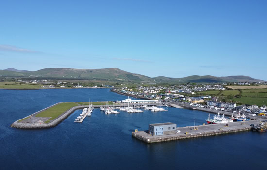
Portmagee is the natural place to combine with a visit to Kerry Cliffs. The harbour village is closely associated with journeys to the Skellig Islands and is a useful stop for food or refreshments while exploring the western Iveragh Peninsula.
Valentia Island
Reached from the Portmagee side by bridge, Valentia Island deserves considerably more than a quick detour. Its landscape combines coastal scenery, geology, maritime history and several excellent viewpoints.
Skellig Michael
Even if you are not travelling to Skellig Michael by boat, understanding its early Christian monastery and extraordinary location adds another layer to the view from Kerry Cliffs.
Boat landings are highly dependent on weather and sea conditions, so seeing the island from the mainland is a very different but worthwhile experience.
Waterville
Continuing around the Skellig Ring eventually brings travellers towards Waterville, where the character of the landscape changes again as the route meets Ballinskelligs Bay and rejoins the wider Ring of Kerry journey.
Cahersiveen
Cahersiveen is another useful base or stopping point on the western side of the Iveragh Peninsula. Its position connects the Skellig coast with the northern section of the Ring of Kerry and provides access to a landscape rich in local history.
Continue Exploring the Ring of Kerry
Kerry Cliffs makes most sense when understood as part of the wider landscape rather than as an isolated attraction.
Portmagee explains the area’s maritime connection with the Skelligs. Valentia Island adds geology, history and another perspective on the Atlantic. The Skellig Islands introduce one of Ireland’s most extraordinary early Christian landscapes.
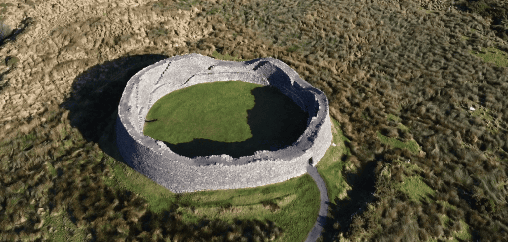
Together, these places make the western Iveragh Peninsula one of the most rewarding sections of the Ring of Kerry to explore slowly. Visitors continuing around the southern side of the peninsula can travel onwards towards Waterville, Sneem and Kenmare. This section also provides opportunities to explore important historical locations such as Staigue Fort.
If you are deciding which places deserve priority, the guide to the top sites on the Ring of Kerry provides a broader overview of the route. Visitors planning a longer holiday can also use the seven-day Kerry itinerary to understand how the Iveragh Peninsula fits into a wider stay in the county.
Kerry Cliffs can also be incorporated into Steve’s Peninsula Tours’ private Ring of Kerry and Skellig Ring tour, where the route can be adjusted around weather, visibility and the interests of the group.
Whether travelling independently or with a guide, the important thing here is not simply to reach the cliffs, take a photograph and move on. Give yourself time to look offshore, identify the islands and understand how the cliffs fit into the much larger Atlantic landscape of southwest Kerry. Further regional ideas can be found through the wider Explore Kerry guide.
Frequently Asked Questions About Kerry Cliffs
Where are Kerry Cliffs?
Kerry Cliffs are near Portmagee on the Skellig Ring, on the western side of the Iveragh Peninsula in southwest County Kerry.
Are Kerry Cliffs part of the Ring of Kerry?
They are commonly included in Ring of Kerry itineraries, but the cliffs are situated on the Skellig Ring, a scenic extension of the principal N70 touring route.
Can you see Skellig Michael from Kerry Cliffs?
Skellig Michael can be seen from the cliff-top viewpoints when visibility is good. Mist, rain and low cloud can obscure the island, so the view is never guaranteed.
How long should I allow at Kerry Cliffs?
Allow enough time to walk from the entrance, explore the designated viewpoints and appreciate the wider coastline. The time required will depend on walking pace, weather, visibility and how long you want to spend taking photographs.
Is there parking at Kerry Cliffs?
Parking is provided for visitors at the attraction. As arrangements can change, check current visitor information before travelling if parking or accessibility is particularly important to you.
Is admission required?
Kerry Cliffs is a managed visitor attraction and admission charges apply. Check the attraction’s current information for up-to-date prices and opening arrangements.
What should I bring to Kerry Cliffs?
Suitable outdoor footwear and a waterproof layer are sensible. The viewpoints are exposed to Atlantic wind and weather, even when conditions around Portmagee appear relatively calm. Binoculars can also be useful for observing the offshore islands and seabirds.