
SKELLIG COAST · COUNTY KERRY
Rising dramatically above the Atlantic on the Skellig Ring near Portmagee, Kerry Cliffs offer expansive views across the Skellig Coast. From the clifftop viewpoints, visitors can look towards Puffin Island and the Skellig Islands, including the distinctive outline of Skellig Michael.
Sea Cliffs & Viewpoint
Skellig Ring, County Kerry
Portmagee
Atlantic Cliffs & Offshore Islands
Kerry Cliffs rise above the Atlantic on the Skellig Ring, a coastal route extending from the western side of the Iveragh Peninsula near Portmagee. From the clifftop viewing area, the coastline opens towards Puffin Island and the Skellig Islands, placing visitors directly within the dramatic seascape of the Skellig Coast.
The experience is shaped as much by the wider setting as by the cliffs themselves. Exposed headlands, offshore islands and open Atlantic water create a landscape that can change quickly with the weather and visibility. On a clear day, Skellig Michael is a particularly distinctive feature on the horizon, while closer views reveal the scale and rugged geology of the cliffs beneath the established viewing areas.
The viewpoints at Kerry Cliffs reveal the full drama of the Skellig Coast, with sheer rock faces dropping towards the Atlantic and distant islands rising from the ocean. Take your time here—the views change as you follow the cliff-top paths, offering a wonderful sense of the scale and wild beauty of this remarkable coastline.
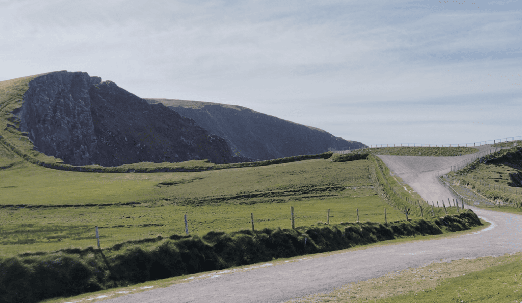
Access is through the Kerry Cliffs visitor site, with parking provided near the entrance.
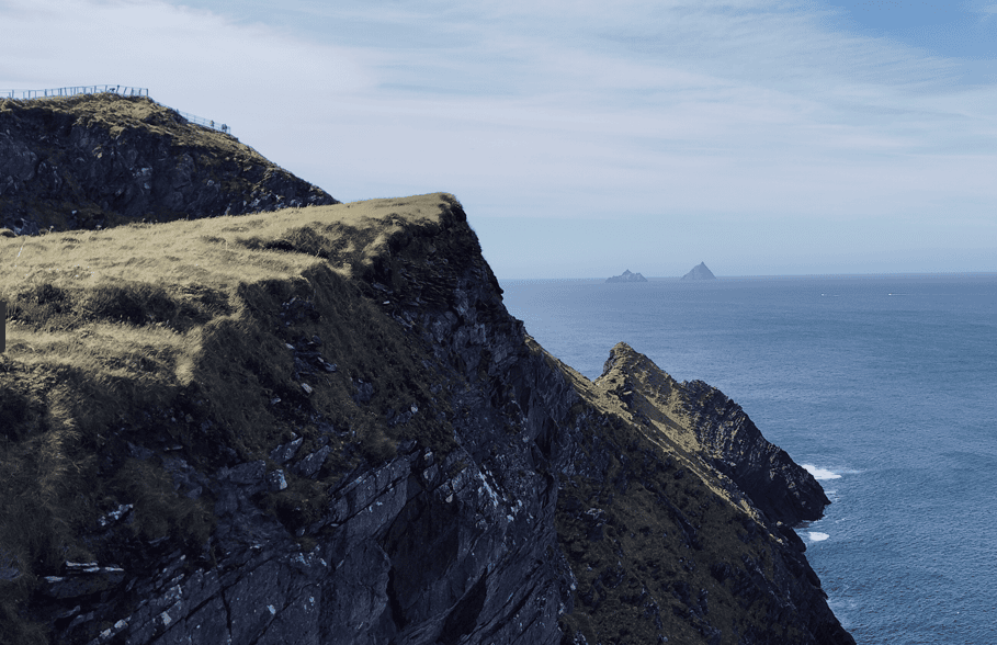
On clear days, the Skellig Islands can be seen offshore, with Skellig Michael recognisable by its steep, pyramidal profile.
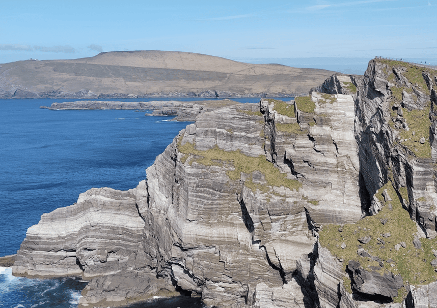
The exposed cliffs form part of the rugged Atlantic coastline of the western Iveragh Peninsula.
Kerry Cliffs are a managed visitor attraction on the Skellig Ring, a short distance from Portmagee. Visitors should allow time for the walk from the entrance area to the viewpoints and be prepared for exposed Atlantic weather.
PLACE TYPE
Sea Cliffs & Viewpoint
VISITOR ACCESS
Walking Route to Designated Viewpoints
Irish name
Aillte Chiarraí
PARKING
On-Site Parking
AREA
Skellig Ring
PUBLIC ACCESS
Managed Visitor Site
FACILITIES
Parking, Toilets & Refreshments
ADMISSION
Paid Entry
TYPICAL VISIT
45–60 Minutes
LANDSCAPE
Atlantic Sea Cliffs
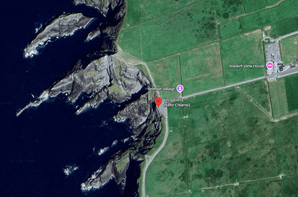
Latitude
51.868594
Longitude
-10.384745
Address
Kerry Cliffs, Skellig Ring, near Portmagee, County Kerry
NEAREST TOWN OR VILLAGE
Portmagee
Road access
Accessed from the Skellig Ring (R566) near Portmagee, with the visitor entrance and parking located off the local approach road.
The experience of Kerry Cliffs begins with the walk towards the coast, where the landscape gradually opens onto the Atlantic. At the designated viewpoints, the scale of the cliffs becomes apparent, with steep rock faces, open ocean and offshore islands forming a remarkably expansive coastal scene.
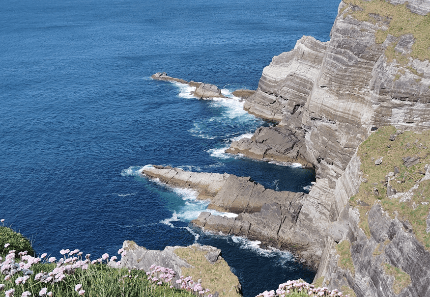
Kerry Cliffs Atlantic Rock Ledges
Kerry Cliffs offer one of the clearest places on the Skellig Ring to appreciate the relationship between the Iveragh Peninsula, the open Atlantic and the offshore islands of the Skellig Coast.
From the viewing areas, the immediate landscape is dominated by steep sea cliffs dropping towards the Atlantic. Beyond them, Puffin Island sits comparatively close to the mainland, while Skellig Michael and Little Skellig lie much farther offshore and become particularly distinctive when visibility is good.
Conditions play an important part in every visit. Clear weather can reveal an extensive Atlantic panorama, while mist, low cloud and sea spray can dramatically reduce visibility. The exposed position also means that wind conditions may be very different from those experienced in nearby Portmagee.
The site is best experienced without rushing. Allow time to walk to the viewpoints, observe the changing perspectives along the coastline and look beyond the main Skellig view towards the surrounding headlands and islands.
Kerry Cliffs are highly exposed to Atlantic weather. Stay on the designated visitor routes and viewing areas, supervise children closely, and expect wind, rain or reduced visibility even when conditions around Portmagee appear relatively settled.
Kerry Cliffs are straightforward to include while exploring the Skellig Ring, but their exposed coastal position makes weather an important consideration. Allow enough time to walk from the visitor entrance to the viewpoints and enjoy the coastline without rushing.
Kerry Cliffs are approximately 3 km from Portmagee on the Skellig Ring. The attraction is reached by road, with signs directing visitors towards the entrance as they approach the site.
On-site parking is provided for visitors. From the parking and entrance area, continue on foot along the designated route towards the clifftop viewpoints.
Allow approximately 45–60 minutes for a typical visit, including the walk to and from the viewpoints. You may want longer in clear conditions when views towards the Skellig Islands are particularly good.
Visibility is more important than the time of day. Clear, settled conditions provide the best opportunity for long-distance views towards Skellig Michael and Little Skellig, while mist and low cloud can obscure the islands completely.
The cliffs are exposed to Atlantic wind and rapidly changing weather. Bring a waterproof outer layer and wear comfortable footwear suitable for walking on outdoor paths and uneven ground.
Visitor facilities are available at the entrance area, including toilets and refreshments. Facilities and opening arrangements can vary, particularly outside the main visitor season, so current information should be checked before making a special journey.
The main attraction is the scale of the Atlantic coastline, but several distinct features make the viewpoint particularly interesting. Take time to look both along the cliffs themselves and farther offshore towards the islands of the Skellig Coast.
The steep sea cliffs are the defining feature of the site, with exposed rock faces descending directly towards the Atlantic. Looking along the coastline from the designated viewpoints gives a much stronger impression of their scale than simply looking out to sea.
In clear conditions, Skellig Michael and Little Skellig can be seen offshore. Skellig Michael is particularly recognisable by its steep profile, while the two islands together form one of the most distinctive views from this part of the Iveragh Peninsula.
Puffin Island lies considerably closer to the mainland and is an important seabird habitat. Its position just offshore adds depth to the view and helps illustrate the island-rich character of the Skellig Coast.
Look beyond the individual landmarks and the scale of the wider seascape becomes apparent. From this exposed western edge of the Iveragh Peninsula, there is very little between the coastline and the open North Atlantic, giving the viewpoints a distinctly maritime character.
The scale of Kerry Cliffs is the result of a geological story stretching back hundreds of millions of years. The rocks forming this part of the Iveragh coastline originated in very different environmental conditions from the Atlantic landscape seen today.
The cliffs are formed from ancient sedimentary rocks associated with the Old Red Sandstone landscape characteristic of much of the Iveragh Peninsula. The material from which these rocks developed was deposited roughly 400 million years ago, during the Devonian period, when environmental conditions were very different from modern-day Kerry.
Much later, the coastline was shaped by weathering and the persistent action of the Atlantic. Waves exploit fractures and weaker sections of rock at the base of coastal cliffs, gradually enlarging openings and contributing to erosion and occasional rock collapse. This continuing interaction between resistant rock and Atlantic wave energy helps create the steep headlands, cliff faces and coastal formations visible around the Skellig Coast.
Kerry Cliffs rise to approximately 305 metres (1,000 ft) above the Atlantic, making their vertical scale particularly apparent when viewed along the coastline rather than simply out to sea.
The rocks originated from sediments deposited during the Devonian period, roughly 400 million years ago, long before the modern Atlantic coastline existed.
The coastline continues to be shaped by waves, weathering and erosion. Sea caves and other coastal features can develop where Atlantic wave action repeatedly exploits weaknesses within the rock.
Continue exploring Kerry’s landscapes, coast, mountains and remarkable places, with more locations worth discovering across the county.
Kerry Cliffs are part of a much larger landscape stretching around the Skellig Ring and western Iveragh Peninsula. A visit can be combined with Portmagee, Valentia Island, Waterville and other viewpoints along the Atlantic coast, turning the cliffs into part of a wider journey through South Kerry rather than an isolated stop.
Steve’s Peninsula Tours visits this area as part of the Private Ring of Kerry & Skellig Ring Tour, with the route adapted to the day’s conditions and the interests of your group. Travelling privately also allows more time to understand the landscape, communities and stories that connect the Skellig Coast.
If you would rather leave the driving behind, I offer private tours across the Dingle Peninsula and County Kerry. Each experience is designed for small private groups, with a relaxed pace, local knowledge and the flexibility to spend more time at the places that interest you most.
A relaxed three-hour private tour around Slea Head and the spectacular western coastline of the Dingle Peninsula.
Explore Slea Head, ancient heritage sites, coastal viewpoints and the landscapes of West Kerry on a private half-day experience.
Discover more of the Dingle Peninsula with a full day to explore its scenery, history, villages and lesser-known places.
Journey around the Iveragh Peninsula, combining the Ring of Kerry with the dramatic landscapes and Atlantic coastline of the Skellig Ring.
Explore Killarney National Park, its lakes, mountain viewpoints, waterfalls and some of the most beautiful landscapes in County Kerry.
Travel north from Kerry for a private day tour through the Burren to the spectacular Cliffs of Moher on Ireland’s Atlantic coast.
Create a private Kerry itinerary around the places, landscapes and experiences that matter most to you.
Loading availability…