From Prehistoric Settlement to the Gaeltacht and Blasket Islands
The Dingle Peninsula is one of the most historically significant landscapes in County Kerry. Long before colourful villages, scenic drives and visitors exploring the Wild Atlantic Way, generations of people lived, worked, worshipped and travelled through this remarkable corner of Ireland. Today, prehistoric monuments, early Christian sites, medieval ruins and traditional Irish-speaking communities combine to tell a story stretching back thousands of years.
What makes the peninsula particularly rewarding is not simply the number of historic places. It is the concentration of different periods of Irish history within a relatively small area. Ancient settlement remains stand within modern farmland, early Christian monuments survive close to medieval churches, and the literary legacy of the Blasket Islanders remains closely connected with the living Gaeltacht culture of West Kerry.
For visitors who want to explore these places individually, the wider Historical Sites in Kerry collection provides detailed guides to many of the monuments discussed below.
Why the Dingle Peninsula Became an Important Place
The history of the Dingle Peninsula begins with its landscape.
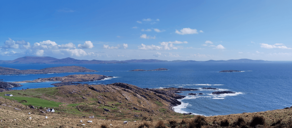
Surrounded by the Atlantic on three sides and crossed by substantial mountain ranges, the peninsula offered agricultural land, fishing grounds, sheltered bays and access to maritime routes.
Its geography could create isolation, but the Atlantic was not simply a barrier. The sea also connected communities with other parts of Ireland and, during later periods, with Britain and continental Europe.
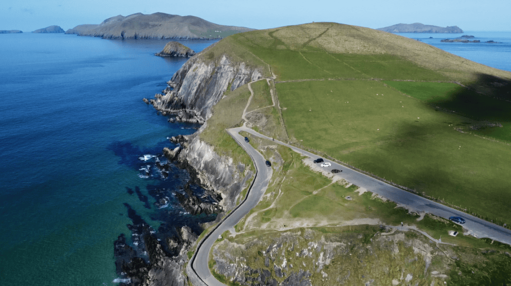
This relationship between land and sea remains particularly clear along Slea Head Drive, where ancient settlement remains, stone-walled fields and Atlantic viewpoints exist side by side.
The First Settlers
People were living on the peninsula thousands of years before written historical records began.
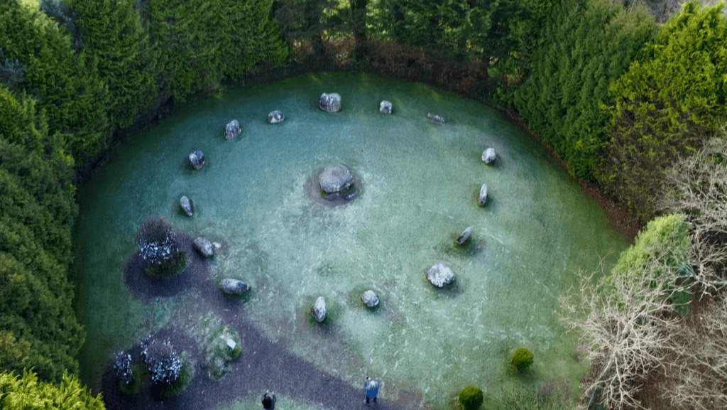
Early farming communities gradually altered the natural environment by clearing land, keeping livestock and creating permanent fields and settlements. Over successive prehistoric periods they also constructed monuments that continue to survive within the modern landscape.
Evidence associated with the peninsula’s prehistoric past includes:
- Megalithic tombs
- Standing stones
- Fulachtaí fiadh
- Ancient field systems
- Burial monuments
- Later inscribed stones
These sites do not all belong to the same period, and their surviving forms tell only part of the story. Together, however, they demonstrate that people were organising and using this landscape thousands of years before the development of Dingle town or the medieval settlements visitors recognise today.
Ogham and Ireland’s Earliest Writing
One particularly important archaeological tradition preserved on the Dingle Peninsula is ogham.
Ogham inscriptions were created by cutting groups of lines and notches along the edges of standing stones. Most surviving examples record personal names and belong broadly to the early centuries of the first millennium AD.
The peninsula contains an important concentration of these inscriptions. One accessible example is the Kilmalkedar Ogham Stone, which survives within the much larger ecclesiastical landscape at Kilmalkedar.
The presence of ogham is particularly valuable because it connects language, identity and landscape at a point when Ireland was moving between prehistoric traditions and the increasingly documented early medieval world.
Forts, Settlement and the Atlantic Landscape
Defended settlements form another important part of the peninsula’s archaeology.
Ringforts, stone enclosures and coastal promontory forts show how communities used both constructed defences and natural geography.
One of the best-known examples is Dún Beag Promontory Fort at Fahan. The monument occupies a dramatic cliff-edge position where the Atlantic promontory itself formed part of the defensive system.
Archaeological investigation has identified a substantial stone rampart, banks and ditches, an entrance passage, a souterrain and evidence of occupation. Its chronology is complex, with evidence of rebuilding and different phases of activity rather than one simple construction date.
The site is also a powerful reminder that archaeological landscapes continue to change. Coastal erosion has already removed significant parts of Dún Beag, and modern access must reflect the instability of the cliff edge.
The Fahan Clocháns
Nearby, the Fahan Beehive Huts provide another perspective on historic settlement.
More accurately known as clocháns, these dry-stone structures belong to a long building tradition found across western Ireland. Their familiar “beehive” appearance comes from corbelled construction, where successive courses of stone gradually project inwards.
The surviving huts should not all be assumed to belong to precisely the same period or function. What matters is the wider landscape around them: stone enclosures, old field systems and settlement remains demonstrate generations of occupation and farming beneath Mount Eagle.
Dún Beag and the Fahan clocháns are particularly useful when experienced together because they reveal different aspects of life within the same broader archaeological landscape.
Early Christianity Arrives
The spread of Christianity transformed the Dingle Peninsula during the early medieval period.
Religious communities developed throughout West Kerry, leaving behind churches, monastic settlements, cross-slabs, inscribed stones, burial grounds and traditions of pilgrimage.
Several of the peninsula’s most important historic sites survive within only a few kilometres of one another, including Gallarus Oratory, Kilmalkedar Church and Riasc Monastic Settlement.
These places should not be treated as interchangeable examples of “early Christian Ireland”. Each preserves evidence from different periods and reveals a different aspect of religious life.
Riasc Monastic Settlement
Riasc is one of the best places to understand how an early ecclesiastical community functioned.
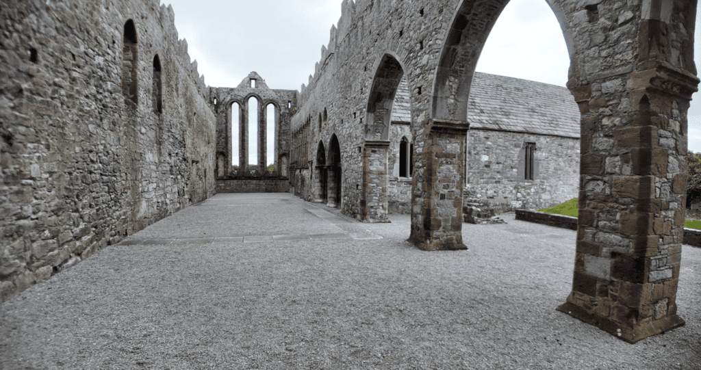
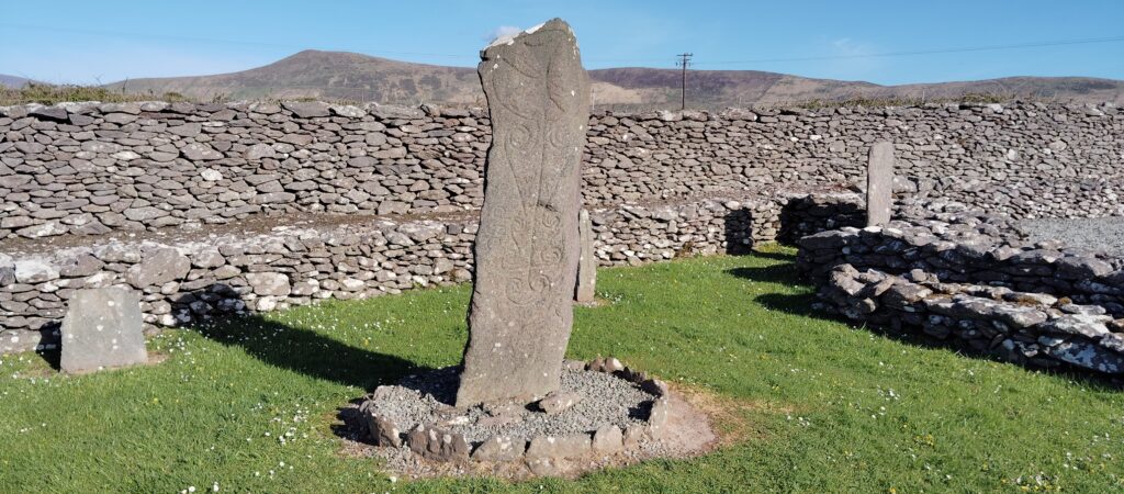
Excavation revealed an enclosed religious settlement containing an oratory, stone-built structures, burial areas, workshops and distinctive carved cross-slabs.
Much of the site survives as foundations rather than tall standing buildings, so Riasc rewards visitors who understand the plan rather than looking for one spectacular monument.
The Riasc Monastic Settlement guide explores how worship, craft, burial and everyday life were brought together within the same enclosed community.
Gallarus Oratory
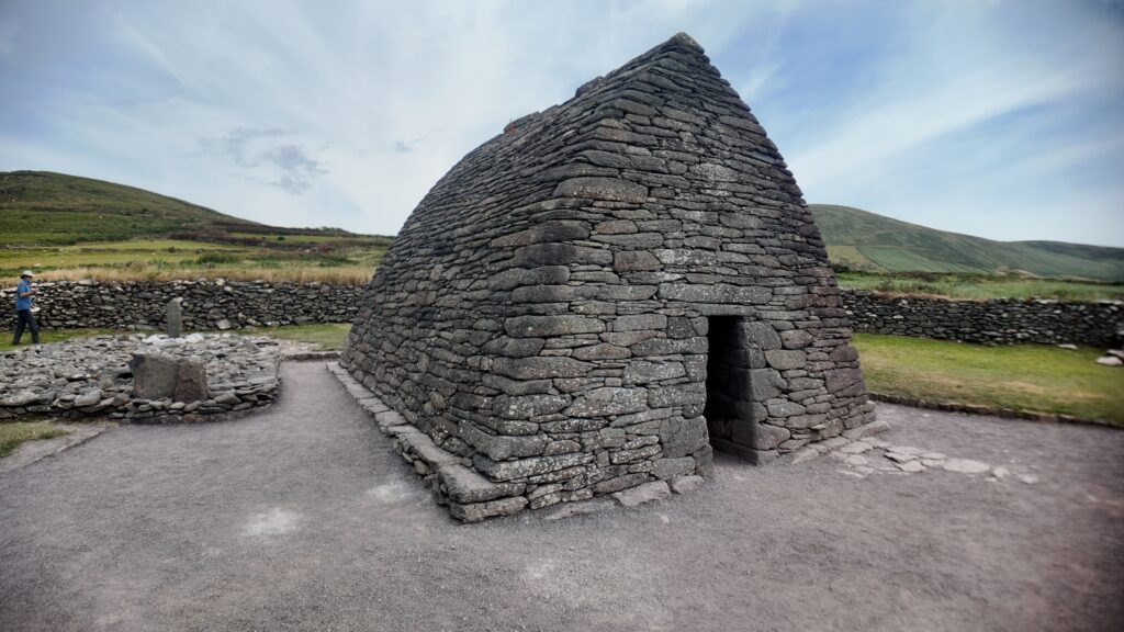
Gallarus Oratory provides a very different experience.
The compact stone church survives with its corbelled roof intact, making it one of the most recognisable historic buildings on the Dingle Peninsula.
Its exact construction date has been debated, so it is better understood as an important medieval ecclesiastical monument than assigned an unsupported precise foundation year.
The extraordinary survival of its stone roof allows visitors to experience the architecture in a way that is impossible at many other ruined church sites.
Kilmalkedar Church
Kilmalkedar brings several historical periods together within one ecclesiastical landscape.
The surviving Romanesque church dates from the medieval period, but the surrounding site contains earlier monuments including an ogham stone and a stone sundial, along with crosses, graves and evidence of long religious use.
Kilmalkedar also forms part of the traditional pilgrimage landscape associated with Mount Brandon and Saint Brendan.
Seeing Kilmalkedar alongside Gallarus and Riasc demonstrates how religious settlement and architecture changed across many centuries rather than appearing suddenly in one uniform early Christian period.
Pilgrimage and Medieval Life
By the medieval period, the Dingle Peninsula formed part of an important sacred landscape.
Routes connected churches, holy places and pilgrimage destinations, including the traditional journey towards Mount Brandon. Pilgrims moved through a landscape in which the journey itself could carry religious meaning.
Today we normally encounter these sites separately by car. Medieval travellers would have experienced them through movement on foot, creating a very different relationship with distance, mountains and sacred places.
That historical perspective helps explain why individual churches and monuments should be viewed as parts of a connected landscape rather than isolated attractions.
Medieval and Later Settlement
The peninsula’s history continued to evolve far beyond the early Christian period.
Medieval lordship, farming, local conflict and changing patterns of settlement produced another layer of castles, churches, roads and communities.
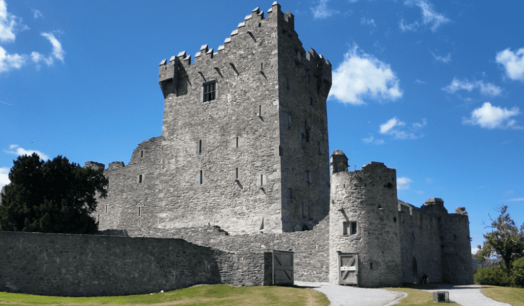
Minard Castle, for example, preserves the ruins of a substantial tower house in a commanding coastal setting. Its surviving structure is associated with the FitzGerald presence on the peninsula and the violent upheavals of the seventeenth century.
The monument sits within a much older archaeological landscape, demonstrating again how different periods of history can occupy the same geographical space.
Historic Roads and Bridges
Not every important historical structure is a castle, fort or church.
Roads and bridges reveal how people moved through the peninsula and connected settlements long before modern transport.
Garfinny Bridge is one example of how surviving stone infrastructure can provide another perspective on local history.
Features like this are easy to overlook because they remained functional elements of the landscape rather than becoming monumental visitor attractions.
Dingle Harbour and European Connections
Although the peninsula appears geographically remote, it maintained important connections with the wider Atlantic world.
Dingle town developed around one of the peninsula’s most important natural harbours. During the later medieval and early modern periods, maritime trade connected the town with ports beyond Ireland.
Fish, agricultural goods and other commodities moved outward, while imported products and overseas contacts contributed to the development of the settlement.
Dingle’s harbour therefore represents much more than the attractive waterfront visitors see today. Maritime activity has shaped the town’s identity for centuries.
Eask Tower and Nineteenth-Century Maritime History
The importance of Dingle Harbour continued into the nineteenth century.
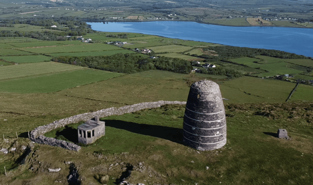
Eask Tower was constructed in 1847 on high ground above the harbour as a daylight navigation beacon for approaching ships.
The project was developed during the Great Famine and also provided relief employment for local workers.
The tower therefore combines several strands of nineteenth-century history: maritime navigation, harbour development, famine-era hardship and the efforts made locally to create employment during one of the most difficult periods in Irish history.
Language, Culture and the Gaeltacht
One of the peninsula’s greatest historical treasures is not an archaeological monument but a living tradition.
Much of western Corca Dhuibhne forms part of the Gaeltacht, where Irish remains an important community language.
Generations have preserved and developed local culture through:
- Irish language
- Storytelling
- Traditional music
- Poetry and literature
- Folklore
- Placenames
- Local customs and crafts
This makes the peninsula fundamentally different from a historical region where culture survives only within museums.
The Irish names visible on road signs and maps belong to communities where the language remains connected with everyday life, family, education and identity.
The Blasket Islands
Just beyond the western end of the peninsula lie the Blasket Islands.
For generations, families lived on Great Blasket and the surrounding islands, building a community shaped by fishing, farming, the Irish language and the demands of an exceptionally exposed Atlantic environment.
The permanent community on Great Blasket was evacuated in 1953, but its cultural legacy became internationally significant through books written by islanders including Tomás Ó Criomhthain, Peig Sayers and Muiris Ó Súilleabháin.
The wider history and culture of the Blasket Islands provides one of the strongest connections between the landscape of West Kerry and twentieth-century Irish-language literature.
The Blasket Centre
The Blasket Centre at Dún Chaoin is one of the best places to understand the island community.
Its exhibitions explore island life, language, literature, culture and the eventual evacuation of Great Blasket.
The Centre is particularly valuable because it sits directly opposite the islands. After learning about the families who lived there, the Atlantic view outside changes completely.
The islands stop being distant scenery and become a landscape of homes, livelihoods and remembered lives.
Slea Head as a Historical Journey
Most visitors initially approach Slea Head because of the scenery.
Yet Slea Head Drive is also one of the best routes for understanding the history of the western peninsula.
Within a relatively short journey you pass the archaeological landscape of Fahan, early settlement sites, Gaeltacht communities and viewpoints towards the Blasket Islands.
The road therefore connects archaeology, language, maritime history and the modern working landscape rather than simply linking scenic viewpoints.
The History You Can Still Experience Today
Unlike many historical regions where most evidence has been moved into museums, the Dingle Peninsula allows visitors to encounter much of its history in the landscape where it developed.
You can:
- Examine the defensive setting of Dún Beag above the Atlantic.
- Explore dry-stone settlement remains around Fahan.
- Stand inside Gallarus Oratory.
- Walk through the medieval church and graveyard at Kilmalkedar.
- Study the foundations and carved stones at Riasc.
- See an original ogham inscription.
- Explore the ruins of Minard Castle.
- Learn about the Blasket Islanders while looking directly towards their former home.
- Visit communities where Irish remains part of everyday life.
This continuity between monument, community and landscape is one of the things that makes West Kerry particularly rewarding.
A Suggested Historical Journey
If history is one of the main reasons you are visiting the peninsula, a full day allows you to connect several of its most important places without treating them as isolated stops.
A rewarding historical route could include:
- Dún Beag Promontory Fort
- The Fahan Beehive Huts
- Dún Chaoin and the Blasket landscape
- The Blasket Centre
- Riasc Monastic Settlement
- Gallarus Oratory
- Kilmalkedar Church and its ogham stone
I would not regard that list as a checklist that must be completed regardless of time or weather. History is better understood when you have enough time to examine a smaller number of sites properly.
The broader Kerry historical-sites guide can help you choose which places best match your own interests.
Exploring the Peninsula with Historical Context
The greatest challenge when visiting archaeological sites independently is often interpretation.
A low wall, inscribed stone or ruined structure can be easy to overlook when you do not know what you are seeing.
That is why the Dingle Peninsula rewards visitors who learn a little of the story before or during the journey. Once the chronology becomes clearer, individual monuments begin to connect with one another.
If you prefer to drive yourself, the Dingle Peninsula GPS Audio Tour provides location-triggered stories, history and cultural context along the Slea Head route.
Exploring with a Private Local Guide
Visitors who want to concentrate particularly on history and archaeology may prefer a private guided journey.
The advantage is flexibility. If Riasc becomes the site that interests you most, we can spend longer there. If early Christianity is your priority, Gallarus and Kilmalkedar can be explored in greater depth. If you want to understand how the archaeological sites relate to the wider peninsula, the route can be shaped around that story.
My full-day private Dingle Peninsula tour provides enough time to connect Slea Head, historic sites, Gaeltacht communities and the wider landscape without reducing the day to a sequence of short photograph stops.
Frequently Asked Questions About Dingle Peninsula History
How old is the history of the Dingle Peninsula?
Human settlement on the peninsula stretches back thousands of years into prehistory. The surviving archaeological landscape includes prehistoric monuments, early inscribed stones, defended settlements, early medieval ecclesiastical sites, medieval churches and much later historic buildings.
Why is the Dingle Peninsula historically important?
The peninsula contains an unusually dense concentration of archaeological and historic remains within a relatively small area. Its importance is strengthened by the survival of the Corca Dhuibhne Gaeltacht and the literary and cultural legacy of the Blasket Islands.
What are the most important historic sites on the Dingle Peninsula?
Major sites include Gallarus Oratory, Dún Beag Promontory Fort, Kilmalkedar Church, Riasc Monastic Settlement, the Fahan Beehive Huts and the Kilmalkedar Ogham Stone. Minard Castle and Eask Tower add important later chapters to the peninsula’s history.
Is Dún Beag an Iron Age fort?
Dún Beag has sometimes been given simple prehistoric or Iron Age labels in older descriptions, but archaeological evidence indicates a more complicated sequence of construction, rebuilding and occupation. It is better understood as a promontory fort with a complex chronology rather than assigned one unsupported precise date.
What is the oldest writing found on the Dingle Peninsula?
Ogham inscriptions preserve some of Ireland’s earliest written records. The Kilmalkedar Ogham Stone is one accessible example and forms part of the peninsula’s important concentration of inscribed stones.
Why are there so many early Christian sites around Dingle?
The western peninsula developed a substantial early medieval ecclesiastical landscape containing religious settlements, churches, carved stones and pilgrimage traditions. Riasc, Gallarus and Kilmalkedar preserve different parts of that history.
What is the historical importance of the Blasket Islands?
The islands supported an Irish-speaking community whose way of life became internationally known through autobiographical works written by islanders. Although Great Blasket was permanently evacuated in 1953, its literary and cultural legacy remains central to the history of West Kerry.
Is Irish still spoken on the Dingle Peninsula?
Yes. Western Corca Dhuibhne forms part of the Gaeltacht, where Irish remains a living community language rather than simply a historical subject.
Can you visit several historic sites in one day?
Yes. Several important archaeological and ecclesiastical sites lie relatively close together around the western peninsula. However, I would choose a balanced selection rather than rushing through every monument simply because they appear close on a map.
What is the best way to understand the history while visiting?
Learn the basic chronology before you begin and consider the monuments as parts of a connected landscape. The historical-sites collection, GPS audio tour and private guided experiences can all add context that is difficult to gain from seeing individual ruins alone.
Continue Exploring the History of the Dingle Peninsula
The history of the Dingle Peninsula is far too rich to discover in a single article. Each monument, village and landscape contributes another part of a story stretching from prehistoric settlement to the modern Gaeltacht.
Continue with the detailed guides to Gallarus Oratory, Dún Beag Promontory Fort, Kilmalkedar Church, Riasc Monastic Settlement, the Blasket Islands and Dingle town.
The wider Explore Kerry collection then connects the peninsula’s history with the castles, forts, towns and historic landscapes found throughout County Kerry.
The real strength of the Dingle Peninsula is that its past never feels completely separated from the present. Ancient stones remain within working farmland, medieval churches stand beside modern communities, Irish is still spoken in the landscape recorded by generations of writers, and the Atlantic continues to shape life exactly as it has for centuries.