Conor Pass, or An Chonair, is one of the highest mountain road passes in Ireland and the main mountain crossing between Dingle town and the northern side of the Dingle Peninsula. The road climbs from Dingle into a glaciated landscape of steep mountain slopes, corrie lakes and broad valleys before descending towards Cloghane, Brandon and the north coast.
For visitors, Conor Pass is more than a viewpoint. It is one of the best places on the peninsula to understand how the mountains divide the landscape and how dramatically the scenery can change within a relatively short drive.
It is also a road that deserves respect. The northern side is extremely narrow in places, vehicle restrictions apply, and weather can completely transform the experience.
What Is Conor Pass?
Conor Pass crosses the mountains north of Dingle and provides a direct route between the town and the communities on the northern side of the peninsula.
From Dingle, the road climbs steadily towards the summit before continuing north-east towards Cloghane, Brandon, Castlegregory and Camp.
The full mountain route runs for approximately 12 kilometres between Dingle and Kilmore Cross.
Much of what makes the pass interesting is geological. The surrounding mountains were shaped by glaciation, leaving steep-sided valleys, corries and mountain lakes that are particularly easy to recognise from the road and summit.
Is Conor Pass Worth Driving?
Yes, particularly in clear weather.
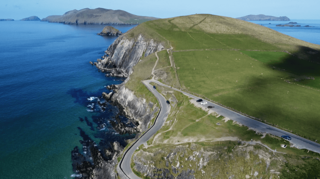
The summit gives visitors a completely different perspective on the Dingle Peninsula from the coastal scenery of Slea Head. Instead of Atlantic cliffs and offshore islands, the landscape here is dominated by mountains, glacial valleys and lakes.
On a clear day, views extend northwards across the peninsula and can reach as far as the Aran Islands.
However, Conor Pass is very weather-dependent. Low cloud can remove the long-distance views completely, and the narrow northern section becomes considerably more demanding in fog or heavy rain.
If visibility is poor and your main reason for visiting is the view, there is nothing wrong with leaving it for another day.
Driving from Dingle to the Summit
The approach from Dingle town is the simplest way for many visitors to experience Conor Pass.
The road climbs steadily out of town towards the mountains, gaining height quickly as Dingle Bay and the surrounding countryside begin to open behind you.
Eventually you reach the summit car park and viewing area.
An important point for nervous drivers is that you do not have to cross the entire pass.
You can drive from Dingle to the summit, enjoy the views and return to Dingle without continuing through the narrowest part of the route towards Cloghane.
For some visitors, that is the best way to experience Conor Pass.
The Narrow Northern Side of Conor Pass
The character of the road changes considerably beyond the summit.
The first approximately 2 kilometres descending towards Cloghane, Brandon and Castlegregory are particularly narrow, with sections where two vehicles cannot comfortably pass.
Passing places are provided along the route.
Look well ahead, anticipate approaching traffic and use the lay-bys rather than continuing until two vehicles meet at the narrowest point.
Drivers approaching from the northern side face the same conditions on the final section of the climb towards the summit.
There is no benefit in rushing this road. Patience and awareness of other traffic make the journey considerably easier.
Vehicle Restrictions on Conor Pass
Vehicle restrictions apply on the northern section of Conor Pass.
The published maximum vehicle length is 7.2 metres, with a maximum weight of 2 tonnes.
Vehicles weighing more than 2 tonnes are not permitted to travel north-east from the summit car park towards Cloghane, Brandon, Castlegregory and Camp.
This restriction affects vehicles such as coaches, caravans, many campervans, trucks and other larger vehicles.
Larger vehicles can approach the summit from the Dingle side, but they should not continue beyond the restricted section.
Always follow the road signs in place rather than relying solely on sat-nav directions.
Can You Drive Conor Pass in a Normal Car?
A standard car can use Conor Pass, provided the driver is comfortable with narrow mountain roads.
The most demanding section is beyond the summit towards Cloghane, where the road passes close to steep rock faces and relies on passing places for opposing traffic.
If you are uncomfortable with very narrow roads, drive from Dingle to the summit and return the same way.
You will still experience the mountain landscape and summit viewpoint without committing to the narrow northern descent.
What Can You See from the Summit?
The summit is one of the best places on the peninsula for understanding its geography.
Looking across the surrounding landscape, you can see the evidence of glaciation in the valleys and corrie lakes below the mountain slopes.
In clear weather, the view opens north towards Brandon Bay and beyond, with visibility sometimes extending as far as the Aran Islands off County Galway.
Turn in the opposite direction and the route drops back towards Dingle and the southern side of the peninsula.
This contrast is part of what makes Conor Pass interesting. Within a short distance, you move between two very different sides of the same mountain range.
The Glacial Landscape of Conor Pass
The shape of Conor Pass was created long before there was a road through it.
Ice once occupied these mountains, carving steep hollows into the slopes and creating the corries and valleys visible today.
As the glaciers retreated, water remained in some of these hollows, forming the mountain lakes that sit below the road.
Understanding this changes the way you look at the pass.
The cliffs, valleys and lakes are not separate scenic features. They are parts of the same glacial landscape.
Pedlar’s Lake
One of the best-known lakes associated with Conor Pass is Pedlar’s Lake, lying below the road within a steep-sided corrie.
It is a good example of the glacial landscape that defines this part of the peninsula.
Visitors often stop nearby to look down towards the lake and surrounding cliffs, but any exploration away from the road should be treated as mountain terrain rather than a formal visitor attraction.
Conditions can be wet and slippery, particularly after rain, so appropriate footwear and judgement are important.
What Is Conor Pass Like in Fog or Rain?
Mountain weather can be completely different from conditions in Dingle town.
Cloud can settle around the summit with very little warning, reducing visibility and removing the views that brought you there in the first place.
Heavy rain can also send water down the mountain slopes and across the rocky landscape in temporary streams and waterfalls.
If you encounter fog, slow down, use appropriate lights and pay particular attention to the signs identifying passing places.
There is no reason to force the journey in poor conditions.
If visibility is very limited and you are not comfortable driving the northern section, turning back towards Dingle is the sensible choice.
Do You Have to Cross the Whole Pass?
No.
This is something many first-time visitors do not realise.
There are effectively several ways to include Conor Pass in your day.
You can drive from Dingle to the summit and return to town.
You can continue across the pass towards Cloghane and Brandon if your vehicle is suitable and you are comfortable with narrow roads.
Or you can approach from the northern peninsula and cross the mountains towards Dingle.
Which option makes sense depends on where you are going next rather than on feeling that you have to complete the entire road.
Continuing to Cloghane and Brandon
If you do continue north, Conor Pass becomes much more than a scenic detour.
The road eventually brings you towards Cloghane and Brandon, opening access to an entirely different part of the Dingle Peninsula.
Mount Brandon dominates the landscape here, while Brandon Bay stretches along the northern coastline.
This part of the peninsula receives less attention from first-time visitors than Slea Head, but it deserves time if you have more than one day in the area.
Walking, mountain scenery, beaches and smaller communities give the northern peninsula a character of its own.
Conor Pass or Slea Head Drive?
They are very different experiences.
Slea Head is primarily a coastal journey, combining Atlantic views, the Blasket Islands, beaches, archaeological sites and Gaeltacht communities.
Conor Pass is a mountain crossing shaped by elevation, glacial valleys, corrie lakes and the transition between the southern and northern sides of the peninsula.
If you only have a short first visit to Dingle, I would usually give Slea Head more time.
If you have a full day or longer, Conor Pass adds another dimension to understanding the peninsula.
The two routes complement each other rather than compete.
How Much Time Should You Allow?
If you are simply driving from Dingle to the summit, stopping for the view and returning, you do not need a large part of the day.
If you are crossing the pass and continuing towards Cloghane, Brandon or the northern peninsula, allow considerably more time.
The distance itself is not the issue.
Narrow roads, passing traffic, photography stops and changing weather all slow the journey.
As with much of the Dingle Peninsula, it is better to allow more time than the distance on a map suggests.
Local Advice Before Driving Conor Pass
Check the weather before setting out, but also look at the mountains themselves.
If the summit is covered completely in cloud, the conditions above Dingle may be very different from those in town.
Follow local road signs before sat-nav instructions.
Be prepared to stop and use passing places.
Watch for walkers, cyclists, sheep and other road users.
Most importantly, don’t feel that you have to drive beyond the summit simply because the road continues.
The summit itself is a worthwhile destination.
Exploring Beyond Conor Pass
Conor Pass is one of the natural gateways between Dingle and the northern peninsula.
From the summit you can return to Dingle, continue towards Cloghane and Brandon, or use the journey as the beginning of a wider exploration of Brandon Bay and the north coast.
That is one of the reasons I enjoy including the pass when conditions allow.
It helps visitors understand that the Dingle Peninsula is much more than a single scenic loop around Slea Head. The mountains, valleys and communities north of the pass reveal another side of the landscape entirely.