
DÚN CHAOIN • DINGLE PENINSULA
Dunquin Pier is a small working pier on the western edge of the Dingle Peninsula, reached by a distinctive winding path descending through the cliffs towards the Atlantic. Overlooking the Blasket Islands, it is one of the most recognisable coastal viewpoints along Slea Head Drive.
Coastal Pier & Viewpoint
Dún Chaoin, Dingle Peninsula
Atlantic Cliffs & Blasket Islands
Short Steep Walk to Pier
Dunquin Pier sits below the cliffs at Dún Chaoin, close to the westernmost end of the Dingle Peninsula. From the road above, the land falls sharply towards the Atlantic, opening up views across the sound towards the Blasket Islands and creating the dramatic setting for the pier’s distinctive winding access path.
The pier has a practical purpose as well as being a popular coastal viewpoint. Seasonal passenger boats use Dún Chaoin as a departure point for Great Blasket Island, continuing the area’s long connection with the islands offshore. For visitors travelling the Slea Head Drive, the short walk towards the pier offers a particularly clear sense of the peninsula’s relationship with the Atlantic and the Blaskets.
From the winding descent to the open views towards the Blasket Islands, Dunquin Pier is shaped by its exposed position on the Atlantic coast. These views help show both the dramatic setting of the harbour and its continuing connection with the islands offshore.
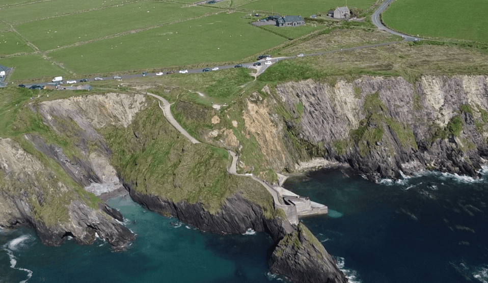
The Blasket Islands lie directly offshore, giving the pier its strong visual and historic connection with the island community.
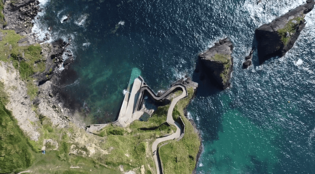
The steep, winding approach to Dunquin Pier is one of the most distinctive views on the western Dingle Peninsula.
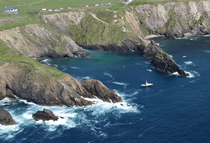
Steep coastal slopes shelter the small pier below the exposed Atlantic landscape of Dún Chaoin.
Dunquin Pier is straightforward to include while travelling Slea Head Drive, but its steep setting and limited parking are worth understanding before you arrive. The pier remains a working coastal access point, so visitors should keep the approach clear and take particular care on the descent.
PLACE TYPE
Coastal Pier & Viewpoint
LANDSCAPE
Atlantic Cliffs & Islands
Irish name
Cé Dhún Chaoin
PARKING
Limited Parking Near Pier
AREA
Dún Chaoin, Dingle Peninsula
PUBLIC ACCESS
Pedestrian Access to Pier
NEAREST TOWN OR VILLAGE
Dún Chaoin
FACILITIES
Limited at Pier
ADMISSION
Free to Visit
TYPICAL VISIT
30–45 Minutes
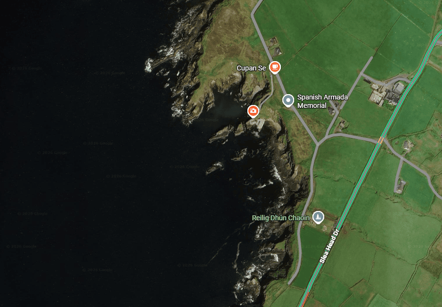
Latitude
52.124526
Longitude
-10.459745
Address
Dunquin Pier, Dún Chaoin, Dingle Peninsula, County Kerry
NEAREST TOWN OR VILLAGE
Dún Chaoin
Road access
Local road from the Slea Head Drive at Dún Chaoin, followed by a steep pedestrian descent to the pier.
The experience of Dunquin Pier begins above the harbour, where the coastline suddenly drops towards the Atlantic and the winding path can be seen cutting through the steep grassy slopes below.
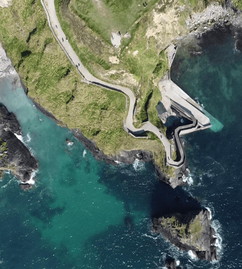
Dunquin Pier Winding Path
Walking towards the pier changes the perspective completely. What begins as a famous viewpoint from above becomes a much more immediate experience of the exposed western coastline and the narrow stretch of Atlantic separating the mainland from the Blasket Islands.
The concrete approach descends steeply from the road towards the small harbour below. As you walk down, the surrounding slopes increasingly block out the road and wider landscape behind, drawing attention instead towards the sea, cliffs and islands ahead.
At the bottom, Dunquin feels less like a conventional visitor attraction and more like what it actually is: a small working pier on an exposed Atlantic coastline. Boats operating to Great Blasket Island use the harbour seasonally, and marine conditions can change quickly depending on wind and swell.
The view offshore is central to understanding the location. Great Blasket and the surrounding islands form part of the landscape directly in front of you, while the nearby Blasket Centre tells the wider story of the island community and its evacuation in 1953.
Visitors do not need to walk all the way to the bottom to appreciate Dunquin Pier. Some of the strongest views are from the upper section, where the curves of the pathway, cliffs and Atlantic can be seen together.
The route down to the pier is steep, which also means the return involves a sustained uphill walk. Wear suitable footwear, allow people working at the pier to pass freely, and never block the access route with a vehicle. Conditions can also feel considerably more exposed near the water than they do at road level.
Dunquin Pier is an easy stop to incorporate into a journey around Slea Head, but the steep approach, exposed coastal setting and limited parking make a little planning worthwhile. Allow extra time if you intend to walk all the way down to the harbour.
Dunquin Pier is reached from a local road at Dún Chaoin, just off the Slea Head Drive on the western Dingle Peninsula. Follow signs for the pier rather than attempting to take a vehicle down the steep access path.
Parking close to the pier is limited. Use the available parking areas carefully, avoid obstructing local access and never drive or park on the pedestrian route descending to the harbour.
Allow around 30–45 minutes for the viewpoint and a walk towards the pier. Allow longer if you want to spend time at the harbour or are combining the stop with nearby attractions.
Earlier or later in the day can provide a quieter experience, particularly during the busy summer season. Visibility towards the Blasket Islands depends heavily on Atlantic weather, cloud and sea mist.
The descent is steep and the coastal environment is exposed to wind and rain. Wear footwear with reliable grip and take additional care when surfaces are wet.
The steep gradient makes the walk to the pier unsuitable for some visitors with limited mobility. The coastal setting and Blasket views can still be appreciated from the upper area without completing the full descent.
Dunquin Pier is more than a single photographic viewpoint. Its winding approach, island views and working harbour reveal several different aspects of the landscape and maritime character of this remote western edge of the Dingle Peninsula.
The narrow concrete path descending through the steep coastal slopes creates Dunquin Pier’s most recognisable view. From above, its sweeping curves lead the eye naturally towards the harbour and Atlantic beyond.
Look west across the Blasket Sound towards An Blascaod Mór — Great Blasket Island and the surrounding island group. Their proximity helps explain why Dún Chaoin has such a strong historical and cultural connection with the former island community.
At the bottom of the descent is a small working harbour rather than a purpose-built tourist attraction. Seasonal passenger boats operate from here towards Great Blasket Island when weather and sea conditions permit, giving the pier an ongoing maritime role.
The wider setting is as important as the pier itself. Steep grassy slopes, exposed cliffs, offshore islands and open Atlantic water combine to show the rugged geography of the western Dingle Peninsula particularly clearly.
Dunquin Pier occupies an exposed position on the Atlantic coast, and conditions at the harbour can be very different from those on the road above. Visitors should treat it as a working maritime location rather than simply a scenic viewpoint.
The steep descent leads directly to a small harbour facing the waters between the Dingle Peninsula and the Blasket Islands. Wind, rain and Atlantic swell can make conditions around the pier change quickly, particularly when weather systems approach from the west.
Passenger boats use Dunquin Pier for seasonal services to Great Blasket Island. These crossings are dependent on suitable weather and sea conditions, so visitors planning an island trip should always check directly with their chosen ferry operator rather than relying on a fixed timetable.
The access route also serves the working pier. Pedestrians should remain aware of harbour activity, keep the route clear and follow any instructions or temporary restrictions in place when boats are operating.
Ventry is used for sea swimming, with lifeguard cover provided during designated summer periods. Visitors should check the safety information displayed at the beach and confirm whether lifeguards are on duty before entering the water. Outside supervised periods, particular care should be taken when assessing conditions.
Weather elsewhere on the peninsula should not be used as a guide to conditions in the water. Wind direction, waves, tides and visibility can change, so decisions about swimming should always be based on the conditions actually present at the beach.
The concrete route between the road and harbour has a significant gradient. The return climb is considerably more demanding than the descent, particularly in wet or windy conditions.
Dunquin is directly exposed to Atlantic weather. Strong winds, rain, sea mist and changing visibility can all affect the experience, while wet surfaces require additional care.
Seasonal passenger services connect Dunquin with Great Blasket Island when conditions permit. Sailing times, operating periods and cancellations can change, so ferry arrangements should always be confirmed with the operator before travelling.
Continue exploring Kerry’s landscapes, coast, mountains and remarkable places, with more locations worth discovering across the county.
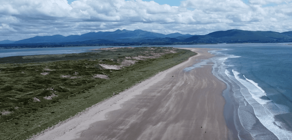
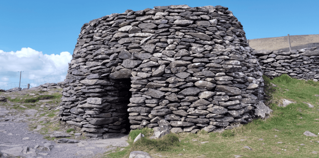
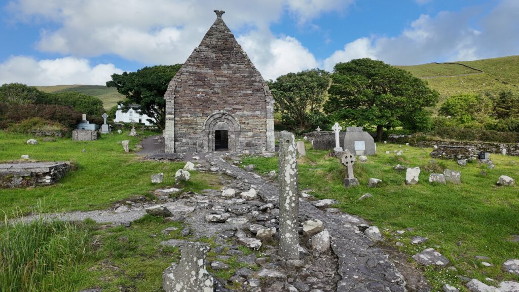
Dunquin Pier sits at the heart of the western Dingle Peninsula, surrounded by many of the landscapes and historic places that make Slea Head such an interesting area to explore. Rather than seeing the pier as an isolated photo stop, a guided journey can place it within the wider story of Dún Chaoin, the Blasket Islands and the communities that developed along this Atlantic coastline.
Steve’s Peninsula Tours visits this part of the peninsula on the Slea Head Drive Private Tour, with time to experience the scenery while learning about the landscape, archaeology, local history and Blasket Island heritage found along the route.
If you would rather leave the driving behind, I offer private tours across the Dingle Peninsula and County Kerry. Each experience is designed for small private groups, with a relaxed pace, local knowledge and the flexibility to spend more time at the places that interest you most.
A relaxed three-hour private tour around Slea Head and the spectacular western coastline of the Dingle Peninsula.
Explore Slea Head, ancient heritage sites, coastal viewpoints and the landscapes of West Kerry on a private half-day experience.
Discover more of the Dingle Peninsula with a full day to explore its scenery, history, villages and lesser-known places.
Journey around the Iveragh Peninsula, combining the Ring of Kerry with the dramatic landscapes and Atlantic coastline of the Skellig Ring.
Explore Killarney National Park, its lakes, mountain viewpoints, waterfalls and some of the most beautiful landscapes in County Kerry.
Travel north from Kerry for a private day tour through the Burren to the spectacular Cliffs of Moher on Ireland’s Atlantic coast.
Create a private Kerry itinerary around the places, landscapes and experiences that matter most to you.
Loading availability…