
HISTORY COLLECTION
Standing high above Dingle Harbour, Eask Tower is a nineteenth-century stone beacon built in 1847 to help guide ships safely into one of Ireland’s most difficult natural harbours. Unlike a lighthouse, it functioned as a daylight navigation marker, using its elevated position and a large directional hand to indicate the harbour entrance to approaching vessels.
Great Famine
1847
Carhoo West
Near Dingle Harbour
Maritime Beacon Tower
Stone Daymark
Walking Trail
Private Land Access
Eask Tower stands on one of the highest points overlooking Dingle Harbour, where its commanding position made it an effective maritime beacon. The surrounding landscape, the tower itself and the nearby coastline all help explain how this nineteenth-century navigation system functioned and why the monument remains significant today.
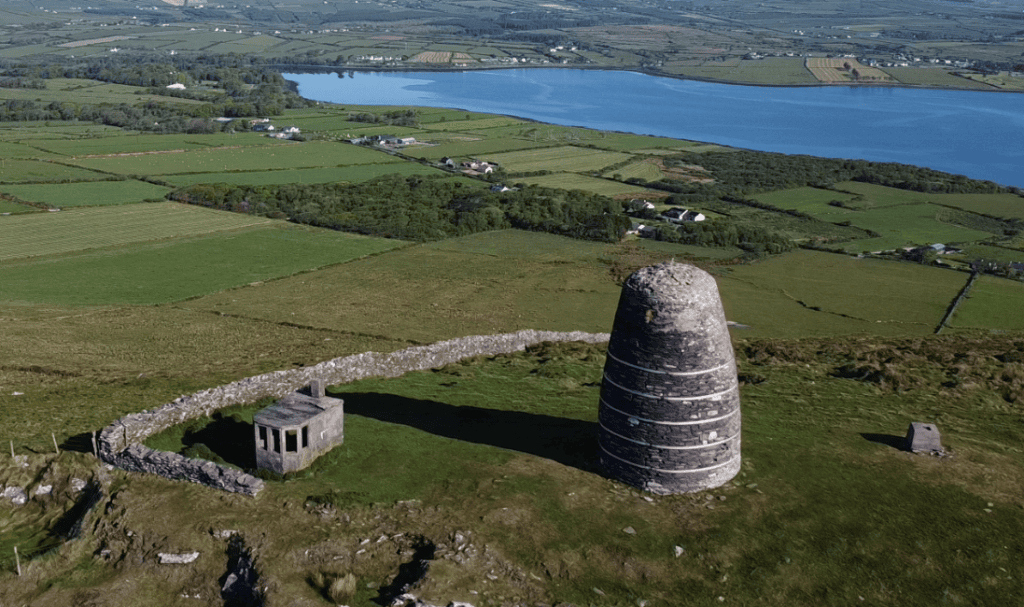
Eask Tower overlooking the entrance to Dingle Harbour from Carhoo West.
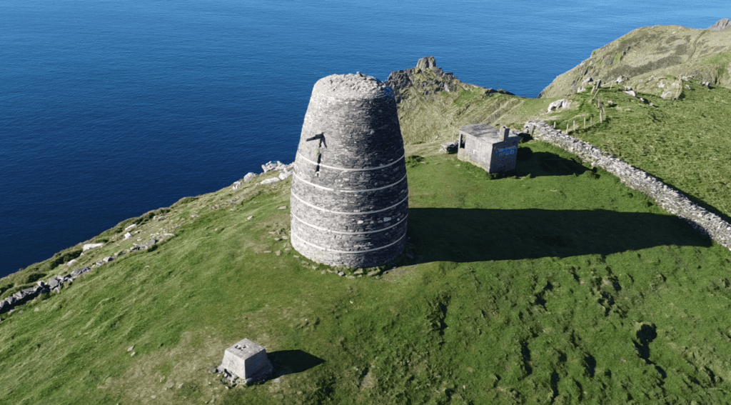
The stone beacon was built in 1847 as a daylight navigation marker for approaching vessels.
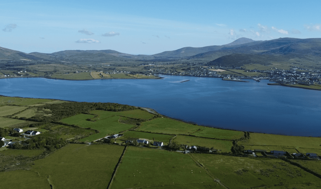
Its elevated position formed part of a wider system of harbour beacons guiding ships safely ashore.
Every historic site has a unique story shaped by its landscape, history and surviving remains. This section provides the key facts you need to understand the monument, including its location, historical importance and defining features, offering a solid foundation before exploring the site in greater depth.
Irish name
Teabhar na hEisce
County
Kerry
Monument Type
Maritime Beacon Tower (Stone Daymark)
National Monument Number
Unknown
Historical Period
Post-Medieval
Ownership
NA
Date
1847
Condition
Deteriorating
Townland
Carhoo West (An Cheathrú Thiar)
Archaeological Investigation
No archaeological excavation recorded
Civil Parish
Dingle (Daingean Uí Chúis)
Public Access
Across private land
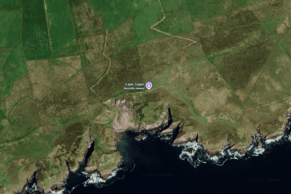
Latitude
52.115613
Longitude
-10.282224
Address
Carhoo West, Co. Kerry
Nearest Town
Dingle
Road access
R559
Eask Tower was built in 1847 on high ground above Dingle Harbour as part of a coordinated system of stone beacons designed to help ships identify and safely enter the harbour. At the time, Dingle’s natural harbour was considered difficult to recognise from the sea, making navigation particularly challenging in poor conditions. Unlike a lighthouse, Eask Tower functioned as a daylight navigation marker, relying on its prominent position and a large directional hand to guide approaching vessels.
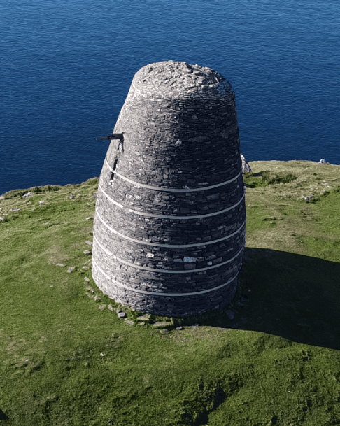
Eask Tower
The project was initiated by Reverend Charles Gayer during the Great Famine. Contemporary evidence shows that the construction also provided employment for local people as part of a famine-relief scheme. Archival sources report that around 200 men worked on the beacon projects, although the number employed specifically at Eask Tower is not known. The evidence clearly supports both the tower’s maritime purpose and its role in relief employment.
Reverend Gayer was closely associated with the Church of Ireland’s evangelical mission in west Kerry. While this religious background forms an important part of the tower’s historical context, the available evidence does not demonstrate that employment on the beacon works was conditional upon religious conversion. Reverend Gayer was closely associated with the Church of Ireland’s evangelical mission in west Kerry. While this religious background forms an important part of the tower’s historical context, there is insufficient evidence to demonstrate that employment on the beacon works was conditional upon religious conversion. Claims that the tower was built solely to convert Catholics should therefore not be presented as established fact.
Eask Tower continued to serve as a prominent landmark overlooking the harbour and was reportedly increased in height around the late nineteenth or early twentieth century, although the exact date of this alteration has not been confirmed from primary records. In recent years the structure has been recognised as requiring significant conservation work, receiving Historic Structures Fund support during 2023 and 2024 for repair, stabilisation and resilience works. Today it remains one of the best-preserved survivors of Dingle Harbour’s nineteenth-century beacon system and is protected within the Kerry County Development Plan.
Eask Tower was never intended to operate as a lighthouse. Its purpose was to act as a highly visible daylight beacon, using its elevated position and a large directional hand to help ships identify the correct approach into Dingle Harbour.
Eask Tower was designed as a practical maritime beacon rather than an occupied building. Standing on an exposed ridge above Dingle Harbour, its primary purpose was to provide a highly visible landmark for ships approaching the harbour during daylight. The structure is a freestanding stone tower whose simple form emphasises visibility, durability and stability rather than accommodation or decoration.
The tower is constructed of rubble-stone masonry, most likely using locally available stone typical of the Dingle Peninsula’s Devonian geology. Although the visible masonry is well documented, no detailed architectural survey or scientific analysis has yet confirmed the precise stone source, internal construction or original mortar composition.
One of the tower’s most distinctive architectural features is its large directional hand, which formed the essential signalling element of the beacon system. Contemporary accounts confirm that these hands pointed towards the harbour entrance, helping mariners identify the safest approach. The original hand has not survived in its documented nineteenth-century form, and specialists believe the present feature may include later replacement fabric.
Secondary sources consistently describe the original tower as standing approximately 8.2 metres (27 feet) high before being increased to around 12.2 metres (40 feet) following a later extension. However, the exact date of this heightening and the records describing the work have not yet been verified through primary documentary evidence or a modern measured survey.
The exposed Atlantic location strongly influenced the tower’s engineering. Its broad base, massive masonry construction and absence of large openings made it well suited to withstand powerful winds and harsh coastal weather. Modern conservation work has focused on stabilising the structure and improving its long-term resilience against further deterioration.
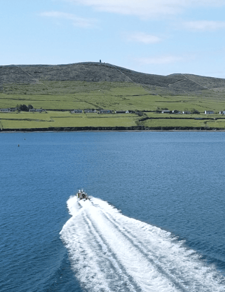
Dingle Harbour with Eask Tower visible on Carhoo Hill
Unlike many historic monuments on the Dingle Peninsula, Eask Tower has not been the subject of an archaeological excavation or published scientific investigation. As a result, much of what is understood about the monument comes from contemporary documents, historic maps, archival research, surviving nineteenth-century illustrations and the standing structure itself rather than from excavation evidence.
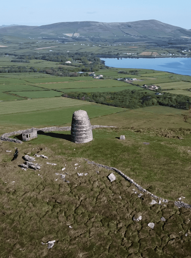
Eask Tower and WWII Lookout
The strongest evidence for the tower’s date comes from a contemporary National Library of Ireland drawing titled Beacon Towers Erected by the Reverend Charles Gayer 1847 (Entrance to Dingle Harbour), together with nineteenth-century newspaper reports describing the construction of multiple harbour beacons and their use in maritime navigation. These contemporary records firmly establish both the tower’s construction in 1847 and its role within a wider beacon system protecting the entrance to Dingle Harbour.
Researchers have also relied on official placename records, protected-structure documentation and recent conservation records to build an understanding of the monument. These sources confirm its historic function, legal protection and recent conservation needs, while also identifying several important questions that remain unanswered, including the exact details of its later heightening, original construction methods and the complete extent of the associated beacon network.
No archaeological evidence has yet confirmed the tower’s internal construction, original mortar composition or precise building sequence. Further investigation could include detailed measured survey, laser scanning, photogrammetry, material analysis and archaeological examination of the surviving beacon sites around Dingle Harbour. This could help resolve questions surrounding the tower’s construction, later alterations and the wider nineteenth-century beacon network.
Most of what we know about Eask Tower comes from surviving historical records rather than excavation. The absence of archaeological investigation means several aspects of its construction and later alterations remain subjects for future research rather than established fact.
Eask Tower was built during one of the most difficult periods in Irish history, the Great Famine of the 1840s. Contemporary evidence shows that the beacon project provided paid employment for local people at a time of widespread poverty and hardship. Historical sources report that around 200 men worked across the beacon construction programme, although the number employed specifically at Eask Tower is not known.
The available evidence confirms that Roman Catholic labourers were employed on the works under the direction of Reverend Charles Gayer. The project therefore served both as a practical maritime improvement and as a famine-relief scheme, providing income when employment opportunities were extremely limited.
Reverend Gayer was also a leading figure in the Church of Ireland’s evangelical mission in the Dingle area. While this religious context is an important part of the site’s history, the research does not support claims that employment on the tower was dependent upon religious conversion. Instead, the available evidence suggests that humanitarian relief, improved harbour navigation and evangelical activity formed overlapping aspects of the wider historical context.
Although no archaeological excavation has revealed the daily experiences of the workers themselves, contemporary records demonstrate how large public works could provide vital employment while also creating lasting infrastructure. Eask Tower continues to reflect both the hardship of the Great Famine and the practical efforts made to improve maritime safety along Ireland’s Atlantic coast.
Historical records show that Eask Tower was both a navigation project and a famine-relief scheme. The evidence supports these dual roles but does not prove that employment was conditional upon religious conversion, despite later popular claims.
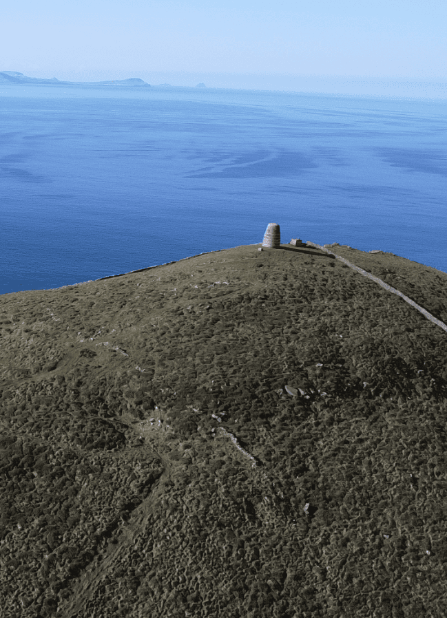
Eask Tower and Skellig Islands
Eask Tower occupies a commanding position on high ground at Carhoo West above Dingle Harbour. Its location was carefully chosen to maximise visibility from the sea, allowing approaching vessels to identify the concealed harbour entrance from a considerable distance. The surrounding landscape was therefore an essential part of the beacon’s function rather than simply its setting.
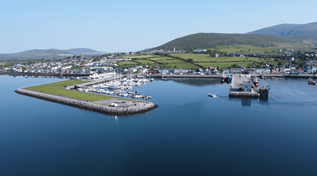
Dingle Marina
The tower overlooks the Atlantic approaches to Dingle Bay while maintaining direct visual links with the harbour entrance and the locations of other nineteenth-century beacon towers. Together these formed a coordinated navigation system that guided ships through one of the most visually challenging harbour approaches on Ireland’s south-west coast.
The surrounding uplands, coastline and harbour preserve a landscape shaped by centuries of maritime activity, including fishing, trade, harbour development and coastal navigation. Nearby stands a Second World War lookout post, a separate protected structure that reflects a later phase in the area’s coastal history and should not be confused with the nineteenth-century beacon itself.
Several associated beacon sites once formed part of the same navigation network, including locations at Beenbane (Beenbawn) Head and Reenbeg. Although these survive only as fragmentary remains or uncertain archaeological sites, they demonstrate that Eask Tower originally functioned as one element within a wider harbour guidance system rather than as an isolated landmark.
The significance of Eask Tower lies not only in the stone structure itself but also in its relationship with the surrounding landscape. Its elevated position, views across Dingle Harbour and visual connection with other beacon sites were fundamental to how the navigation system worked.
Follow the story of Eask Tower from the hardship of the Great Famine and its construction in 1847 through its later alteration and modern conservation. Built as part of a system of navigation beacons around Dingle Harbour, the tower has remained a prominent maritime landmark for more than 175 years.
Reverend Charles Gayer documented the widespread distress affecting the Dingle district shortly before the beacon project began.
Eask Tower and the associated harbour beacons were built to improve navigation into Dingle Harbour while providing employment during the Great Famine.
A contemporary newspaper reported that the new beacon towers helped guide the French brig Leontina safely into Dingle Bay during severe weather.
Reverend Charles Gayer died of typhus fever shortly after completing the beacon project that transformed navigation into Dingle Harbour.
The tower was reportedly increased from about 27 feet to approximately 40 feet, although the exact date has not been confirmed from primary records.
A military lookout post was built beside Eask Tower as part of Ireland’s coastal observation network during the Emergency. It is a separate protected structure.
Historic Structures Fund grants supported urgent repair, stabilisation and conservation work to help protect Eask Tower for the future.
Eask Tower is reached on foot across private land at Carhoo West, overlooking Dingle Harbour. The walking route crosses uneven ground, and access arrangements may change, so visitors should respect the landowner’s requirements and current local access conditions.
Carhoo West, near Dingle, County Kerry
Small private parking area at the start of the walking route. Availability may vary.
Reached on foot via a permissive walking route across private land over uneven ground. Access arrangements may change.
A contribution or admission charge may apply. Confirm current arrangements locally before visiting.
Clear weather offers the best views of Dingle Harbour and the surrounding coastline.
Dingle Harbour, Emergency (Second World War) Lookout Post, Beenbane Beacon Site, Reenbeg (Towereen Bán) Beacon Site
.
Explore more historic places, monuments and archaeological sites across County Kerry.
You can experience Eask Tower with Steve as part of a private tour of the Dingle Peninsula. Its elevated position above Dingle Harbour helps explain why the site was chosen for a nineteenth-century navigation beacon and reveals the close relationship between the tower, harbour entrance and surrounding maritime landscape.
If you would rather leave the driving behind, I offer private tours across the Dingle Peninsula and County Kerry. Each experience is designed for small private groups, with a relaxed pace, local knowledge and the flexibility to spend more time at the places that interest you most.
A relaxed three-hour private tour around Slea Head and the spectacular western coastline of the Dingle Peninsula.
Explore Slea Head, ancient heritage sites, coastal viewpoints and the landscapes of West Kerry on a private half-day experience.
Discover more of the Dingle Peninsula with a full day to explore its scenery, history, villages and lesser-known places.
Journey around the Iveragh Peninsula, combining the Ring of Kerry with the dramatic landscapes and Atlantic coastline of the Skellig Ring.
Explore Killarney National Park, its lakes, mountain viewpoints, waterfalls and some of the most beautiful landscapes in County Kerry.
Travel north from Kerry for a private day tour through the Burren to the spectacular Cliffs of Moher on Ireland’s Atlantic coast.
Create a private Kerry itinerary around the places, landscapes and experiences that matter most to you.
Eask Tower is documented through contemporary nineteenth-century records, historic illustrations, official heritage records and modern conservation documentation. These sources establish its construction in 1847, its role within the Dingle Harbour beacon system and its connection with famine-relief employment, while some details of its later alteration remain unresolved.
Kerry County Council — Kerry County Development Plan 2022–2028 (Record of Protected Structures, RPS-KY-0281)
Kerry County Council — Dingle Functional Area Local Area Plan (Protected Structure cross-reference)
Placenames Database of Ireland (Logainm.ie) — Teabhar na hEisce / Beacon Tower, An Eisc / Eask and Carhoo West (An Cheathrú Thiar)
Department of Housing, Local Government and Heritage — Historic Structures Fund (2023 and 2024 conservation records)
National Library of Ireland — Beacon Towers Erected by the Reverend Charles Gayer 1847 (Entrance to Dingle Harbour)
Contemporary nineteenth-century newspaper reports, including the Kerry Evening Post and reports concerning the French brig Leontina
O’Donohoe Archive — Gayer’s Beacons: Signposts to Dingle Harbour
Geological Survey Ireland — Geology of the Dingle Peninsula
Architectural Heritage Protection Guidelines for Planning Authorities
ICOMOS — Principles for the Analysis, Conservation and Structural Restoration of Architectural Heritage
Loading availability…