
DINGLE PENINSULA · COUNTY KERRY
Inch Beach is a sweeping sandy strand stretching for approximately 5 km along the southern side of the Dingle Peninsula. Set between Dingle Bay and the Slieve Mish Mountains, its broad Atlantic shoreline is known for walking, surfing, swimming and expansive views towards the Iveragh Peninsula.
Long Sandy Strand
Dingle Peninsula
Approx. 5 km
Public Beach
Inch Beach forms a long sandy peninsula extending into Dingle Bay on the southern side of the Dingle Peninsula. Its broad strand is backed by dunes and opens onto a remarkable natural setting, with the Slieve Mish Mountains rising behind and views extending across the bay towards the mountains of the Iveragh Peninsula.
The scale of the beach is a large part of its character. At lower tides, an extensive area of firm sand is exposed, creating space for long shoreline walks and wide, uninterrupted coastal views. The Atlantic-facing conditions also make Inch one of Kerry’s established surfing locations, while its accessible setting and extensive shoreline make it equally appealing for visitors who simply want to experience the landscape of Dingle Bay.
Inch Beach feels wonderfully open and expansive, with its long sandy strand, rolling dunes and mountain views stretching across Dingle Bay. Whether you stop for a peaceful walk, watch the surfers or simply take in the scenery, every part of the beach offers a different view of this remarkable coastal landscape.
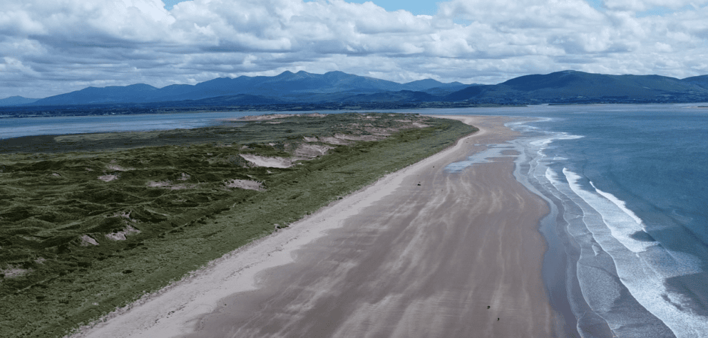
Sand dunes form an important part of the coastal landscape behind the open strand at Inch.
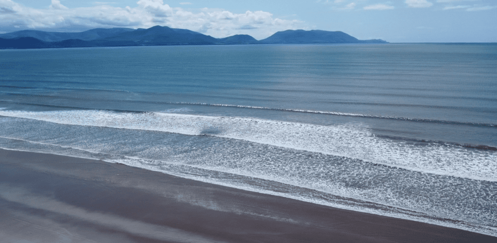
The long sandy strand at Inch extends into Dingle Bay, creating one of the most distinctive coastal landscapes on the southern side of the Dingle Peninsula.

Atlantic waves meeting the wet sand along the shoreline at Inch Beach.
Inch Beach is an easily reached coastal stop on the southern side of the Dingle Peninsula, with direct access from the main Dingle–Killarney route. The broad sandy strand is popular for walking, surfing and seaside visits, but Atlantic conditions can change quickly and visitors should always pay attention to local safety information.
PLACE TYPE
Beach
BEACH TYPE
Long sandy strand
Irish name
Inse
PARKING
Free Parking Available
AREA
Dingle Peninsula
PUBLIC ACCESS
Open year-round
FACILITIES
Toilets and nearby visitor services
LIFEGUARD
Seasonal lifeguard service
SWIMMING
Yes — designated bathing area; follow local safety advice
LANDSCAPE
Sand dunes, Dingle Bay & mountain views
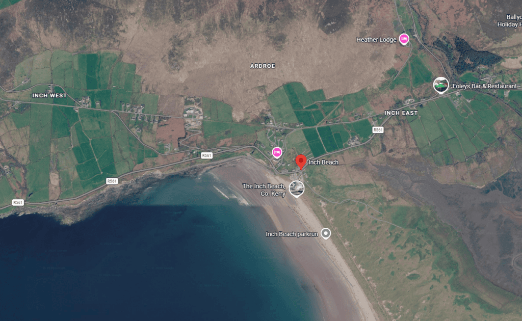
Latitude
52.143193
Longitude
-9.978177
Address
Inch, Dingle Peninsula, County Kerry, Ireland
NEAREST TOWN OR VILLAGE
Inch
Road access
Accessed from the R561, the main road connecting Dingle with Castlemaine and the Killarney direction. The principal beach access and parking area are close to Inch village.
The experience of Inch Beach is defined by its scale. Rather than being a small enclosed cove, the strand opens onto Dingle Bay with a long expanse of sand, changing Atlantic conditions and mountain scenery on both sides of the bay.
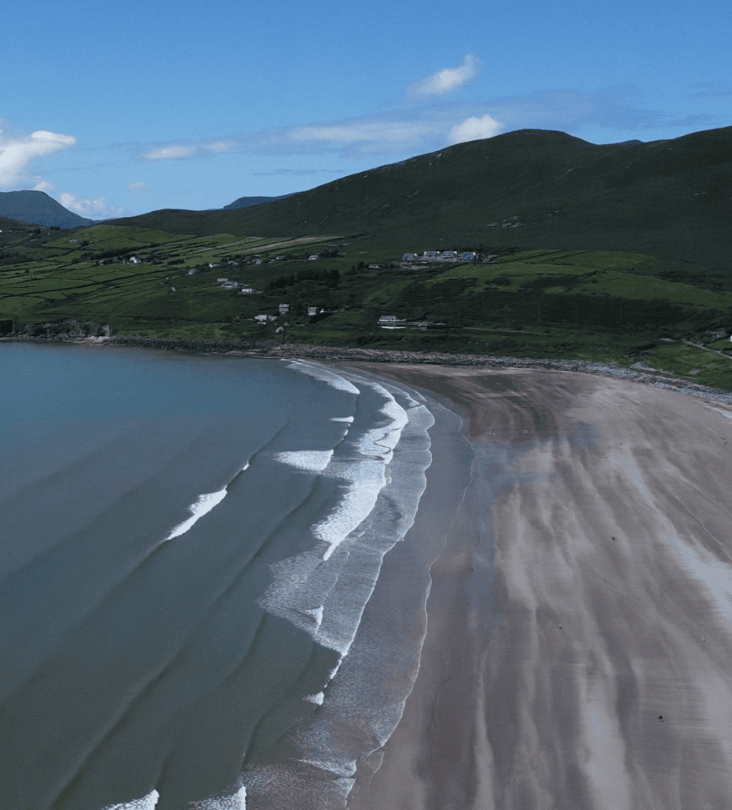
Inch Beach showing Atlantic waves
Inch is particularly rewarding when explored on foot. The long, open strand gives visitors room to move away from the main access area and appreciate just how large the beach and surrounding bay really are.
Walking along Inch Beach reveals a landscape that changes considerably with the tide, weather and light. At lower tide, broad areas of sand are exposed and the shoreline can feel remarkably expansive. Looking inland, the Slieve Mish Mountains form the backdrop to the beach, while across Dingle Bay the higher ground of the Iveragh Peninsula defines the southern horizon.
The beach is also strongly associated with surfing and other water-based activities because of its Atlantic exposure. Conditions, however, are not uniform: waves, wind, tides and currents can change, so anyone entering the water should use the designated bathing area where applicable and follow lifeguard instructions and current beach safety information.
Visitors do not need to enter the water to appreciate Inch. A shoreline walk, time spent watching the surf, or simply taking in the changing views across Dingle Bay can make it a worthwhile stop when travelling between Dingle and the eastern side of the peninsula.
Atlantic conditions can change quickly. If swimming, use the lifeguarded bathing area when the seasonal service is operating and pay attention to beach flags and instructions on the day. Outside supervised periods, take additional care and never assume calm-looking water means conditions are safe.
Inch Beach is straightforward to include in a journey around the Dingle Peninsula, whether you are stopping briefly for the views or allowing more time for a walk along the strand. Weather, tides and sea conditions can significantly change the experience, so it is worth planning around the conditions on the day.
Inch Beach lies beside the R561, the main route between Dingle and Castlemaine. The turn towards the principal beach access is in Inch village and is clearly signposted.
Free parking is available at the main beach access. Inch is unusual in that vehicles may also be encountered on parts of the strand, so pedestrians should remain aware of moving traffic as well as natural beach conditions.
Allow around 30–60 minutes for a relaxed stop and short shoreline walk. If you plan a longer beach walk, photography session, surf lesson or time in the water, allow considerably longer.
The beach can be visited throughout the year. Lower tides reveal a much greater expanse of sand, while clear conditions provide the best opportunity to appreciate the views across Dingle Bay and the surrounding mountains.
Visitor facilities are concentrated around the main beach entrance and Inch village, including food and drink options and toilets. Opening hours for individual businesses can vary seasonally.
The principal access area provides relatively direct access to the beach, but the surface beyond is naturally sand and conditions vary with tides and weather. Visitors with specific mobility requirements should assess conditions at the main access point before proceeding onto the strand.
Inch Beach is more than a long stretch of sand. Its position within Dingle Bay brings together several of the landscapes that define this part of Kerry — an extensive Atlantic shoreline, coastal dunes and mountain ranges framing the bay.
The sheer length of Inch is one of its defining features. At lower tide, the exposed beach becomes particularly broad, creating an impressive open landscape and plenty of space for a shoreline walk.
Look south across Dingle Bay towards the mountains of the Iveragh Peninsula. Changes in cloud, visibility and sunlight can dramatically alter the view, making the beach particularly rewarding for landscape photography.
Behind the open strand lies a coastal dune system that forms an important part of Inch’s natural character. The dunes also help explain the distinctive shape and geography of the beach as it extends into Dingle Bay.
Inch is one of the Dingle Peninsula’s established surfing beaches. Even for visitors staying on shore, watching Atlantic swells arrive across the bay adds another dimension to the experience, particularly when conditions are active.
Inch Beach is a recognised bathing and surfing location, but conditions in Dingle Bay can vary with wind, swell and tide. Visitors entering the water should assess conditions on arrival and use the supervised bathing area when lifeguards are on duty. Discover Ireland currently identifies Inch as a Blue Flag beach and specifically notes its seasonal lifeguarded bathing.
The long sandy shoreline makes Inch suitable for a range of water activities, particularly swimming and surfing. Surf conditions vary considerably, however, and the same beach can present very different conditions from one day — or part of a day — to another.
During the official bathing season, lifeguard cover is provided at Inch. Kerry County Council states that its 2026 bathing season runs from 1 June to 15 September, although visitors should always check the information displayed at the beach for the service operating on a particular day.
For swimming, the safest approach when lifeguards are present is to enter the water between the red and yellow flags and follow their advice. Kerry County Council also specifically warns beach users about rip currents and advises swimmers to check safety signage before entering the sea.
Ventry is used for sea swimming, with lifeguard cover provided during designated summer periods. Visitors should check the safety information displayed at the beach and confirm whether lifeguards are on duty before entering the water. Outside supervised periods, particular care should be taken when assessing conditions.
Weather elsewhere on the peninsula should not be used as a guide to conditions in the water. Wind direction, waves, tides and visibility can change, so decisions about swimming should always be based on the conditions actually present at the beach.
Inch is an established bathing beach. During lifeguarded periods, swim between the red and yellow flags and follow any instructions or warnings displayed on the beach.
Inch is an established Kerry surfing location used by beginners as well as more experienced surfers. Visitors unfamiliar with the beach should consider professional instruction and check tides, swell and local conditions before entering the water.
Kerry County Council provides a free beach wheelchair service at Inch during summer 2026, operating from the lifeguard hut and requiring advance booking. This is a useful accessibility feature that is worth mentioning on the page while the service remains available.
Inch Beach sits at a natural transition point between the Dingle Peninsula and the eastern side of Dingle Bay. From here, visitors can continue towards some of the peninsula’s most distinctive beaches, coastal viewpoints and mountain landscapes.

Inch Beach is a natural introduction to the landscapes of the Dingle Peninsula, particularly when approaching from Killarney or the eastern side of Kerry. From the shores of Dingle Bay, the journey west continues towards Dingle, the Atlantic coastline and the historic landscapes around Slea Head.
A private tour provides the opportunity to experience these places as part of the wider peninsula rather than as isolated stops. Local guiding adds geographical, historical and cultural context along the way, while allowing time to adapt the day to the weather, visibility and interests of your group.
If you would rather leave the driving behind, I offer private tours across the Dingle Peninsula and County Kerry. Each experience is designed for small private groups, with a relaxed pace, local knowledge and the flexibility to spend more time at the places that interest you most.
A relaxed three-hour private tour around Slea Head and the spectacular western coastline of the Dingle Peninsula.
Explore Slea Head, ancient heritage sites, coastal viewpoints and the landscapes of West Kerry on a private half-day experience.
Discover more of the Dingle Peninsula with a full day to explore its scenery, history, villages and lesser-known places.
Journey around the Iveragh Peninsula, combining the Ring of Kerry with the dramatic landscapes and Atlantic coastline of the Skellig Ring.
Explore Killarney National Park, its lakes, mountain viewpoints, waterfalls and some of the most beautiful landscapes in County Kerry.
Travel north from Kerry for a private day tour through the Burren to the spectacular Cliffs of Moher on Ireland’s Atlantic coast.
Create a private Kerry itinerary around the places, landscapes and experiences that matter most to you.
Loading availability…