
HISTORY COLLECTION
Kilmalkedar Church is one of the finest surviving Romanesque churches on the Dingle Peninsula and forms the centrepiece of a remarkable multi-period ecclesiastical complex in County Kerry.
Early Medieval to Medieval
Kilmalkedar, County Kerry
Romanesque Church & Ecclesiastical Complex
Open to the public
Kilmalkedar Church is one of the finest surviving Romanesque churches on the Dingle Peninsula and forms the centrepiece of a remarkable multi-period ecclesiastical complex in County Kerry. Set beneath the slopes of Reenconnell Mountain overlooking Smerwick Harbour, the site preserves evidence of Christian worship spanning several centuries. Alongside the twelfth-century church are an ogham stone, a pillar sundial, crosses, cross-slabs, carved stones and an active graveyard. Together these monuments provide valuable insight into the religious, architectural and cultural development of early medieval and medieval Ireland, making Kilmalkedar one of Kerry’s most significant historic sacred landscapes.
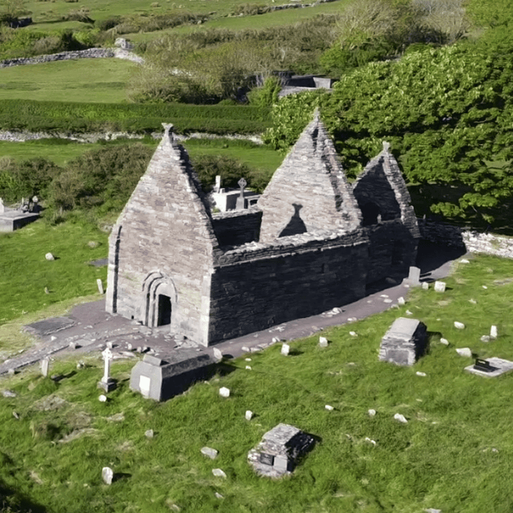
Twelfth-century Romanesque church with surviving nave and later chancel.
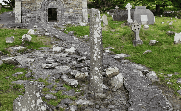
Early medieval ogham stone commemorating a named individual.
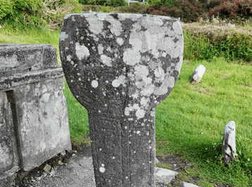
Pillar sundial and carved crosses reflecting centuries of Christian worship.
Every historic site has a unique story shaped by its landscape, history and surviving remains. This section provides the key facts you need to understand the monument, including its location, historical importance and defining features, offering a solid foundation before exploring the site in greater depth.
Irish name
Cill Maoilchéadair
County
Kerry
Monument Type
Romanesque Church & Ecclesiastical Complex
National Monument Number
KE042-026
Historical Period
Early Medieval to Medieval
Ownership
State-owned
Date
Mid-12th century
Condition
Well maintained
Townland
Kilmalkedar
Archaeological Investigation
Survey completed in 2011
Civil Parish
Kilmalkedar
Public Access
Open to the public
Latitude
52.184821
Longitude
-10.336514
Address
Kilmalkedar, Co. Kerry
Nearest Town
Ballyferriter
Road access
R559
Christian activity at Kilmalkedar predates the surviving church by several centuries. The earliest phase is represented by an ogham stone, a pillar sundial, carved crosses and other inscribed stones, demonstrating that the site had become an important ecclesiastical centre during the early medieval period. While local tradition associates the foundation with St Maolcethair, whose death is traditionally dated to AD 636, this tradition does not provide archaeological evidence that the site was established at that date.
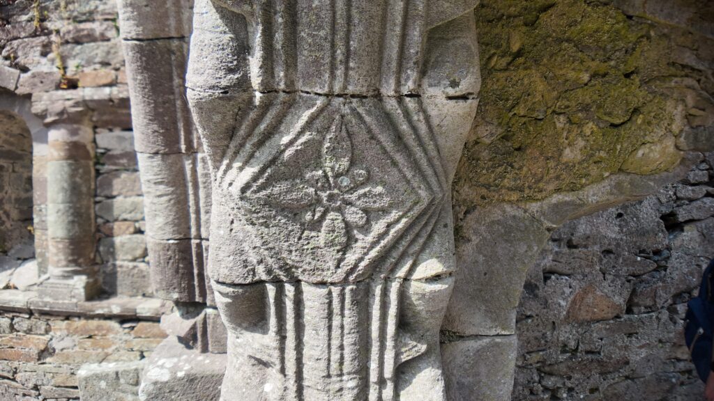
Romanesque Doorway Capital
The principal church was constructed during the mid-twelfth century as part of Ireland’s Romanesque architectural tradition. Official interpretation places its construction shortly after AD 1134, although the precise patron and construction date remain unknown. Architectural similarities with Cormac’s Chapel at Cashel suggest connections through shared design traditions or possibly travelling craftsmen, but this remains a scholarly interpretation rather than an established historical fact.
A chancel was added or rebuilt shortly after the nave, creating the familiar nave-and-chancel layout that survives today. The church continued to serve as a place of burial and devotion long after it ceased functioning as a roofed parish church. Today, Kilmalkedar is best understood as a layered sacred landscape where monuments from different periods illustrate centuries of religious practice, commemoration and pilgrimage on the Dingle Peninsula.
Early Christian worship at Kilmalkedar is firmly supported by archaeological evidence, but the site’s traditional foundation by St Maolcethair remains part of historical tradition rather than proven archaeological fact.
The surviving church at Kilmalkedar is one of County Kerry’s finest examples of Hiberno-Romanesque architecture. Its principal structure consists of a rectangular nave with a slightly later chancel, reflecting the growing architectural sophistication of Irish churches during the twelfth century. Much of the nave survives to almost its original height, allowing many of its architectural features to be clearly understood today.
The church was constructed mainly from carefully dressed sandstone laid in regular courses. Builders also selected contrasting green, red and yellow stone for decorative effect around the doorway and wall banding, demonstrating that appearance was considered alongside structural strength. Projecting antae at both gable ends strengthen and visually define the walls.
The richly decorated west doorway is among the building’s most significant architectural features. It includes three orders, a projecting hood, moulded abaci, chevron ornament, carved animal-head stops and a carved head positioned at the apex of the arch. Inside, blind arcading decorates the walls, while the round-headed opening between the nave and chancel reflects the Romanesque style.
Evidence within the gables shows that the church originally carried a steeply pitched pointed barrel-vaulted stone roof. Only the lower springing of the vault survives, but it demonstrates the structural ambition of the original builders. Some masonry details also preserve forms derived from earlier timber architecture, a feature known as skeuomorphism.
The surviving springing of the pointed barrel vault provides direct evidence that Kilmalkedar originally had a stone roof, although the complete form of that roof can only be reconstructed in part.
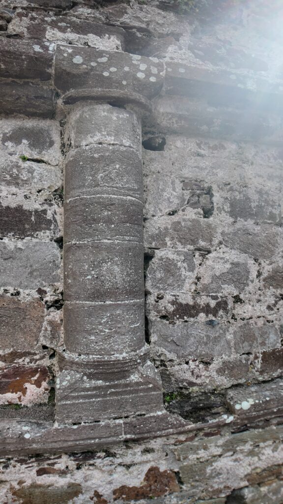
Romanesque Column
Kilmalkedar is one of the richest ecclesiastical archaeological sites on the Dingle Peninsula. Rather than representing a single monument, it forms part of a multi-period complex containing twenty-two recorded archaeological monuments within the graveyard, including the church, ogham stone, pillar sundial, crosses, cross-slabs, carved stones, a font and centuries of burials. Together these remains reveal a long sequence of religious activity extending from the early medieval period into modern times.
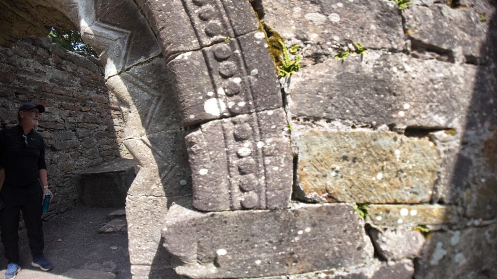
Romanesque Doorway Detail
The most important evidence for the site’s earliest Christian community comes from its carved stone monuments. The ogham stone, officially recorded as KE042-026001 and catalogued as CIIC 187, is conventionally dated to around AD 600. Its inscription commemorates a named individual, providing direct evidence of literacy and Christian commemoration during the early medieval period. Nearby, the pillar sundial demonstrates how the community may have marked divisions of the day for religious observance, while crosses and cross-slabs further reinforce the site’s ecclesiastical importance.
Archaeological survey has also recorded at least seventeen lintelled graves within the graveyard, including burials inside both the nave and chancel. Because many stone-covered graves remain concealed beneath grass, archaeologists believe additional examples are likely to survive below ground. No modern programme of radiocarbon dating or osteological analysis is currently documented for these burials, so their precise chronology remains uncertain.
Unlike many important ecclesiastical sites, Kilmalkedar has not been extensively excavated using modern archaeological methods. Instead, knowledge of the monument is based largely on the surviving buildings, carved stones, architectural analysis and the detailed archaeological survey completed in 2011. This means several aspects of the site’s earliest development, including the exact sequence of its first churches, remain subjects for future research rather than established fact.
Although Kilmalkedar has exceptional archaeological significance, many of its earliest phases remain unexcavated. Archaeologists continue to rely primarily on standing structures, carved stones and architectural evidence to reconstruct the site’s history.
Although no written records describe daily life at Kilmalkedar in detail, the surviving archaeological evidence provides valuable insight into how the site functioned. The ogham stone, carved crosses, pillar sundial and other inscribed stones indicate that Kilmalkedar was an established centre of Christian worship where religious ceremonies, commemoration and teaching formed part of everyday life.
The pillar sundial is one of the clearest pieces of evidence for the routine organisation of religious life. Its carved face was designed to divide the day into periods, helping regulate prayers and other liturgical activities. While the exact timetable followed by the community is unknown, the monument demonstrates that timekeeping played an important role within the ecclesiastical complex.
The many carved stones and inscriptions also suggest a community where literacy held particular religious significance. Ogham inscriptions commemorated individuals, while decorated crosses and cross-slabs reflected Christian belief and remembrance. These monuments demonstrate that Kilmalkedar was more than a church building—it was a place where worship, burial and memorial traditions continued over many generations.
Some aspects of everyday life remain uncertain. Although the archaeological evidence securely identifies Kilmalkedar as an ecclesiastical complex, it does not prove the presence of a monastery in the institutional sense. For this reason, archaeologists distinguish between established evidence and later interpretation when describing how the community may have been organised.
The pillar sundial provides rare physical evidence that daily religious life at Kilmalkedar was organised around fixed times for worship, making it one of the site’s most important early medieval artefacts.
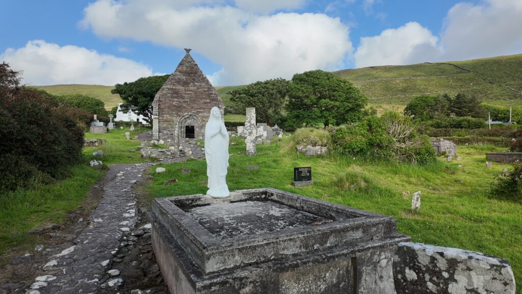
Kilmalkedar Church View
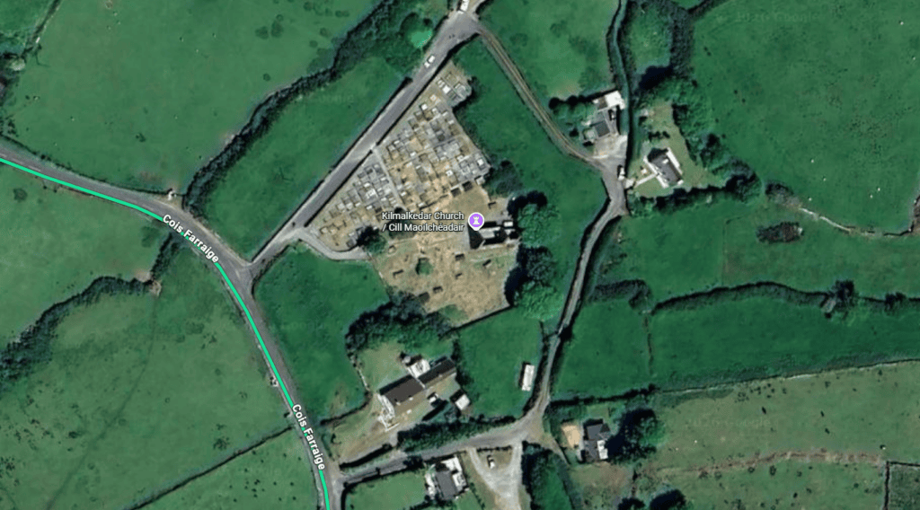
Kilmalkedar occupies the lower western slopes of Reenconnell Mountain, overlooking Smerwick Harbour on the Dingle Peninsula. This elevated position provided wide views across the surrounding countryside while remaining closely connected to fertile pasture, local routeways and neighbouring settlements. Today, the landscape remains largely pastoral, enclosed by traditional dry-stone walls that preserve much of its historic character.
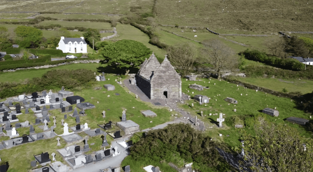
Kilmalkedar Church from Above
The church was not an isolated monument but the focal point of a wider ecclesiastical landscape. The surrounding townland contains numerous archaeological sites, including additional church remains, clocháin (dry-stone huts), a souterrain, holy wells, bullaun stones, standing stones and other historic features. Together these monuments demonstrate that Kilmalkedar formed part of a long-established centre of settlement, worship and pilgrimage rather than a single religious building.
Kilmalkedar is also associated with the historic pilgrimage landscape of Mount Brandon and St Brendan. While this broader connection is well recognised in heritage interpretation, the available evidence does not prove that individual surviving paths date unchanged to the early medieval period. Archaeologists therefore distinguish between the established pilgrimage association and the dating of specific routeways.
The abundance of local Old Red Sandstone influenced both the appearance and construction of the church. Readily available building stone allowed medieval masons to create a durable Romanesque structure while incorporating contrasting colours for decorative architectural detail.
Kilmalkedar is best understood as the centre of a wider sacred landscape, where churches, carved stones, holy wells, pilgrimage traditions and surrounding archaeological monuments together illustrate centuries of religious activity on the Dingle Peninsula.
The history of Kilmalkedar spans more than a thousand years, from its earliest evidence of Christian worship to its survival as one of Ireland’s finest Romanesque churches. While some dates are established through archaeology and architectural study, others remain based on historical tradition or scholarly interpretation. This timeline highlights the key stages in the site’s development, showing how Kilmalkedar evolved into one of the Dingle Peninsula’s most significant ecclesiastical landscapes.
The earliest evidence of Christian worship appears through the ogham stone and other carved monuments, with the ogham stone conventionally dated to around AD 600.
Local tradition associates Kilmalkedar with St Maolcethair, whose death is traditionally dated to AD 636. This is not archaeological dating of the site.
The presence of the sundial, crosses and carved stones indicates continued religious activity, although the exact sequence of development remains uncertain.
Construction of the principal Romanesque nave transformed Kilmalkedar into one of the finest medieval churches on the Dingle Peninsula.
The eastern chancel was probably constructed or enlarged within a short time of the nave, creating the church seen today.
Burials and devotional traditions continued after the church ceased functioning as a roofed parish church.
A detailed archaeological and condition survey documented the church, graveyard and associated monuments, providing the principal modern assessment of the site.
Kilmalkedar is an unguided National Monument cared for by the Office of Public Works and remains an active burial ground. Visitors can freely explore the historic church and surrounding monuments while respecting both the archaeological remains and those who continue to use the cemetery. As conditions and facilities can change over time, it is always advisable to check current access arrangements before travelling.
Kilmalkedar, near Ballyferriter, Dingle Peninsula, County Kerry.
A small roadside parking area is available near the entrance. Larger vehicles may need to use nearby widened roadside areas. Parking arrangements should be checked locally before visiting.
Public access is available via a short entrance avenue. Visitors should expect uneven ground, grass, gravel, stiles and historic pathways within the active graveyard.
Free admission.
Daylight hours during favourable weather offer the best opportunity to appreciate the church, carved stones and surrounding landscape.
Gallarus Oratory, Riasc Monastic Site, Mount Brandon Pilgrimage Route, Smerwick Harbour
Explore more historic places, monuments and archaeological sites across County Kerry.
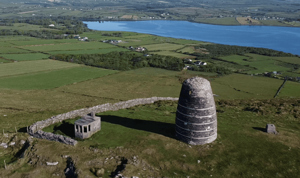
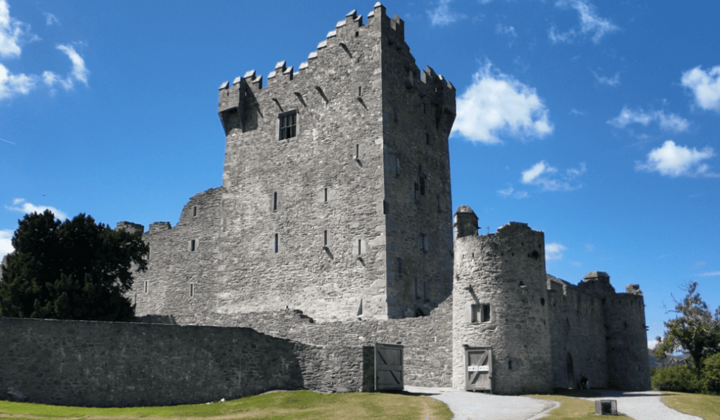
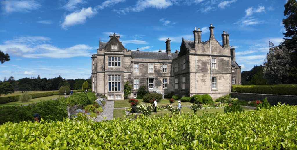
You can experience Kilmalkedar Church with Steve as part of a private tour of the Dingle Peninsula. Exploring the Romanesque church, carved stones, ogham pillar and surrounding graveyard together provides a much clearer understanding of how Kilmalkedar developed as an important ecclesiastical landscape over many centuries.
If you would rather leave the driving behind, I offer private tours across the Dingle Peninsula and County Kerry. Each experience is designed for small private groups, with a relaxed pace, local knowledge and the flexibility to spend more time at the places that interest you most.
A relaxed three-hour private tour around Slea Head and the spectacular western coastline of the Dingle Peninsula.
Explore Slea Head, ancient heritage sites, coastal viewpoints and the landscapes of West Kerry on a private half-day experience.
Discover more of the Dingle Peninsula with a full day to explore its scenery, history, villages and lesser-known places.
Journey around the Iveragh Peninsula, combining the Ring of Kerry with the dramatic landscapes and Atlantic coastline of the Skellig Ring.
Explore Killarney National Park, its lakes, mountain viewpoints, waterfalls and some of the most beautiful landscapes in County Kerry.
Travel north from Kerry for a private day tour through the Burren to the spectacular Cliffs of Moher on Ireland’s Atlantic coast.
Create a private Kerry itinerary around the places, landscapes and experiences that matter most to you.
The history of Kilmalkedar has been documented through archaeological survey, architectural study, official heritage records and specialist scholarship. The sources below provide the principal evidence for understanding the church, its associated monuments and the development of the wider ecclesiastical landscape.
Office of Public Works (OPW) / Heritage Ireland – Kilmalkedar Church
Headland Archaeology (Ireland) Ltd. (2011) – Archaeological Survey of Kilmalkedar Burial Ground, Dingle, County Kerry
Placenames Database of Ireland (logainm.ie) – Cill Maoilchéadair / Kilmalkedar
Dublin Institute for Advanced Studies – Ogham in 3D (CIIC 187)
Ó Carragáin, T. (2010) – Churches in Early Medieval Ireland: Architecture, Ritual and Memory
Geological Survey Ireland – Old Red Sandstone and the Dingle Peninsula
National Monuments Service – Record of Monuments and Places (KE042-026)
Cuppage, J. et al. (1986) – Archaeological Survey of the Dingle Peninsula
Harbison, P. (1992) – Guide to National and Historic Monuments of Ireland
Loading availability…